
EMS LYRA
General Cargo
Current Trip
DZ GHA
| Time Travelled | 6 days |
|---|---|
| Remaining Time | --- |
| Distance Travelled | 1326.30 nm |
| Remaining Distance | --- |
| AVG Speed | 8.9 Noeuds |
| MAX Speed | 14.5 Noeuds |
| AVG Wind | 17.2 knots |
| MAX Wind | 30.3 knots |
| MIN Temp | 4.6°C / 40.28°F |
| MAX Temp | 16.4°C / 61.52°F |
| Tirant d eau | 5.7 m |
| Position reçue | 1 d depuis |
Current Position
| Longitude | -10.05425° |
|---|---|
| Latitude | 38.59760° |
| Etat | Under way using engine |
| Vitesse | 7.4 Noeuds |
| Parcours | 163.6° |
| Zone | North Atlantic Ocean |
| Station | T-AIS |
| Position reçue | 1 d depuis |
Info
Information
The current position of EMS LYRA is in North Atlantic Ocean with coordinates 38.59760° / -10.05425° as reported on 2026-01-03 15:56 by AIS to our vessel tracker app. The vessel's current speed is 7.4 Noeuds
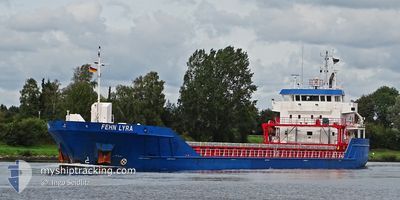
The vessel EMS LYRA (IMO: 9374741, MMSI: 275472000) is a General Cargo that was built in 2010 ( 16 Age ). It's sailing under the flag of [LV] Latvia.
In this page you can find informations about the vessels current position, last detected port calls, and current voyage information. If the vessels is not in coverage by AIS you will find the latest position.
The current position of EMS LYRA is detected by our AIS receivers and we are not responsible for the reliability of the data. The last position was recorded while the vessel was in Coverage by the Ais receivers of our vessel tracking app.
The current draught of EMS LYRA as reported by AIS is 5.7 meters
Weather
| Temperature | 16.5°C / 61.7°F |
|---|---|
| Wind Speed | 15 knots |
| Direction | 329° NNW |
| Pressure | 1001.1 hPa |
| Humidity | 75.4 % |
| Cloud Coverage | 92 % |
Featured Company
Last Port Calls
| Port | Arrival | Departure | Time In Port |
|---|---|---|---|
| 2025-12-22 13:51 | 2025-12-29 15:13 | 7 d | |
| 2025-12-17 05:53 | 2025-12-19 20:48 | 2 d | |
| 2025-12-15 01:39 | 2025-12-17 01:51 | 2 d | |
| 2025-12-12 10:37 | 2025-12-12 11:29 | 52 m | |
| 2025-12-08 14:44 | 2025-12-12 08:53 | 3 d | |
| 2025-12-08 12:58 | 2025-12-08 13:44 | 46 m | |
| 2025-12-03 03:14 | 2025-12-04 19:36 | 1 d | |
| 2025-11-27 10:45 | 2025-11-29 15:47 | 2 d | |
| 2025-11-23 15:21 | 2025-11-25 16:31 | 2 d | |
| 2025-11-13 15:02 | 2025-11-14 20:18 | 1 d |
Last Trips
| Origin | Departure | Destination | Arrival | Distance | |
|---|---|---|---|---|---|
| 2025-12-19 20:48 | 2025-12-22 14:51 | 595.16 nm | |||
| 2025-12-17 01:51 | 2025-12-17 05:53 | 19.72 nm | |||
| 2025-12-12 12:29 | 2025-12-15 01:39 | 561.99 nm | |||
| 2025-12-12 09:53 | 2025-12-12 11:37 | 10.23 nm | |||
| 2025-12-08 14:44 | 2025-12-08 15:44 | 7.21 nm | |||
| 2025-12-04 19:36 | 2025-12-08 13:58 | 582.96 nm | |||
| 2025-11-29 16:47 | 2025-12-03 03:14 | 616.61 nm | |||
| 2025-11-25 17:31 | 2025-11-27 11:45 | 95.36 nm | |||
| 2025-11-14 21:18 | 2025-11-23 16:21 | 1832.85 nm | |||
| 2025-11-12 16:38 | 2025-11-13 16:02 | 118.99 nm |
Events
| Heure | Evenement | Détails | Position/ Destination | Info |
|---|---|---|---|---|
| 2026-01-03 16:03 | Etat Changé | Default Under way using engine |
38.58411 / -10.05104
DZ GHA
|
Vitesse: 7.4 kn Parcours: 163.6° |
| 2026-01-03 15:56 | Hors de la zone couverte |
38.59760 / -10.05425
North Atlantic Ocean
DZ GHA
|
Vitesse: 7.4 kn Parcours: 163.6° |
|
| 2026-01-03 15:31 | Etat Changé | Under way using engine Default |
38.64820 / -10.07412
DZ GHA
|
Vitesse: 8 kn Parcours: 178° |
| 2026-01-03 15:31 | Dans la zone couverte |
38.64154 / -10.07200
North Atlantic Ocean
DZ GHA
|
Vitesse: 7.6 kn Parcours: 173.9° |
|
| 2026-01-03 14:12 | Etat Changé | Default Under way using engine |
38.82201 / -10.09084
DZ GHA
|
Vitesse: 8.9 kn Parcours: 175.2° |
| 2026-01-03 14:10 | Hors de la zone couverte |
38.82668 / -10.09072
North Atlantic Ocean
DZ GHA
|
Vitesse: 8.9 kn Parcours: 175.2° |
|
| 2026-01-03 13:36 | Etat Changé | Under way using engine Default |
38.90138 / -10.09046
DZ GHA
|
Vitesse: 8.4 kn Parcours: 182° |
| 2026-01-03 13:33 | Etat Changé | Default Under way using engine |
38.90761 / -10.09051
DZ GHA
|
Vitesse: 7.9 kn Parcours: 164.7° |
| 2026-01-03 12:23 | Etat Changé | Under way using engine Default |
39.06222 / -10.09001
DZ GHA
|
Vitesse: 7 kn Parcours: 171° |
| 2026-01-03 12:06 | Etat Changé | Default Under way using engine |
39.09983 / -10.08909
DZ GHA
|
Vitesse: 9 kn Parcours: 177.1° |