
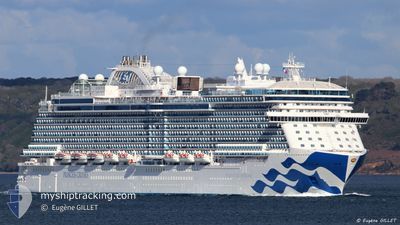
ENCHANTED PRINCESS
Passenger
Current Trip
| Trip Time | 13 h, 39 mins |
|---|---|
| Trip Distance | 187.44 nm |
| AVG Speed | 12.2 Noeuds |
| MAX Speed | 15.4 Noeuds |
| Tirant d eau | 8.6 m |
| AVG Wind | 20 knots |
| MAX Wind | 23 knots |
| MIN Temp | 24.8°C / 76.64°F |
| MAX Temp | 26.3°C / 79.34°F |
| Position reçue | 1 m depuis |
Current Position
| Longitude | -61.07194° |
|---|---|
| Latitude | 14.59995° |
| Etat | Moored |
| Vitesse | |
| Parcours | 50° |
| Zone | Caribbean Sea |
| Station | T-AIS |
| Position reçue | 1 m depuis |
Info
Information
The current position of ENCHANTED PRINCESS is in Caribbean Sea with coordinates 14.59995° / -61.07194° as reported on 2025-02-12 15:34 by AIS to our vessel tracker app. The vessel's current speed is 0 Noeuds and is currently inside the port of FORT DE FRANCE.
The vessel ENCHANTED PRINCESS (IMO: 9807126, MMSI: 310791000) is a Passenger It's sailing under the flag of [BM] Bermuda.
In this page you can find informations about the vessels current position, last detected port calls, and current voyage information. If the vessels is not in coverage by AIS you will find the latest position.
The current position of ENCHANTED PRINCESS is detected by our AIS receivers and we are not responsible for the reliability of the data. The last position was recorded while the vessel was in Coverage by the Ais receivers of our vessel tracking app.
The current draught of ENCHANTED PRINCESS as reported by AIS is 8.6 meters
Weather
| Temperature | 26.8°C / 80.24°F |
|---|---|
| Wind Speed | 18 knots |
| Direction | 80° E |
| Pressure | 1017.1 hPa |
| Humidity | 65.6 % |
| Cloud Coverage | 7 % |
Featured Company
Last Port Calls
| Port | Arrival | Departure | Time In Port |
|---|---|---|---|
| 2025-02-12 07:33 | |||
| 2025-02-11 08:00 | 2025-02-11 17:54 | 9 h | |
| 2025-02-08 05:10 | 2025-02-08 17:27 | 12 h | |
| 2025-02-07 08:05 | 2025-02-07 17:51 | 9 h | |
| 2025-02-04 07:23 | 2025-02-04 17:54 | 10 h | |
| 2025-02-03 07:04 | 2025-02-03 18:02 | 10 h | |
| 2025-02-02 07:28 | 2025-02-02 17:53 | 10 h | |
| 2025-02-01 09:21 | 2025-02-01 21:46 | 12 h | |
| 2025-01-30 08:09 | 2025-01-30 16:08 | 7 h | |
| 2025-01-29 05:19 | 2025-01-29 15:28 | 10 h |
Most Visited Ports (Last year)
| Port | Arrivals | |
|---|---|---|
| 33 | ||
| 18 | ||
| 16 | ||
| 14 | ||
| 12 | ||
| 11 |
Last Trips
| Origin | Departure | Destination | Arrival | Distance | |
|---|---|---|---|---|---|
| 2025-02-11 17:54 | 2025-02-12 07:33 | 187.44 nm | |||
| 2025-02-08 17:27 | 2025-02-11 08:00 | 1172.33 nm | |||
| 2025-02-07 17:51 | 2025-02-08 05:10 | 185.88 nm | |||
| 2025-02-04 17:54 | 2025-02-07 08:05 | 1023.20 nm | |||
| 2025-02-03 18:02 | 2025-02-04 07:23 | 136.96 nm | |||
| 2025-02-02 17:53 | 2025-02-03 07:04 | 136.62 nm | |||
| 2025-02-01 21:46 | 2025-02-02 07:28 | 117.71 nm | |||
| 2025-01-30 16:08 | 2025-02-01 09:21 | 743.42 nm | |||
| 2025-01-29 15:28 | 2025-01-30 08:09 | 288.55 nm | |||
| 2025-01-27 19:04 | 2025-01-29 05:19 | 592.64 nm |
Events
| Heure | Evenement | Détails | Position/ Destination | Info |
|---|---|---|---|---|
| 2025-02-12 15:34 | Etat Changé | Moored Default |
14.59995 / -61.07194
[MQ] FORT DE FRANCE
|
Vitesse: Parcours: 50° |
| 2025-02-12 15:28 | Etat Changé | Default Moored |
14.59996 / -61.07194
[MQ] FORT DE FRANCE
|
Vitesse: Parcours: 50° |
| 2025-02-12 11:45 | Etat Changé | Moored Under way using engine |
14.59977 / -61.07192
[MQ] FORT DE FRANCE
|
Vitesse: 0.3 kn Parcours: 49° |
| 2025-02-12 11:45 | Arret |
14.59977 / -61.07192
[MQ] FORT DE FRANCE
|
Vitesse: 0.3 kn Parcours: 49° |
|
| 2025-02-12 11:33 | Port d'arrivée |
|
14.59516 / -61.07572
[MQ] FORT DE FRANCE
|
Vitesse: 3.9 kn Parcours: 60° |
| 2025-02-12 09:46 | Changement de destination | MQFDF AGSJO |
14.77545 / -61.36829
MQFDF
|
Vitesse: 13.1 kn Parcours: 138.3° |
| 2025-02-12 09:46 | Changement d'ETA | 2025/02/12 11:15 2025/02/11 11:45 |
14.77545 / -61.36829
MQFDF
|
Vitesse: 13.1 kn Parcours: 138.3° |
| 2025-02-12 08:46 | Changement de zone | Guadeloupe and Martinique part of the Caribbean Sea Dominican part of the Caribbean Sea |
14.94349 / -61.51031
Caribbean Sea
|
Vitesse: 13 kn Parcours: 138.9° |
| 2025-02-12 06:04 | Etat Changé | Under way using engine Default |
15.47795 / -61.82889
AGSJO
|
Vitesse: 14.8 kn Parcours: 150° |
| 2025-02-12 06:03 | Etat Changé | Default Under way using engine |
15.48260 / -61.83166
AGSJO
|
Vitesse: 14.9 kn Parcours: 151.6° |