
ESL AMERICA
General Cargo
Current Trip
| Trip Time | 10 days |
|---|---|
| Trip Distance | 1198.30 nm |
| AVG Speed | 11.8 Noeuds |
| MAX Speed | 15.9 Noeuds |
| Tirant d eau | 5.8 m |
| AVG Wind | 9.6 knots |
| MAX Wind | 29 knots |
| MIN Temp | 0.7°C / 33.26°F |
| MAX Temp | 7.4°C / 45.32°F |
| Position reçue | 3 m depuis |
Current Position
| Longitude | 4.33918° |
|---|---|
| Latitude | 51.89680° |
| Etat | Moored |
| Vitesse | |
| Parcours | 256° |
| Zone | North Sea |
| Station | T-AIS |
| Position reçue | 3 m depuis |
Info
Information
The current position of ESL AMERICA is in North Sea with coordinates 51.89680° / 4.33918° as reported on 2025-02-06 05:14 by AIS to our vessel tracker app. The vessel's current speed is 0 Noeuds and is currently inside the port of VLAARDINGEN - ROTTERDAM.
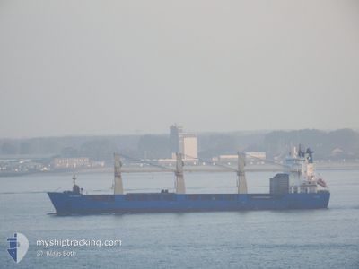
The vessel ESL AMERICA (IMO: 9347035, MMSI: 212558000) is a General Cargo that was built in 2006 ( 19 Age ). It's sailing under the flag of [CY] Cyprus.
In this page you can find informations about the vessels current position, last detected port calls, and current voyage information. If the vessels is not in coverage by AIS you will find the latest position.
The current position of ESL AMERICA is detected by our AIS receivers and we are not responsible for the reliability of the data. The last position was recorded while the vessel was in Coverage by the Ais receivers of our vessel tracking app.
The current draught of ESL AMERICA as reported by AIS is 5.8 meters
Weather
| Temperature | 4.2°C / 39.56°F |
|---|---|
| Wind Speed | 5 knots |
| Direction | 40° NE |
| Pressure | 1041.9 hPa |
| Humidity | 94.7 % |
| Cloud Coverage | 69 % |
Featured Company
Last Port Calls
| Port | Arrival | Departure | Time In Port |
|---|---|---|---|
| 2025-02-06 02:05 | |||
| 2025-01-22 14:01 | 2025-01-26 21:16 | 4 d | |
| 2025-01-17 01:49 | 2025-01-19 02:05 | 2 d | |
| 2024-12-30 17:22 | 2025-01-04 13:27 | 4 d | |
| 2024-12-21 23:10 | 2024-12-29 06:11 | 7 d | |
| 2024-12-10 07:10 | 2024-12-13 17:54 | 3 d | |
| 2024-12-05 04:10 | 2024-12-09 09:55 | 4 d |
Most Visited Ports (Last year)
| Port | Arrivals | |
|---|---|---|
| 2 | ||
| 2 | ||
| 2 | ||
| 2 | ||
| 2 | ||
| 1 |
Last Trips
| Origin | Departure | Destination | Arrival | Distance | |
|---|---|---|---|---|---|
| 2025-01-26 23:16 | 2025-02-06 03:05 | 1198.30 nm | |||
| 2025-01-19 03:05 | 2025-01-22 16:01 | 1119.09 nm | |||
| 2025-01-04 13:27 | 2025-01-17 02:49 | 3913.59 nm | |||
| 2024-12-29 06:11 | 2024-12-30 17:22 | 178.37 nm | |||
| 2024-12-13 17:54 | 2024-12-21 23:10 | 218.22 nm | |||
| 2024-12-09 09:55 | 2024-12-10 07:10 | 176.37 nm | |||
| 2024-11-30 11:42 | 2024-12-05 04:10 | 1542.21 nm |
Events
| Heure | Evenement | Détails | Position/ Destination | Info |
|---|---|---|---|---|
| 2025-02-06 02:10 | Etat Changé | Moored Under way using engine |
51.89681 / 4.33930
[NL] VLAARDINGEN - ROTTERDAM
|
Vitesse: 0.2 kn Parcours: 252° |
| 2025-02-06 02:05 | Port d'arrivée |
|
51.89651 / 4.33896
[NL] VLAARDINGEN - ROTTERDAM
|
Vitesse: 1.1 kn Parcours: 256° |
| 2025-02-06 01:56 | Arret | 0.41 nm, South West of VLAARDINGEN - ROTTERDAM |
51.89525 / 4.33526
NLVLA
|
Vitesse: 0.3 kn Parcours: 242° |
| 2025-02-06 00:01 | Changement d'ETA | 2025/02/05 23:45 2025/02/05 21:00 |
52.00256 / 3.94916
NLVLA
|
Vitesse: 12.4 kn Parcours: 101° |
| 2025-02-05 23:48 | Etat Changé | Under way using engine Default |
52.01259 / 3.87442
NLVLA
|
Vitesse: 13 kn Parcours: 98° |
| 2025-02-05 23:37 | Etat Changé | Default Under way using engine |
52.01877 / 3.81199
NLVLA
|
Vitesse: 12.8 kn Parcours: 165.9° |
| 2025-02-05 23:26 | Etat Changé | Under way using engine Default |
52.03481 / 3.77058
NLVLA
|
Vitesse: 9.4 kn Parcours: 176° |
| 2025-02-05 23:08 | Etat Changé | Default Under way using engine |
52.07781 / 3.76627
NLVLA
|
Vitesse: 9.5 kn Parcours: 175.6° |
| 2025-02-05 22:42 | Etat Changé | Under way using engine Default |
52.15532 / 3.76178
NLVLA
|
Vitesse: 10.6 kn Parcours: 181° |
| 2025-02-05 22:35 | Etat Changé | Default Under way using engine |
52.17565 / 3.76278
NLVLA
|
Vitesse: 10.6 kn Parcours: 182.1° |