
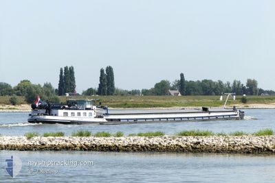
ESPERANCE
Cargo
Current Trip
HAFEN BULSTRINGEN BA
| Time Travelled | 19 h, 59 mins |
|---|---|
| Remaining Time | --- |
| Distance Travelled | 30.82 nm |
| Remaining Distance | --- |
| AVG Speed | 5.1 Noeuds |
| MAX Speed | 6.7 Noeuds |
| AVG Wind | 10.5 knots |
| MAX Wind | 14.7 knots |
| MIN Temp | 0.9°C / 33.62°F |
| MAX Temp | 4.6°C / 40.28°F |
| Tirant d eau | 1 m |
| Position reçue | 2 h, 50 m depuis |
Current Position
| Longitude | 6.78038° |
|---|---|
| Latitude | 51.64840° |
| Etat | Under way using engine |
| Vitesse | 4.8 Noeuds |
| Parcours | 87.9° |
| Zone | North Sea |
| Station | T-AIS |
| Position reçue | 2 h, 50 m depuis |
Info
Information
The current position of ESPERANCE is in North Sea with coordinates 51.64840° / 6.78038° as reported on 2026-01-09 10:44 by AIS to our vessel tracker app. The vessel's current speed is 4.8 Noeuds
The vessel ESPERANCE (MMSI: 244255003) is a Cargo It's sailing under the flag of [NL] Netherlands.
In this page you can find informations about the vessels current position, last detected port calls, and current voyage information. If the vessels is not in coverage by AIS you will find the latest position.
The current position of ESPERANCE is detected by our AIS receivers and we are not responsible for the reliability of the data. The last position was recorded while the vessel was in Coverage by the Ais receivers of our vessel tracking app.
The current draught of ESPERANCE as reported by AIS is 1 meters
Weather
| Temperature | 4°C / 39.2°F |
|---|---|
| Wind Speed | 15 knots |
| Direction | 148° SSE |
| Pressure | 983.4 hPa |
| Humidity | 94.8 % |
| Cloud Coverage | 100 % |
Featured Company
Last Port Calls
| Port | Arrival | Departure | Time In Port |
|---|---|---|---|
| 2026-01-08 17:24 | 2026-01-08 18:36 | 1 h | |
| 2026-01-06 19:56 | 2026-01-07 10:55 | 14 h | |
| 2026-01-06 17:58 | 2026-01-06 18:34 | 36 m | |
| 2026-01-05 21:55 | 2026-01-06 13:33 | 15 h | |
| 2026-01-05 18:25 | 2026-01-05 21:15 | 2 h | |
| 2025-12-30 12:20 | 2025-12-30 13:04 | 43 m | |
| 2025-12-22 16:59 | 2025-12-30 10:39 | 7 d | |
| 2025-12-14 10:28 | 2025-12-14 12:53 | 2 h | |
| 2025-12-12 18:08 | 2025-12-14 08:20 | 1 d | |
| 2025-12-12 13:37 | 2025-12-12 15:44 | 2 h |
Last Trips
| Origin | Departure | Destination | Arrival | Distance | |
|---|---|---|---|---|---|
| 2026-01-07 10:55 | 2026-01-08 17:24 | 26.69 nm | |||
| 2026-01-06 18:34 | 2026-01-06 19:56 | 8.92 nm | |||
| 2026-01-06 13:33 | 2026-01-06 17:58 | 31.13 nm | |||
| 2026-01-05 21:15 | 2026-01-05 21:55 | 4.17 nm | |||
| 2025-12-30 13:04 | 2026-01-05 18:25 | 89.83 nm | |||
| 2025-12-30 10:39 | 2025-12-30 12:20 | 12.05 nm | |||
| 2025-12-14 12:53 | 2025-12-22 16:59 | 357.44 nm | |||
| 2025-12-14 08:20 | 2025-12-14 10:28 | 11.87 nm | |||
| 2025-12-12 15:44 | 2025-12-12 18:08 | 12.97 nm | |||
| 2025-12-11 18:46 | 2025-12-12 13:37 | 77.30 nm |
Events
| Heure | Evenement | Détails | Position/ Destination | Info |
|---|---|---|---|---|
| 2026-01-09 10:44 | Hors de la zone couverte |
51.64840 / 6.78038
North Sea
HAFEN BULSTRINGEN BA
|
Vitesse: 4.8 kn Parcours: 87.9° |
|
| 2026-01-09 10:44 | Démarrage | 6.62 nm, East of WESEL |
51.64842 / 6.77935
HAFEN BULSTRINGEN BA
|
Vitesse: 4.3 kn Parcours: 91.7° |
| 2026-01-09 10:39 | Etat Changé | Under way using engine Moored |
51.64832 / 6.77589
HAFEN BULSTRINGEN BA
|
Vitesse: Parcours: 511° |
| 2026-01-09 09:16 | Etat Changé | Moored Under way using engine |
51.64839 / 6.76886
HAFEN BULSTRINGEN BA
|
Vitesse: Parcours: 511° |
| 2026-01-09 08:36 | Arret | 6.23 nm, East of WESEL |
51.64838 / 6.76888
HAFEN BULSTRINGEN BA
|
Vitesse: Parcours: 511° |
| 2026-01-09 07:20 | Dans la zone couverte |
51.63159 / 6.64909
North Sea
HAFEN BULSTRINGEN BA
|
Vitesse: 2.4 kn Parcours: 61.2° |
|
| 2026-01-09 00:30 | Hors de la zone couverte |
51.63124 / 6.64808
North Sea
HAFEN BULSTRINGEN BA
|
Vitesse: 0.1 kn Parcours: 330.6° |
|
| 2026-01-09 00:26 | Arret | 2.14 nm, South East of WESEL |
51.63112 / 6.64802
HAFEN BULSTRINGEN BA
|
Vitesse: 0.2 kn Parcours: 511° |
| 2026-01-09 00:14 | Dans la zone couverte |
51.62858 / 6.63830
North Sea
HAFEN BULSTRINGEN BA
|
Vitesse: 3.9 kn Parcours: 74.3° |
|
| 2026-01-08 22:47 | Hors de la zone couverte |
51.62969 / 6.61107
North Sea
HAFEN BULSTRINGEN BA
|
Vitesse: 1 kn Parcours: 122.9° |