
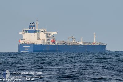
EUROINTEGRITY
Crude Oil Tanker
Current Trip
| Time Travelled | 1 day |
|---|---|
| Remaining Time | --- |
| Distance Travelled | 9.29 nm |
| Remaining Distance | --- |
| AVG Speed | 18.3 Noeuds |
| MAX Speed | 18.3 Noeuds |
| AVG Wind | 3.7 knots |
| MAX Wind | 7.2 knots |
| MIN Temp | 0.2°C / 32.36°F |
| MAX Temp | 7.9°C / 46.22°F |
| Tirant d eau | 8 m |
| Position reçue | 4 d depuis |
Current Position
| Longitude | 31.64960° |
|---|---|
| Latitude | 42.51278° |
| Etat | Under way using engine |
| Vitesse | 11 Noeuds |
| Parcours | 71° |
| Zone | Black Sea |
| Station | T-AIS |
| Position reçue | 4 d depuis |
Info
Information
The current position of EUROINTEGRITY is in Black Sea with coordinates 42.51278° / 31.64960° as reported on 2025-02-10 00:38 by AIS to our vessel tracker app. The vessel's current speed is 11 Noeuds
The vessel EUROINTEGRITY (IMO: 9410648, MMSI: 636018917) is a Crude Oil Tanker that was built in 2009 ( 16 Age ). It's sailing under the flag of [LR] Liberia.
In this page you can find informations about the vessels current position, last detected port calls, and current voyage information. If the vessels is not in coverage by AIS you will find the latest position.
The current position of EUROINTEGRITY is detected by our AIS receivers and we are not responsible for the reliability of the data. The last position was recorded while the vessel was in Coverage by the Ais receivers of our vessel tracking app.
The current draught of EUROINTEGRITY as reported by AIS is 8 meters
Weather
| Temperature | 8°C / 46.4°F |
|---|---|
| Wind Speed | 8 knots |
| Direction | 308° NW |
| Pressure | 1021.3 hPa |
| Humidity | 60.2 % |
| Cloud Coverage | 100 % |
Featured Company
Last Port Calls
| Port | Arrival | Departure | Time In Port |
|---|---|---|---|
| 2025-02-12 08:35 | 2025-02-12 09:07 | 31 m | |
| 2025-02-11 15:51 | 2025-02-11 20:03 | 4 h | |
| 2025-01-23 08:30 | 2025-01-23 18:09 | 9 h | |
| 2025-01-11 13:26 | 2025-01-20 22:03 | 9 d | |
| 2024-12-27 10:28 | 2024-12-27 19:45 | 9 h |
Most Visited Ports (Last year)
| Port | Arrivals | |
|---|---|---|
| 9 | ||
| 2 | ||
| 2 | ||
| 2 | ||
| 1 |
Last Trips
| Origin | Departure | Destination | Arrival | Distance | |
|---|---|---|---|---|---|
| 2025-02-11 20:03 | 2025-02-12 08:35 | 141.45 nm | |||
| 2025-01-20 22:03 | 2025-02-11 15:51 | 2059.66 nm | |||
| 2025-01-20 22:03 | 2025-01-23 08:30 | 508.06 nm | |||
| 2024-11-07 19:17 | 2025-01-11 13:26 | 2128.53 nm | |||
| 2024-11-07 19:17 | 2024-12-27 10:28 | 6138.74 nm |
Events
| Heure | Evenement | Détails | Position/ Destination | Info |
|---|---|---|---|---|
| 2025-02-12 06:43 | Démarrage | 4.33 nm, North East of TUAPSE |
44.13649 / 39.14284
RU TUA
|
Vitesse: 7.2 kn Parcours: 250° |
| 2025-02-12 06:07 | PORT DE DEPART |
|
44.13649 / 39.14284
RU TUA
|
Vitesse: Parcours: 250° |
| 2025-02-12 05:59 | Arret |
44.08387 / 39.07065
[RU] TUAPSE
|
Vitesse: Parcours: 250° |
|
| 2025-02-12 05:35 | Port d'arrivée |
|
44.08983 / 39.06083
[RU] TUAPSE
|
Vitesse: 8.3 kn Parcours: 273° |
| 2025-02-11 17:03 | Démarrage | 5.02 nm, North East of TUAPSE |
44.14024 / 39.15911
RU TUA
|
Vitesse: 51.3 kn Parcours: 250° |
| 2025-02-11 17:03 | PORT DE DEPART |
|
44.14024 / 39.15911
RU TUA
|
Vitesse: Parcours: 250° |
| 2025-02-11 13:09 | Arret |
44.08383 / 39.07066
[RU] TUAPSE
|
Vitesse: Parcours: 250° |
|
| 2025-02-11 12:51 | Port d'arrivée |
|
44.08317 / 39.06652
[RU] TUAPSE
|
Vitesse: 3.6 kn Parcours: 10° |
| 2025-02-11 12:09 | Démarrage | 3.42 nm, South of TUAPSE |
44.03270 / 39.08171
RU TUA
|
Vitesse: 5.3 kn Parcours: 314° |
| 2025-02-10 00:38 | Hors de la zone couverte |
42.51278 / 31.64960
Black Sea
RU TUA
|
Vitesse: 11 kn Parcours: 71° |