
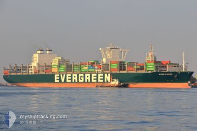
EVER FAVOR
Cargo A
Current Trip
LAST UPDATE TIME
| Time Travelled | 4 days |
|---|---|
| Remaining Time | --- |
| Distance Travelled | 1374.87 nm |
| Remaining Distance | --- |
| AVG Speed | 11.6 Noeuds |
| MAX Speed | 19.3 Noeuds |
| AVG Wind | 15.7 knots |
| MAX Wind | 27 knots |
| MIN Temp | 22.1°C / 71.78°F |
| MAX Temp | 27.2°C / 80.96°F |
| Tirant d eau | 14.7 m |
| Position reçue | 11 h, 16 m depuis |
Current Position
| Longitude | -77.47309° |
|---|---|
| Latitude | 27.79700° |
| Etat | Under way using engine |
| Vitesse | 11.8 Noeuds |
| Parcours | 326.3° |
| Zone | North Atlantic Ocean |
| Station | T-AIS |
| Position reçue | 11 h, 16 m depuis |
Info
Information
The current position of EVER FAVOR is in North Atlantic Ocean with coordinates 27.79700° / -77.47309° as reported on 2025-02-11 14:13 by AIS to our vessel tracker app. The vessel's current speed is 11.8 Noeuds
The vessel EVER FAVOR (IMO: 9850850, MMSI: 636021387) is a Cargo A It's sailing under the flag of [LR] Liberia.
In this page you can find informations about the vessels current position, last detected port calls, and current voyage information. If the vessels is not in coverage by AIS you will find the latest position.
The current position of EVER FAVOR is detected by our AIS receivers and we are not responsible for the reliability of the data. The last position was recorded while the vessel was in Coverage by the Ais receivers of our vessel tracking app.
The current draught of EVER FAVOR as reported by AIS is 14.7 meters
Weather
| Temperature | 23°C / 73.4°F |
|---|---|
| Wind Speed | 16 knots |
| Direction | 180° S |
| Pressure | 1019 hPa |
| Humidity | 70 % |
| Cloud Coverage | 2 % |
Featured Company
Last Port Calls
| Port | Arrival | Departure | Time In Port |
|---|---|---|---|
| 2025-02-05 21:42 | 2025-02-06 22:07 | 1 d | |
| 2025-01-12 16:25 | 2025-01-14 06:24 | 1 d | |
| 2025-01-07 12:24 | 2025-01-08 12:45 | 1 d | |
| 2025-01-04 03:21 | 2025-01-05 05:45 | 1 d | |
| 2024-12-08 17:25 | 2024-12-10 02:31 | 1 d | |
| 2024-12-01 15:10 | 2024-12-03 08:16 | 1 d |
Last Trips
| Origin | Departure | Destination | Arrival | Distance | |
|---|---|---|---|---|---|
| 2025-01-14 06:24 | 2025-02-05 21:42 | 8366.94 nm | |||
| 2025-01-08 12:45 | 2025-01-12 16:25 | 661.52 nm | |||
| 2025-01-05 05:45 | 2025-01-07 12:24 | 471.93 nm | |||
| 2024-12-10 02:31 | 2025-01-04 03:21 | 9610.23 nm | |||
| 2024-12-03 08:16 | 2024-12-08 17:25 | 1969.40 nm | |||
| 2024-11-30 12:29 | 2024-12-01 15:10 | 386.35 nm |
Events
| Heure | Evenement | Détails | Position/ Destination | Info |
|---|---|---|---|---|
| 2025-02-11 14:20 | Etat Changé | Default Under way using engine |
27.81723 / -77.48804
LAST UPDATE TIME
|
Vitesse: 11.8 kn Parcours: 326.3° |
| 2025-02-11 14:13 | Etat Changé | Under way using engine Default |
27.79700 / -77.47309
LAST UPDATE TIME
|
Vitesse: 11.8 kn Parcours: 329° |
| 2025-02-11 14:13 | Dans la zone couverte |
27.79700 / -77.47309
North Atlantic Ocean
|
Vitesse: 11.8 kn Parcours: 326.3° |
|
| 2025-02-11 14:13 | Hors de la zone couverte |
27.79700 / -77.47309
North Atlantic Ocean
|
Vitesse: 11.8 kn Parcours: 326.3° |
|
| 2025-02-11 09:42 | Etat Changé | Default Under way using engine |
27.04378 / -76.93730
LAST UPDATE TIME
|
Vitesse: 11.8 kn Parcours: 328.3° |
| 2025-02-11 09:38 | Hors de la zone couverte |
27.03307 / -76.92996
North Atlantic Ocean
|
Vitesse: 11.8 kn Parcours: 328.3° |
|
| 2025-02-11 09:26 | Etat Changé | Under way using engine Default |
26.99947 / -76.90725
LAST UPDATE TIME
|
Vitesse: 12 kn Parcours: 327° |
| 2025-02-11 09:26 | Dans la zone couverte |
26.99947 / -76.90725
North Atlantic Ocean
|
Vitesse: 11.7 kn Parcours: 328.2° |
|
| 2025-02-11 08:19 | Etat Changé | Default Under way using engine |
26.81505 / -76.77531
LAST UPDATE TIME
|
Vitesse: 11.6 kn Parcours: 328.2° |
| 2025-02-11 08:10 | Hors de la zone couverte |
26.79012 / -76.75716
North Atlantic Ocean
|
Vitesse: 11.6 kn Parcours: 328.2° |