

EXPERT
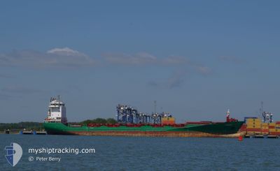
Container Ship

Current Trip
| Time Travelled | 3 h, 36 mins |
|---|---|
| Remaining Time | 23 h, 35 mins |
| Distance Travelled | 51.08 nm |
| Remaining Distance | 349.69 nm |
| AVG Speed | 12.8 Noeuds |
| MAX Speed | 16.2 Noeuds |
| AVG Wind | 9.3 knots |
| MAX Wind | 11.8 knots |
| MIN Temp | 15.5°C / 59.9°F |
| MAX Temp | 16°C / 60.8°F |
| Tirant d eau | 8 m |
| Position reçue | Maintenant |
Current Position
| Longitude | 11.46430° |
|---|---|
| Latitude | 54.49600° |
| Etat | Under way using engine |
| Vitesse | 15.8 Noeuds |
| Parcours | 116.9° |
| Zone | Baltic Sea |
| Station | T-AIS |
| Position reçue | Maintenant |
Information
The current position of EXPERT is in Baltic Sea with coordinates 54.49600° / 11.46430° as reported on 2025-06-04 10:51 by AIS to our vessel tracker app. The vessel's current speed is 15.8 Noeuds and is heading at the port of KLAIPEDA. The estimated time of arrival as calculated by MyShipTracking vessel tracking app is 2025-06-05 13:27 LT
The vessel EXPERT (IMO: 9412529, MMSI: 244742000) is a Container Ship that was built in 2010 ( 15 Age ). It's sailing under the flag of [NL] Netherlands.
In this page you can find informations about the vessels current position, last detected port calls, and current voyage information. If the vessels is not in coverage by AIS you will find the latest position.
The current position of EXPERT is detected by our AIS receivers and we are not responsible for the reliability of the data. The last position was recorded while the vessel was in Coverage by the Ais receivers of our vessel tracking app.
The current draught of EXPERT as reported by AIS is 8 meters
Weather
| Temperature | 15.8°C / 60.44°F |
|---|---|
| Wind Speed | 7 knots |
| Direction | 215° SW |
| Pressure | 1006.6 hPa |
| Humidity | 82.3 % |
| Cloud Coverage | 77 % |


Featured Company
Last Port Calls
| Port | Arrival | Departure | Time In Port |
|---|---|---|---|
| 2025-06-04 09:14 | 2025-06-04 09:16 | 2 m | |
| 2025-06-02 00:52 | 2025-06-03 14:18 | 1 d | |
| 2025-05-31 05:45 | 2025-06-01 16:04 | 1 d | |
| 2025-05-30 15:38 | 2025-05-30 16:13 | 34 m | |
| 2025-05-26 17:35 | 2025-05-27 20:50 | 1 d | |
| 2025-05-24 22:23 | 2025-05-24 22:26 | 3 m | |
| 2025-05-23 06:30 | 2025-05-23 18:14 | 11 h | |
| 2025-05-22 16:04 | 2025-05-23 05:00 | 12 h | |
| 2025-05-19 16:56 | 2025-05-20 19:48 | 1 d | |
| 2025-05-17 11:56 | 2025-05-18 12:28 | 1 d |
Most Visited Ports (Last year)
| Port | Arrivals | |
|---|---|---|
| 5 | ||
| 4 | ||
| 4 | ||
| 1 | ||
| 1 | ||
| 1 |
Last Trips
| Origin | Departure | Destination | Arrival | Distance | |
|---|---|---|---|---|---|
| 2025-06-03 14:18 | 2025-06-04 09:14 | 131.73 nm | |||
| 2025-06-01 16:04 | 2025-06-02 00:52 | 114.46 nm | |||
| 2025-05-30 16:13 | 2025-05-31 05:45 | 87.01 nm | |||
| 2025-05-27 20:50 | 2025-05-30 15:38 | 769.20 nm | |||
| 2025-05-24 22:26 | 2025-05-26 17:35 | 646.48 nm | |||
| 2025-05-23 18:14 | 2025-05-24 22:23 | 320.04 nm | |||
| 2025-05-23 05:00 | 2025-05-23 06:30 | 16.46 nm | |||
| 2025-05-20 19:48 | 2025-05-22 16:04 | 273.94 nm | |||
| 2025-05-18 12:28 | 2025-05-19 16:56 | 320.77 nm | |||
| 2025-05-16 14:09 | 2025-05-17 11:56 | 324.92 nm |
Events
| Heure | Evenement | Détails | Position/ Destination | Info |
|---|---|---|---|---|
| 2025-06-04 10:46 | Changement de zone | Danish part of the Baltic Sea German part of the Baltic Sea |
54.50579 / 11.43060
Baltic Sea
LTKLJ VIA DENOK
|
Vitesse: 15.7 kn Parcours: 116.4° |
| 2025-06-04 09:13 | Changement de zone | German part of the Baltic Sea Danish part of the Baltic Sea |
54.57223 / 10.78518
Baltic Sea
LTKLJ VIA DENOK
|
Vitesse: 16 kn Parcours: 81.8° |
| 2025-06-04 08:49 | Changement de zone | Danish part of the Baltic Sea German part of the Baltic Sea |
54.55900 / 10.60395
Baltic Sea
LTKLJ VIA DENOK
|
Vitesse: 14.6 kn Parcours: 84.2° |
| 2025-06-04 07:52 | Changement de zone | German part of the Baltic Sea German part of the North Sea |
54.46171 / 10.26415
Baltic Sea
LTKLJ VIA DENOK
|
Vitesse: 12.4 kn Parcours: 48.6° |
| 2025-06-04 07:16 | PORT DE DEPART |
|
54.36426 / 10.16898
LTKLJ VIA DENOK
|
Vitesse: 10.2 kn Parcours: 64° |
| 2025-06-04 07:14 | Port d'arrivée |
|
54.36352 / 10.15847
[DE] KIEL
|
Vitesse: 9.2 kn Parcours: 100.8° |
| 2025-06-04 07:10 | Démarrage | 1.33 nm, South West of STICKENHΟRN SPORT |
54.36524 / 10.14489
LTKLJ VIA DENOK
|
Vitesse: 3.9 kn Parcours: 105° |
| 2025-06-04 06:38 | Arret | 1.38 nm, South West of STICKENHΟRN SPORT |
54.36573 / 10.14188
LTKLJ VIA DENOK
|
Vitesse: 0.3 kn Parcours: 104° |
| 2025-06-03 22:19 | Démarrage | 0.65 nm, South West of BRUNSBUETTEL |
53.89494 / 9.14758
LTKLJ VIA DENOK
|
Vitesse: 3.6 kn Parcours: 51° |
| 2025-06-03 22:02 | Etat Changé | Under way using engine Moored |
53.89374 / 9.14515
LTKLJ VIA DENOK
|
Vitesse: Parcours: 48° |