

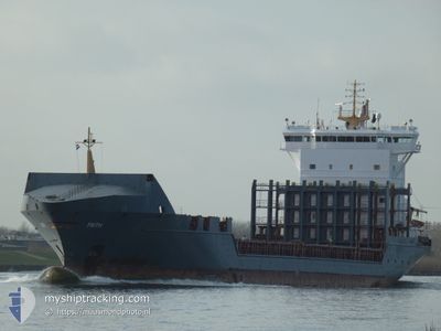
FAITH
General Cargo

Current Trip
| Time Travelled | 2 days |
|---|---|
| Remaining Time | 7 h, 27 mins |
| Distance Travelled | 710.27 nm |
| Remaining Distance | 120.66 nm |
| AVG Speed | 12.5 Noeuds |
| MAX Speed | 15.5 Noeuds |
| AVG Wind | 15.7 knots |
| MAX Wind | 25.3 knots |
| MIN Temp | 12.5°C / 54.5°F |
| MAX Temp | 16.8°C / 62.24°F |
| Tirant d eau | 6.9 m |
| Position reçue | 1 d depuis |
Current Position
| Longitude | -8.44978° |
|---|---|
| Latitude | 43.84654° |
| Etat | Under way using engine |
| Vitesse | 13.9 Noeuds |
| Parcours | 12.8° |
| Zone | North Atlantic Ocean |
| Station | T-AIS |
| Position reçue | 1 d depuis |
Information
The current position of FAITH is in North Atlantic Ocean with coordinates 43.84654° / -8.44978° as reported on 2025-05-24 00:45 by AIS to our vessel tracker app. The vessel's current speed is 13.9 Noeuds and is heading at the port of DUBLIN. The estimated time of arrival as calculated by MyShipTracking vessel tracking app is 2025-05-25 18:58 LT
The vessel FAITH (IMO: 9301108, MMSI: 255802760) is a General Cargo that was built in 2006 ( 19 Age ). It's sailing under the flag of [PT] Portugal.
In this page you can find informations about the vessels current position, last detected port calls, and current voyage information. If the vessels is not in coverage by AIS you will find the latest position.
The current position of FAITH is detected by our AIS receivers and we are not responsible for the reliability of the data. The last position was recorded while the vessel was in Coverage by the Ais receivers of our vessel tracking app.
The current draught of FAITH as reported by AIS is 6.9 meters
Weather
| Temperature | 13.6°C / 56.48°F |
|---|---|
| Wind Speed | 22 knots |
| Direction | 274° W |
| Pressure | 1012.7 hPa |
| Humidity | 62 % |
| Cloud Coverage | 47 % |


Featured Company
Last Port Calls
| Port | Arrival | Departure | Time In Port |
|---|---|---|---|
| 2025-05-22 09:11 | 2025-05-22 22:50 | 13 h | |
| 2025-05-20 14:39 | 2025-05-21 15:34 | 1 d | |
| 2025-05-17 00:04 | 2025-05-17 12:21 | 12 h | |
| 2025-05-14 01:31 | 2025-05-15 04:53 | 1 d | |
| 2025-05-12 19:20 | 2025-05-13 16:11 | 20 h | |
| 2025-05-07 17:12 | 2025-05-08 15:53 | 22 h | |
| 2025-05-05 22:30 | 2025-05-06 22:52 | 1 d | |
| 2025-05-01 08:15 | 2025-05-01 19:11 | 10 h | |
| 2025-04-29 12:21 | 2025-04-30 08:47 | 20 h | |
| 2025-04-28 21:24 | 2025-04-28 22:22 | 58 m |
Last Trips
| Origin | Departure | Destination | Arrival | Distance | |
|---|---|---|---|---|---|
| 2025-05-21 16:34 | 2025-05-22 10:11 | 216.86 nm | |||
| 2025-05-17 14:21 | 2025-05-20 15:39 | 979.31 nm | |||
| 2025-05-15 05:53 | 2025-05-17 02:04 | 457.46 nm | |||
| 2025-05-13 17:11 | 2025-05-14 02:31 | 116.78 nm | |||
| 2025-05-08 16:53 | 2025-05-12 20:20 | 1084.91 nm | |||
| 2025-05-06 23:52 | 2025-05-07 18:12 | 231.99 nm | |||
| 2025-05-01 21:11 | 2025-05-05 23:30 | 972.31 nm | |||
| 2025-04-30 10:47 | 2025-05-01 10:15 | 313.70 nm | |||
| 2025-04-29 00:22 | 2025-04-29 14:21 | 86.92 nm | |||
| 2025-04-27 19:40 | 2025-04-28 23:24 | 363.69 nm |
Events
| Heure | Evenement | Détails | Position/ Destination | Info |
|---|---|---|---|---|
| 2025-05-24 00:54 | Etat Changé | Default Under way using engine |
43.87987 / -8.44140
IEDUB
|
Vitesse: 13.9 kn Parcours: 12.8° |
| 2025-05-24 00:45 | Hors de la zone couverte |
43.84654 / -8.44978
North Atlantic Ocean
IEDUB
|
Vitesse: 13.9 kn Parcours: 12.8° |
|
| 2025-05-23 22:55 | Changement de destination | IEDUB ESPRO |
43.44753 / -8.32933
IEDUB
|
Vitesse: 9.9 kn Parcours: 242.6° |
| 2025-05-23 22:55 | Changement d'ETA | 2025/05/25 21:30 2025/05/23 15:00 |
43.44753 / -8.32933
IEDUB
|
Vitesse: 9.9 kn Parcours: 242.6° |
| 2025-05-23 22:46 | Démarrage | 3.3 nm, West of MUGARDOS |
43.46391 / -8.32053
ESPRO
|
Vitesse: 4.3 kn Parcours: 152° |
| 2025-05-23 22:40 | Etat Changé | Under way using engine Moored |
43.46370 / -8.32387
ESPRO
|
Vitesse: Parcours: 56° |
| 2025-05-23 22:37 | Etat Changé | Moored Default |
43.46370 / -8.32391
ESPRO
|
Vitesse: Parcours: 56° |
| 2025-05-23 22:31 | Etat Changé | Default Moored |
43.46376 / -8.32390
ESPRO
|
Vitesse: Parcours: 56° |
| 2025-05-23 22:25 | Etat Changé | Moored Default |
43.46372 / -8.32390
ESPRO
|
Vitesse: Parcours: 56° |
| 2025-05-23 22:10 | Etat Changé | Default Moored |
43.46373 / -8.32389
ESPRO
|
Vitesse: Parcours: 56° |