
FAMITA
General Cargo
Current Trip
| Time Travelled | 1 day |
|---|---|
| Remaining Time | --- |
| Distance Travelled | 138.73 nm |
| Remaining Distance | --- |
| AVG Speed | 7 Noeuds |
| MAX Speed | 9.8 Noeuds |
| AVG Wind | 5.9 knots |
| MAX Wind | 13 knots |
| MIN Temp | -3.6°C / 25.52°F |
| MAX Temp | 0.9°C / 33.62°F |
| Tirant d eau | 6.3 m |
| Position reçue | 1 m depuis |
Current Position
| Longitude | 12.63363° |
|---|---|
| Latitude | 55.71909° |
| Etat | Moored |
| Vitesse | 0.1 Noeuds |
| Parcours | 230° |
| Zone | Kattegat |
| Station | T-AIS |
| Position reçue | 1 m depuis |
Info
Information
The current position of FAMITA is in Kattegat with coordinates 55.71909° / 12.63363° as reported on 2026-01-06 11:45 by AIS to our vessel tracker app. The vessel's current speed is 0.1 Noeuds
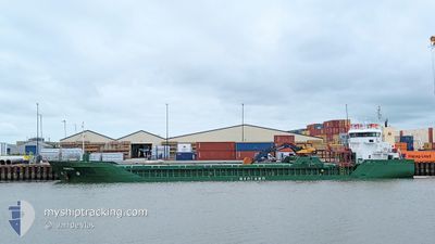
The vessel FAMITA (IMO: 9250438, MMSI: 311001499) is a General Cargo that was built in 2002 ( 24 Age ). It's sailing under the flag of [BS] Bahamas.
In this page you can find informations about the vessels current position, last detected port calls, and current voyage information. If the vessels is not in coverage by AIS you will find the latest position.
The current position of FAMITA is detected by our AIS receivers and we are not responsible for the reliability of the data. The last position was recorded while the vessel was in Coverage by the Ais receivers of our vessel tracking app.
The current draught of FAMITA as reported by AIS is 6.3 meters
Weather
| Temperature | -1.5°C / 29.3°F |
|---|---|
| Wind Speed | 3 knots |
| Direction | 281° W |
| Pressure | 1012.3 hPa |
| Humidity | 77.4 % |
| Cloud Coverage | 85 % |
Featured Company
Last Port Calls
| Port | Arrival | Departure | Time In Port |
|---|---|---|---|
| 2026-01-05 06:34 | 2026-01-05 09:46 | 3 h | |
| 2025-11-15 14:32 | 2025-12-24 15:14 | ||
| 2025-11-04 01:28 | 2025-11-04 17:35 | 16 h |
Most Visited Ports (Last year)
| Port | Arrivals | |
|---|---|---|
| 22 | ||
| 17 | ||
| 9 | ||
| 7 | ||
| 5 | ||
| 4 |
Events
| Heure | Evenement | Détails | Position/ Destination | Info |
|---|---|---|---|---|
| 2026-01-06 04:42 | Etat Changé | Moored Under way using engine |
55.71912 / 12.63365
DKCPH
|
Vitesse: 0.1 kn Parcours: 229° |
| 2026-01-06 04:29 | Arret | 1.54 nm, North East of COPENHAGEN |
55.71899 / 12.63373
DKCPH
|
Vitesse: 0.2 kn Parcours: 237° |
| 2026-01-05 23:16 | Changement de zone | Danish part of the Kattegat Swedish part of the Kattegat |
56.23077 / 12.31688
Kattegat
DKCPH
|
Vitesse: 6.4 kn Parcours: 144° |
| 2026-01-05 21:41 | Changement de zone | Swedish part of the Kattegat Danish part of the Kattegat |
56.37453 / 12.11843
Kattegat
DKCPH
|
Vitesse: 6.9 kn Parcours: 142° |
| 2026-01-05 09:28 | Changement d'ETA | 2026/01/06 05:00 2026/01/06 06:00 |
57.36120 / 10.64447
DKCPH
|
Vitesse: 7.5 kn Parcours: 170° |
| 2026-01-05 08:46 | PORT DE DEPART |
|
57.43127 / 10.55609
DKCPH
|
Vitesse: 6.7 kn Parcours: 128° |
| 2026-01-05 08:43 | Démarrage |
57.43467 / 10.54813
[DK] FREDERIKSHAVN
|
Vitesse: 3.8 kn Parcours: 122° |
|
| 2026-01-05 08:32 | Changement de destination | DKCPH DKFDH |
57.43681 / 10.54911
[DK] FREDERIKSHAVN
|
Vitesse: Parcours: 227° |
| 2026-01-05 08:32 | Changement d'ETA | 2026/01/06 06:00 2026/01/05 06:00 |
57.43681 / 10.54911
[DK] FREDERIKSHAVN
|
Vitesse: Parcours: 227° |
| 2026-01-05 08:25 | Etat Changé | Under way using engine Moored |
57.43680 / 10.54912
[DK] FREDERIKSHAVN
|
Vitesse: Parcours: 226° |