
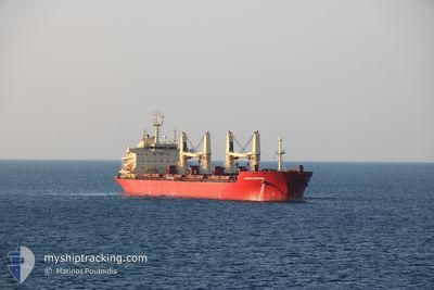
FEDERAL SKEENA
Bulk Carrier
Current Trip
| Trip Time | 25 days |
|---|---|
| Trip Distance | 5346.34 nm |
| AVG Speed | 9.6 Noeuds |
| MAX Speed | 9.6 Noeuds |
| Tirant d eau | 10.5 m |
| AVG Wind | 16.9 knots |
| MAX Wind | 40 knots |
| MIN Temp | -18.4°C / -1.12°F |
| MAX Temp | 17.1°C / 62.78°F |
| Position reçue | 3 d depuis |
Current Position
| Longitude | 35.75219° |
|---|---|
| Latitude | 36.58163° |
| Etat | Under way using engine |
| Vitesse | 8.4 Noeuds |
| Parcours | 50.3° |
| Zone | Mediterranean Sea - Eastern Basin |
| Station | T-AIS |
| Position reçue | 3 d depuis |
Info
Information
The current position of FEDERAL SKEENA is in Mediterranean Sea - Eastern Basin with coordinates 36.58163° / 35.75219° as reported on 2025-02-10 01:03 by AIS to our vessel tracker app. The vessel's current speed is 8.4 Noeuds and is currently inside the port of TOROS.
The vessel FEDERAL SKEENA (IMO: 9595890, MMSI: 538004381) is a Bulk Carrier that was built in 2012 ( 13 Age ). It's sailing under the flag of [MH] Marshall Is.
In this page you can find informations about the vessels current position, last detected port calls, and current voyage information. If the vessels is not in coverage by AIS you will find the latest position.
The current position of FEDERAL SKEENA is detected by our AIS receivers and we are not responsible for the reliability of the data. The last position was recorded while the vessel was in Coverage by the Ais receivers of our vessel tracking app.
The current draught of FEDERAL SKEENA as reported by AIS is 10.5 meters
Weather
| Temperature | 10.7°C / 51.26°F |
|---|---|
| Wind Speed | 3 knots |
| Direction | 227° SW |
| Pressure | 1017 hPa |
| Humidity | 63.1 % |
| Cloud Coverage | 100 % |
Featured Company
Last Port Calls
| Port | Arrival | Departure | Time In Port |
|---|---|---|---|
| 2025-02-12 09:49 | |||
| 2025-01-12 03:15 | 2025-01-18 09:46 | 6 d | |
| 2024-12-25 10:59 | 2025-01-02 17:27 | 8 d |
Last Trips
| Origin | Departure | Destination | Arrival | Distance | |
|---|---|---|---|---|---|
| 2025-01-18 04:46 | 2025-02-12 12:49 | 5346.34 nm | |||
| 2025-01-02 12:27 | 2025-01-11 22:15 | 33.92 nm | |||
| 2024-11-01 00:25 | 2024-12-25 05:59 | 15038.58 nm |
Events
| Heure | Evenement | Détails | Position/ Destination | Info |
|---|---|---|---|---|
| 2025-02-12 09:56 | Arret |
36.91263 / 35.99256
[TR] TOROS
|
Vitesse: 0.1 kn Parcours: 336° |
|
| 2025-02-12 09:49 | Port d'arrivée |
|
36.91199 / 35.99334
[TR] TOROS
|
Vitesse: 2.7 kn Parcours: 319° |
| 2025-02-12 09:17 | Démarrage | 1.92 nm, South of TOROS |
36.88216 / 36.00313
TRTGT
|
Vitesse: 4.1 kn Parcours: 1° |
| 2025-02-12 03:02 | Arret | 2.31 nm, South of TOROS |
36.87619 / 36.00727
TRTGT
|
Vitesse: 0.1 kn Parcours: 323° |
| 2025-02-12 02:56 | Démarrage | 2.3 nm, South of TOROS |
36.87649 / 36.00732
TRTGT
|
Vitesse: 3.3 kn Parcours: 319° |
| 2025-02-10 04:51 | Arret | 2.25 nm, South of TOROS |
36.87681 / 36.00438
TRTGT
|
Vitesse: 0.3 kn Parcours: 57° |
| 2025-02-10 01:09 | Etat Changé | Default Under way using engine |
36.58969 / 35.76395
TRTGT
|
Vitesse: 8.4 kn Parcours: 50.3° |
| 2025-02-10 01:03 | Hors de la zone couverte |
36.58163 / 35.75219
Mediterranean Sea - Eastern Basin
TRTGT
|
Vitesse: 8.4 kn Parcours: 50.3° |
|
| 2025-02-09 21:42 | Etat Changé | Under way using engine Default |
36.38425 / 35.33268
TRTGT
|
Vitesse: 8.1 kn Parcours: 67° |
| 2025-02-09 21:28 | Etat Changé | Default Under way using engine |
36.37470 / 35.29386
TRTGT
|
Vitesse: 7.9 kn Parcours: 65.5° |