

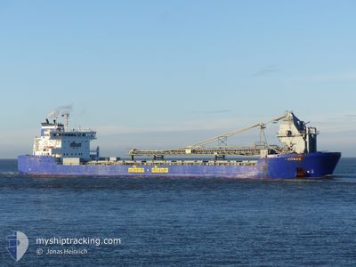
FITNES
Self Discharging Bulk Carrier

Current Trip
| Time Travelled | 5 days |
|---|---|
| Remaining Time | --- |
| Distance Travelled | 1040.92 nm |
| Remaining Distance | --- |
| AVG Speed | 10.4 Noeuds |
| MAX Speed | 10.4 Noeuds |
| AVG Wind | 14.6 knots |
| MAX Wind | 27 knots |
| MIN Temp | 6.3°C / 43.34°F |
| MAX Temp | 13.7°C / 56.66°F |
| Tirant d eau | 6.6 m |
| Position reçue | 1 m depuis |
Current Position
| Longitude | 10.87335° |
|---|---|
| Latitude | 54.82724° |
| Etat | Under way using engine |
| Vitesse | 12.9 Noeuds |
| Parcours | 354° |
| Zone | Baltic Sea |
| Station | T-AIS |
| Position reçue | 1 m depuis |
Information
The current position of FITNES is in Baltic Sea with coordinates 54.82724° / 10.87335° as reported on 2025-05-29 11:55 by AIS to our vessel tracker app. The vessel's current speed is 12.9 Noeuds and is heading at the port of JELSA. The estimated time of arrival as calculated by MyShipTracking vessel tracking app is 2025-05-31 02:00 LT
The vessel FITNES (IMO: 9490105, MMSI: 305530000) is a Self Discharging Bulk Carrier that was built in 2010 ( 15 Age ). It's sailing under the flag of [AG] Antigua Barbuda.
In this page you can find informations about the vessels current position, last detected port calls, and current voyage information. If the vessels is not in coverage by AIS you will find the latest position.
The current position of FITNES is detected by our AIS receivers and we are not responsible for the reliability of the data. The last position was recorded while the vessel was in Coverage by the Ais receivers of our vessel tracking app.
The current draught of FITNES as reported by AIS is 6.6 meters
Weather
| Temperature | 12.5°C / 54.5°F |
|---|---|
| Wind Speed | 6 knots |
| Direction | 238° WSW |
| Pressure | 1019.7 hPa |
| Humidity | 69.4 % |
| Cloud Coverage | 38 % |


Featured Company
Last Port Calls
| Port | Arrival | Departure | Time In Port |
|---|---|---|---|
| 2025-05-23 05:49 | 2025-05-23 22:25 | 16 h | |
| 2025-05-16 22:03 | 2025-05-17 15:53 | 17 h | |
| 2025-05-12 15:32 | 2025-05-13 10:11 | 18 h | |
| 2025-05-09 22:26 | 2025-05-10 20:10 | 21 h | |
| 2025-05-06 15:15 | 2025-05-06 19:12 | 3 h | |
| 2025-04-29 01:22 | 2025-04-29 18:09 | 16 h | |
| 2025-04-24 06:46 | 2025-04-24 22:19 | 15 h | |
| 2025-04-20 13:37 | 2025-04-20 17:27 | 3 h | |
| 2025-04-19 13:20 | 2025-04-20 01:50 | 12 h | |
| 2025-04-19 07:21 | 2025-04-19 12:49 | 5 h |
Most Visited Ports (Last year)
| Port | Arrivals | |
|---|---|---|
| 15 | ||
| 6 | ||
| 5 | ||
| 5 | ||
| 5 | ||
| 4 |
Last Trips
| Origin | Departure | Destination | Arrival | Distance | |
|---|---|---|---|---|---|
| 2025-05-17 15:53 | 2025-05-23 05:49 | 1336.38 nm | |||
| 2025-05-13 10:11 | 2025-05-16 22:03 | 835.83 nm | |||
| 2025-05-10 20:10 | 2025-05-12 15:32 | 547.73 nm | |||
| 2025-05-06 19:12 | 2025-05-09 22:26 | 568.21 nm | |||
| 2025-04-29 18:09 | 2025-05-06 15:15 | 1196.42 nm | |||
| 2025-04-24 22:19 | 2025-04-29 01:22 | 914.41 nm | |||
| 2025-04-20 17:27 | 2025-04-24 06:46 | 780.06 nm | |||
| 2025-04-20 01:50 | 2025-04-20 13:37 | 155.24 nm | |||
| 2025-04-19 12:49 | 2025-04-19 13:20 | 0.63 nm | |||
| 2025-04-17 09:41 | 2025-04-19 07:21 | 435.55 nm |
Events
| Heure | Evenement | Détails | Position/ Destination | Info |
|---|---|---|---|---|
| 2025-05-29 11:34 | Changement de zone | Danish part of the Kattegat Danish part of the Baltic Sea |
54.74977 / 10.87701
Kattegat
NOJEL
|
Vitesse: 13.4 kn Parcours: 6° |
| 2025-05-29 09:34 | Démarrage | 1.47 nm, South East of RODBYHAVN |
54.63613 / 11.37967
NOJEL
|
Vitesse: 3.9 kn Parcours: 201° |
| 2025-05-29 09:27 | Arret | 1.41 nm, South East of RODBYHAVN |
54.63802 / 11.38018
NOJEL
|
Vitesse: 0.3 kn Parcours: 110° |
| 2025-05-29 09:24 | Démarrage | 1.49 nm, South East of RODBYHAVN |
54.63764 / 11.38268
NOJEL
|
Vitesse: 3.1 kn Parcours: 103° |
| 2025-05-29 09:04 | Etat Changé | Under way using engine Moored |
54.63786 / 11.38638
NOJEL
|
Vitesse: 0.1 kn Parcours: 115° |
| 2025-05-29 07:08 | Etat Changé | Moored Default |
54.63787 / 11.38637
NOJEL
|
Vitesse: 0.2 kn Parcours: 115° |
| 2025-05-29 07:05 | Etat Changé | Default Moored |
54.63787 / 11.38637
NOJEL
|
Vitesse: 0.2 kn Parcours: 115° |
| 2025-05-29 02:17 | Changement d'ETA | 2025/05/31 00:00 2025/05/30 21:00 |
54.63788 / 11.38640
NOJEL
|
Vitesse: 0.2 kn Parcours: 115° |
| 2025-05-28 17:20 | Etat Changé | Moored Default |
54.63785 / 11.38639
NOJEL
|
Vitesse: 0.1 kn Parcours: 115° |
| 2025-05-28 17:17 | Etat Changé | Default Moored |
54.63785 / 11.38639
NOJEL
|
Vitesse: 0.1 kn Parcours: 115° |