
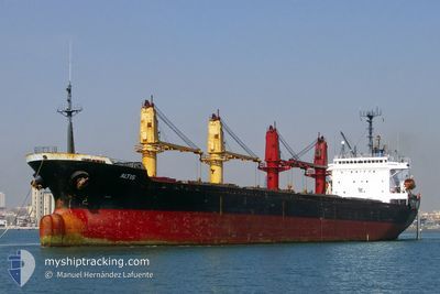
FLORENCIA
Cargo
Current Trip
| Time Travelled | 11 days |
|---|---|
| Remaining Time | --- |
| Distance Travelled | 3039.84 nm |
| Remaining Distance | --- |
| AVG Speed | 10.5 Noeuds |
| MAX Speed | 13.1 Noeuds |
| AVG Wind | 13.6 knots |
| MAX Wind | 26.8 knots |
| MIN Temp | 17.7°C / 63.86°F |
| MAX Temp | 28.5°C / 83.3°F |
| Tirant d eau | 9 m |
| Position reçue | 1 d depuis |
Current Position
| Longitude | 18.06477° |
|---|---|
| Latitude | -34.43699° |
| Etat | Under way using engine |
| Vitesse | 10.1 Noeuds |
| Parcours | 148° |
| Zone | South Atlantic Ocean |
| Station | T-AIS |
| Position reçue | 1 d depuis |
Info
Information
The current position of FLORENCIA is in South Atlantic Ocean with coordinates -34.43699° / 18.06477° as reported on 2025-02-13 09:31 by AIS to our vessel tracker app. The vessel's current speed is 10.1 Noeuds and is heading at the port of GRESIK.
The vessel FLORENCIA (MMSI: 256571000) is a Cargo It's sailing under the flag of [MT] Malta.
In this page you can find informations about the vessels current position, last detected port calls, and current voyage information. If the vessels is not in coverage by AIS you will find the latest position.
The current position of FLORENCIA is detected by our AIS receivers and we are not responsible for the reliability of the data. The last position was recorded while the vessel was in Coverage by the Ais receivers of our vessel tracking app.
The current draught of FLORENCIA as reported by AIS is 9 meters
Weather
| Temperature | 20.6°C / 69.08°F |
|---|---|
| Wind Speed | 17 knots |
| Direction | 259° W |
| Pressure | 1015.2 hPa |
| Humidity | 69.1 % |
| Cloud Coverage | 5 % |
Featured Company
Last Port Calls
| Port | Arrival | Departure | Time In Port |
|---|---|---|---|
| 2025-01-30 14:15 | 2025-02-02 16:51 | 3 d | |
| 2025-01-27 06:57 | 2025-01-29 02:37 | 1 d | |
| 2025-01-06 21:12 | |||
| 2024-12-14 20:06 | 2024-12-20 03:34 | 5 d |
Events
| Heure | Evenement | Détails | Position/ Destination | Info |
|---|---|---|---|---|
| 2025-02-13 09:36 | Etat Changé | Default Under way using engine |
-34.44960 / 18.07393
IDGRE
|
Vitesse: 10.1 kn Parcours: 148° |
| 2025-02-13 09:31 | Hors de la zone couverte |
-34.43699 / 18.06477
South Atlantic Ocean
|
Vitesse: 10.1 kn Parcours: 148° |
|
| 2025-02-13 09:28 | Etat Changé | Under way using engine Default |
-34.43079 / 18.06036
IDGRE
|
Vitesse: 10.1 kn Parcours: 149° |
| 2025-02-13 09:23 | Etat Changé | Default Under way using engine |
-34.41954 / 18.05216
IDGRE
|
Vitesse: 10 kn Parcours: 149° |
| 2025-02-13 09:02 | Tirant d'eau modifié | 9 9.6 |
-34.36774 / 18.01363
IDGRE
|
Vitesse: 9.7 kn Parcours: 146° |
| 2025-02-13 07:56 | Tirant d'eau modifié | 9.6 9 |
-34.21993 / 17.90191
IDGRE
|
Vitesse: 9.6 kn Parcours: 142° |
| 2025-02-13 07:56 | Changement d'ETA | 2025/03/01 11:00 |
-34.21993 / 17.90191
IDGRE
|
Vitesse: 9.6 kn Parcours: 142° |
| 2025-02-13 06:41 | Etat Changé | Under way using engine Default |
-34.02996 / 17.76053
IDGRE
|
Vitesse: 11.1 kn Parcours: 150° |
| 2025-02-13 06:36 | Etat Changé | Default Under way using engine |
-34.01846 / 17.75232
IDGRE
|
Vitesse: 11.1 kn Parcours: 148° |
| 2025-02-13 06:14 | Tirant d'eau modifié | 9 10.6 |
-33.96094 / 17.71135
IDGRE
|
Vitesse: 11 kn Parcours: 147° |