
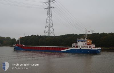
FLUVIUS PLYM
General Cargo
Current Trip
| Time Travelled | 8 days |
|---|---|
| Remaining Time | --- |
| Distance Travelled | 1035.83 nm |
| Remaining Distance | --- |
| AVG Speed | 9 Noeuds |
| MAX Speed | 13.1 Noeuds |
| AVG Wind | 17.2 knots |
| MAX Wind | 27 knots |
| MIN Temp | 1.9°C / 35.42°F |
| MAX Temp | 13.4°C / 56.12°F |
| Tirant d eau | 3.2 m |
| Position reçue | 22 h, 39 m depuis |
Current Position
| Longitude | -5.77289° |
|---|---|
| Latitude | 52.88393° |
| Etat | Under way using engine |
| Vitesse | 12.7 Noeuds |
| Parcours | 181.5° |
| Zone | Irish Sea and St. George's Channel |
| Station | T-AIS |
| Position reçue | 22 h, 39 m depuis |
Info
Information
The current position of FLUVIUS PLYM is in Irish Sea and St. George's Channel with coordinates 52.88393° / -5.77289° as reported on 2026-01-03 02:00 by AIS to our vessel tracker app. The vessel's current speed is 12.7 Noeuds and is heading at the port of BAYONNE. The estimated time of arrival as calculated by MyShipTracking vessel tracking app is 2026-01-05 15:00 LT
The vessel FLUVIUS PLYM (IMO: 9163611, MMSI: 314656000) is a General Cargo that was built in 1998 ( 28 Age ). It's sailing under the flag of [BB] Barbados.
In this page you can find informations about the vessels current position, last detected port calls, and current voyage information. If the vessels is not in coverage by AIS you will find the latest position.
The current position of FLUVIUS PLYM is detected by our AIS receivers and we are not responsible for the reliability of the data. The last position was recorded while the vessel was in Coverage by the Ais receivers of our vessel tracking app.
The current draught of FLUVIUS PLYM as reported by AIS is 3.2 meters
Weather
| Temperature | 7.5°C / 45.5°F |
|---|---|
| Wind Speed | 12 knots |
| Direction | 10° N |
| Pressure | 1018.4 hPa |
| Humidity | 52.4 % |
| Cloud Coverage | 100 % |
Featured Company
Last Port Calls
| Port | Arrival | Departure | Time In Port |
|---|---|---|---|
| 2025-12-19 16:27 | 2025-12-26 16:56 | 7 d | |
| 2025-12-12 23:35 | 2025-12-17 14:52 | 4 d | |
| 2025-12-07 23:38 | 2025-12-08 12:40 | 13 h | |
| 2025-12-04 21:07 | 2025-12-05 18:03 | 20 h | |
| 2025-11-30 00:40 | 2025-12-01 10:25 | 1 d | |
| 2025-11-25 22:10 | 2025-11-28 11:08 | 2 d | |
| 2025-11-19 18:36 | 2025-11-21 07:16 | 1 d | |
| 2025-11-14 07:13 | 2025-11-17 19:45 | 3 d | |
| 2025-11-08 13:02 | 2025-11-08 13:59 | 57 m | |
| 2025-11-06 13:20 | 2025-11-08 11:39 | 1 d |
Most Visited Ports (Last year)
| Port | Arrivals | |
|---|---|---|
| 7 | ||
| 7 | ||
| 5 | ||
| 4 | ||
| 4 | ||
| 3 |
Last Trips
| Origin | Departure | Destination | Arrival | Distance | |
|---|---|---|---|---|---|
| 2025-12-17 15:52 | 2025-12-19 17:27 | 414.65 nm | |||
| 2025-12-08 13:40 | 2025-12-13 00:35 | 826.33 nm | |||
| 2025-12-05 18:03 | 2025-12-08 00:38 | 189.19 nm | |||
| 2025-12-01 10:25 | 2025-12-04 21:07 | 708.63 nm | |||
| 2025-11-28 11:08 | 2025-11-30 00:40 | 344.12 nm | |||
| 2025-11-21 08:16 | 2025-11-25 22:10 | 606.71 nm | |||
| 2025-11-17 19:45 | 2025-11-19 19:36 | 384.41 nm | |||
| 2025-11-08 14:59 | 2025-11-14 07:13 | 1032.56 nm | |||
| 2025-11-08 12:39 | 2025-11-08 14:02 | 9.20 nm | |||
| 2025-11-06 13:07 | 2025-11-06 14:20 | 7.41 nm |
Events
| Heure | Evenement | Détails | Position/ Destination | Info |
|---|---|---|---|---|
| 2026-01-03 02:07 | Etat Changé | Default Under way using engine |
52.86089 / -5.77390
FRBAY
|
Vitesse: 12.7 kn Parcours: 181.5° |
| 2026-01-03 02:00 | Etat Changé | Under way using engine Default |
52.88393 / -5.77289
FRBAY
|
Vitesse: 12.7 kn Parcours: 182° |
| 2026-01-03 02:00 | Hors de la zone couverte |
52.88393 / -5.77289
Irish Sea and St. George's Channel
FRBAY
|
Vitesse: 12.7 kn Parcours: 181.5° |
|
| 2026-01-03 01:58 | Etat Changé | Default Under way using engine |
52.88992 / -5.77255
FRBAY
|
Vitesse: 12.6 kn Parcours: 181.7° |
| 2026-01-02 21:29 | Tirant d'eau modifié | 3.2 4.6 |
53.70454 / -6.19716
FRBAY
|
Vitesse: 10.7 kn Parcours: 142.6° |
| 2026-01-02 21:29 | Changement de destination | FRBAY IE DRO |
53.70454 / -6.19716
FRBAY
|
Vitesse: 10.7 kn Parcours: 142.6° |
| 2026-01-02 21:29 | Changement d'ETA | 2026/01/05 15:00 2025/12/30 07:00 |
53.70454 / -6.19716
FRBAY
|
Vitesse: 10.7 kn Parcours: 142.6° |
| 2026-01-02 20:51 | Dans la zone couverte |
53.72093 / -6.29551
Irish Sea and St. George's Channel
|
Vitesse: 5.6 kn Parcours: 65.4° |
|
| 2026-01-02 08:41 | Hors de la zone couverte |
53.72086 / -6.30394
Irish Sea and St. George's Channel
[IE] DROGHEDA
|
Vitesse: Parcours: 261.8° |
|
| 2026-01-02 08:38 | Dans la zone couverte |
53.72087 / -6.30391
Irish Sea and St. George's Channel
[IE] DROGHEDA
|
Vitesse: Parcours: 261.8° |