

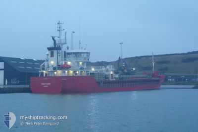
FRAKT FJORD
General Cargo

Current Trip
| Time Travelled | 1 day |
|---|---|
| Remaining Time | 6 h, 32 mins |
| Distance Travelled | 357.22 nm |
| Remaining Distance | 81.08 nm |
| AVG Speed | 9.3 Noeuds |
| MAX Speed | 12.3 Noeuds |
| AVG Wind | 20 knots |
| MAX Wind | 29.8 knots |
| MIN Temp | 1.7°C / 35.06°F |
| MAX Temp | 6.5°C / 43.7°F |
| Tirant d eau | 4.1 m |
| Position reçue | 5 m depuis |
Current Position
| Longitude | 7.39318° |
|---|---|
| Latitude | 54.29326° |
| Etat | Under way using engine |
| Vitesse | 11.6 Noeuds |
| Parcours | 179° |
| Zone | North Sea |
| Station | T-AIS |
| Position reçue | 5 m depuis |
Information
The current position of FRAKT FJORD is in North Sea with coordinates 54.29326° / 7.39318° as reported on 2025-02-25 10:09 by AIS to our vessel tracker app. The vessel's current speed is 11.6 Noeuds and is heading at the port of BRAKE. The estimated time of arrival as calculated by MyShipTracking vessel tracking app is 2025-02-25 17:47 LT
The vessel FRAKT FJORD (IMO: 9356581, MMSI: 212530000) is a General Cargo that was built in 2008 ( 17 Age ). It's sailing under the flag of [CY] Cyprus.
In this page you can find informations about the vessels current position, last detected port calls, and current voyage information. If the vessels is not in coverage by AIS you will find the latest position.
The current position of FRAKT FJORD is detected by our AIS receivers and we are not responsible for the reliability of the data. The last position was recorded while the vessel was in Coverage by the Ais receivers of our vessel tracking app.
The current draught of FRAKT FJORD as reported by AIS is 4.1 meters
Weather
| Temperature | 5.1°C / 41.18°F |
|---|---|
| Wind Speed | 15 knots |
| Direction | 218° SW |
| Pressure | 1012.2 hPa |
| Humidity | 97.3 % |
| Cloud Coverage | 92 % |


Featured Company
Last Port Calls
| Port | Arrival | Departure | Time In Port |
|---|---|---|---|
| 2025-02-22 10:47 | 2025-02-24 00:31 | 1 d | |
| 2025-02-16 21:26 | 2025-02-18 19:59 | 1 d | |
| 2025-02-12 12:08 | 2025-02-14 18:27 | 2 d | |
| 2025-02-08 22:04 | 2025-02-09 22:48 | 1 d | |
| 2025-02-07 05:58 | 2025-02-07 21:26 | 15 h | |
| 2025-02-04 17:46 | 2025-02-05 04:11 | 10 h | |
| 2025-01-28 19:06 | 2025-01-30 18:09 | 1 d | |
| 2025-01-26 17:31 | 2025-01-28 11:54 | 1 d | |
| 2025-01-24 21:50 | 2025-01-25 14:53 | 17 h | |
| 2025-01-22 11:01 | 2025-01-23 04:11 | 17 h |
Last Trips
| Origin | Departure | Destination | Arrival | Distance | |
|---|---|---|---|---|---|
| 2025-02-18 19:59 | 2025-02-22 10:47 | 884.42 nm | |||
| 2025-02-14 18:27 | 2025-02-16 21:26 | 196.03 nm | |||
| 2025-02-09 22:48 | 2025-02-12 12:08 | 688.79 nm | |||
| 2025-02-07 21:26 | 2025-02-08 22:04 | 303.32 nm | |||
| 2025-02-05 04:11 | 2025-02-07 05:58 | 432.54 nm | |||
| 2025-01-30 18:09 | 2025-02-04 17:46 | 286.49 nm | |||
| 2025-01-28 11:54 | 2025-01-28 19:06 | 73.88 nm | |||
| 2025-01-25 14:53 | 2025-01-26 17:31 | 252.64 nm | |||
| 2025-01-23 04:11 | 2025-01-24 21:50 | 317.02 nm | |||
| 2025-01-18 18:22 | 2025-01-22 11:01 | 863.11 nm |
Events
| Heure | Evenement | Détails | Position/ Destination | Info |
|---|---|---|---|---|
| 2025-02-25 09:20 | Etat Changé | Under way using engine Default |
54.45123 / 7.38785
BRAKE DE
|
Vitesse: 11.7 kn Parcours: 179° |
| 2025-02-25 09:04 | Etat Changé | Default Under way using engine |
54.50246 / 7.38817
BRAKE DE
|
Vitesse: 11.4 kn Parcours: 182° |
| 2025-02-25 08:59 | Etat Changé | Under way using engine Default |
54.51823 / 7.38914
BRAKE DE
|
Vitesse: 11.6 kn Parcours: 181° |
| 2025-02-25 08:54 | Etat Changé | Default Under way using engine |
54.53152 / 7.38964
BRAKE DE
|
Vitesse: 11.7 kn Parcours: 180° |
| 2025-02-25 08:28 | Etat Changé | Under way using engine Default |
54.61550 / 7.38795
BRAKE DE
|
Vitesse: 11.5 kn Parcours: 177° |
| 2025-02-25 08:21 | Etat Changé | Default Under way using engine |
54.64068 / 7.38596
BRAKE DE
|
Vitesse: 11.8 kn Parcours: 177° |
| 2025-02-25 08:17 | Etat Changé | Under way using engine Default |
54.65308 / 7.38479
BRAKE DE
|
Vitesse: 11.7 kn Parcours: 177° |
| 2025-02-25 07:30 | Etat Changé | Default Under way using engine |
54.80810 / 7.37575
BRAKE DE
|
Vitesse: 11.9 kn Parcours: 180° |
| 2025-02-25 07:24 | Etat Changé | Under way using engine Default |
54.82790 / 7.37630
BRAKE DE
|
Vitesse: 12 kn Parcours: 181° |
| 2025-02-25 07:12 | Etat Changé | Default Under way using engine |
54.86484 / 7.37727
BRAKE DE
|
Vitesse: 12 kn Parcours: 180° |