
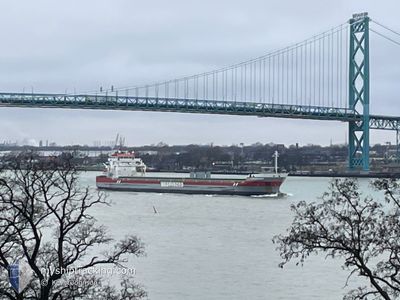
FRASERBORG
General Cargo
Current Trip
| Time Travelled | 4 days |
|---|---|
| Remaining Time | 8 h, 15 mins |
| Distance Travelled | 969.40 nm |
| Remaining Distance | 95.46 nm |
| AVG Speed | 10.7 Noeuds |
| MAX Speed | 12.2 Noeuds |
| AVG Wind | 18.7 knots |
| MAX Wind | 29 knots |
| MIN Temp | 8.2°C / 46.76°F |
| MAX Temp | 14°C / 57.2°F |
| Tirant d eau | 8.1 m |
| Position reçue | 5 m depuis |
Current Position
| Longitude | 7.89472° |
|---|---|
| Latitude | 57.75921° |
| Etat | Under way using engine |
| Vitesse | 12.3 Noeuds |
| Parcours | 272.5° |
| Zone | Skaggerak |
| Station | T-AIS |
| Position reçue | 5 m depuis |
Information
The current position of FRASERBORG is in Skaggerak with coordinates 57.75921° / 7.89472° as reported on 2025-06-10 06:17 by AIS to our vessel tracker app. The vessel's current speed is 12.3 Noeuds and is heading at the port of SKAGEN. The estimated time of arrival as calculated by MyShipTracking vessel tracking app is 2025-06-10 16:37 LT
The vessel FRASERBORG (IMO: 9419319, MMSI: 245639000) is a General Cargo that was built in 2011 ( 14 Age ). It's sailing under the flag of [NL] Netherlands.
In this page you can find informations about the vessels current position, last detected port calls, and current voyage information. If the vessels is not in coverage by AIS you will find the latest position.
The current position of FRASERBORG is detected by our AIS receivers and we are not responsible for the reliability of the data. The last position was recorded while the vessel was in Coverage by the Ais receivers of our vessel tracking app.
The current draught of FRASERBORG as reported by AIS is 8.1 meters
Weather
| Temperature | 10.2°C / 50.36°F |
|---|---|
| Wind Speed | 8 knots |
| Direction | 128° SE |
| Pressure | 1007.8 hPa |
| Humidity | 90.3 % |
| Cloud Coverage | 100 % |
Featured Company
Last Port Calls
| Port | Arrival | Departure | Time In Port |
|---|---|---|---|
| 2025-06-01 15:26 | 2025-06-06 07:22 | 4 d | |
| 2025-05-26 15:12 | 2025-05-29 04:28 | 2 d | |
| 2025-05-20 17:42 | 2025-05-22 20:53 | 2 d | |
| 2025-05-09 22:00 | 2025-05-13 11:54 | 3 d | |
| 2025-04-26 16:06 | 2025-04-27 01:00 | 8 h | |
| 2025-04-25 05:58 | 2025-04-25 06:49 | 50 m | |
| 2025-04-18 20:54 | 2025-04-24 00:09 | 5 d | |
| 2025-04-12 12:36 | 2025-04-16 15:36 | 4 d | |
| 2025-04-09 08:55 | 2025-04-10 09:40 | 1 d | |
| 2025-04-06 23:28 | 2025-04-08 22:30 | 1 d |
Most Visited Ports (Last year)
| Port | Arrivals | |
|---|---|---|
| 6 | ||
| 6 | ||
| 4 | ||
| 4 | ||
| 3 | ||
| 3 |
Last Trips
| Origin | Departure | Destination | Arrival | Distance | |
|---|---|---|---|---|---|
| 2025-05-29 04:28 | 2025-06-01 15:26 | 851.81 nm | |||
| 2025-05-22 20:53 | 2025-05-26 15:12 | 491.88 nm | |||
| 2025-05-13 11:54 | 2025-05-20 17:42 | 825.41 nm | |||
| 2025-04-27 01:00 | 2025-05-09 22:00 | 2899.18 nm | |||
| 2025-04-25 06:49 | 2025-04-26 16:06 | 291.63 nm | |||
| 2025-04-24 00:09 | 2025-04-25 05:58 | 231.07 nm | |||
| 2025-04-16 15:36 | 2025-04-18 20:54 | 565.49 nm | |||
| 2025-04-10 09:40 | 2025-04-12 12:36 | 568.80 nm | |||
| 2025-04-08 22:30 | 2025-04-09 08:55 | 88.77 nm | |||
| 2025-04-06 01:11 | 2025-04-06 23:28 | 164.31 nm |
Events
| Heure | Evenement | Détails | Position/ Destination | Info |
|---|---|---|---|---|
| 2025-06-10 05:08 | Etat Changé | Under way using engine Default |
57.76999 / 8.31991
USFEB VIA DKSKA
|
Vitesse: 11.6 kn Parcours: 266° |
| 2025-06-10 05:07 | Etat Changé | Default Under way using engine |
57.77025 / 8.32591
USFEB VIA DKSKA
|
Vitesse: 11.6 kn Parcours: 265° |
| 2025-06-10 03:04 | Detecté en mer | Norwegian part of the Skaggerak |
57.79252 / 9.03763
Skaggerak
USFEB VIA DKSKA
|
Vitesse: 10.7 kn Parcours: 266.4° |
| 2025-06-10 02:41 | Etat Changé | Under way using engine Default |
57.79712 / 9.16694
USFEB VIA DKSKA
|
Vitesse: 10.7 kn Parcours: 266° |
| 2025-06-10 01:59 | Etat Changé | Default Under way using engine |
57.80533 / 9.39879
USFEB VIA DKSKA
|
Vitesse: 10.5 kn Parcours: 267.6° |
| 2025-06-10 01:51 | Etat Changé | Under way using engine Default |
57.80674 / 9.44028
USFEB VIA DKSKA
|
Vitesse: 10.5 kn Parcours: 266° |
| 2025-06-10 01:39 | Dans la zone couverte |
57.80674 / 9.44028
Skaggerak
USFEB VIA DKSKA
|
Vitesse: 10.5 kn Parcours: 267.6° |
|
| 2025-06-10 00:55 | Etat Changé | Default Under way using engine |
57.81759 / 9.75002
USFEB VIA DKSKA
|
Vitesse: 10.9 kn Parcours: 265.4° |
| 2025-06-10 00:47 | Hors de la zone couverte |
57.81907 / 9.79129
Skaggerak
USFEB VIA DKSKA
|
Vitesse: 10.9 kn Parcours: 265.4° |
|
| 2025-06-10 00:35 | Etat Changé | Under way using engine Default |
57.82151 / 9.86010
USFEB VIA DKSKA
|
Vitesse: 10.9 kn Parcours: 267° |