
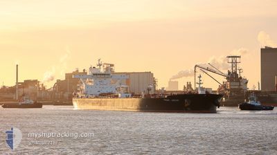
FRONT JAGUAR
Tanker
Current Trip
| Time Travelled | 16 days |
|---|---|
| Remaining Time | --- |
| Distance Travelled | 4071.86 nm |
| Remaining Distance | --- |
| AVG Speed | 11.5 Noeuds |
| MAX Speed | 14.8 Noeuds |
| AVG Wind | 9.6 knots |
| MAX Wind | 26.7 knots |
| MIN Temp | 6.6°C / 43.88°F |
| MAX Temp | 23.3°C / 73.94°F |
| Tirant d eau | 10.8 m |
| Position reçue | 4 h, 51 m depuis |
Current Position
| Longitude | -73.17320° |
|---|---|
| Latitude | 45.99912° |
| Etat | Moored |
| Vitesse | |
| Parcours | 200° |
| Zone | Gulf of St-Lawrence |
| Station | T-AIS |
| Position reçue | 4 h, 51 m depuis |
Information
The current position of FRONT JAGUAR is in Gulf of St-Lawrence with coordinates 45.99912° / -73.17320° as reported on 2025-06-08 11:12 by AIS to our vessel tracker app. The vessel's current speed is 0 Noeuds
The vessel FRONT JAGUAR (IMO: 9703332, MMSI: 538006772) is a Tanker It's sailing under the flag of [MH] Marshall Is.
In this page you can find informations about the vessels current position, last detected port calls, and current voyage information. If the vessels is not in coverage by AIS you will find the latest position.
The current position of FRONT JAGUAR is detected by our AIS receivers and we are not responsible for the reliability of the data. The last position was recorded while the vessel was in Coverage by the Ais receivers of our vessel tracking app.
The current draught of FRONT JAGUAR as reported by AIS is 10.8 meters
Weather
| Temperature | 11.7°C / 53.06°F |
|---|---|
| Wind Speed | 5 knots |
| Direction | 15° NNE |
| Pressure | 1013 hPa |
| Humidity | 69.6 % |
| Cloud Coverage | --- |
Featured Company
Most Visited Ports (Last year)
| Port | Arrivals | |
|---|---|---|
| 3 | ||
| 3 | ||
| 2 | ||
| 2 | ||
| 2 | ||
| 1 |
Events
| Heure | Evenement | Détails | Position/ Destination | Info |
|---|---|---|---|---|
| 2025-06-08 11:12 | Hors de la zone couverte |
45.99912 / -73.17320
Gulf of St-Lawrence
|
Vitesse: Parcours: 155° |
|
| 2025-06-08 11:12 | Dans la zone couverte |
45.99912 / -73.17320
Gulf of St-Lawrence
|
Vitesse: Parcours: 155° |
|
| 2025-06-07 12:51 | Hors de la zone couverte |
45.99910 / -73.17323
Gulf of St-Lawrence
|
Vitesse: Parcours: 172° |
|
| 2025-06-07 12:21 | Dans la zone couverte |
45.99910 / -73.17323
Gulf of St-Lawrence
|
Vitesse: 0.2 kn Parcours: 158.6° |
|
| 2025-06-06 18:21 | Etat Changé | Default Under way using engine |
45.99833 / -73.17167
CASOR
|
Vitesse: 0.1 kn Parcours: 200° |
| 2025-06-06 17:59 | Hors de la zone couverte |
45.99911 / -73.17319
Gulf of St-Lawrence
|
Vitesse: 0.1 kn Parcours: 204.5° |
|
| 2025-06-06 17:39 | Arret | 3.83 nm, South West of SOREL |
46.00008 / -73.17351
CASOR
|
Vitesse: 0.3 kn Parcours: 188° |
| 2025-06-06 15:33 | Etat Changé | Under way using engine Default |
46.16908 / -72.93183
CASOR
|
Vitesse: 8.7 kn Parcours: 225° |
| 2025-06-06 15:26 | Etat Changé | Default Under way using engine |
46.18247 / -72.91305
CASOR
|
Vitesse: 8.7 kn Parcours: 232.7° |
| 2025-06-06 15:18 | Etat Changé | Under way using engine Default |
46.19304 / -72.89067
CASOR
|
Vitesse: 9.4 kn Parcours: 251° |