
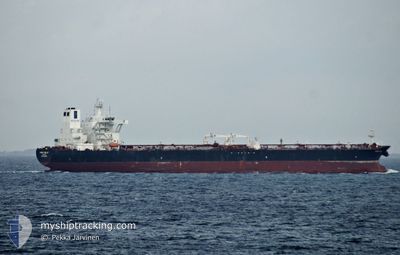
FRONT OCELOT
Tanker
Current Trip
| Time Travelled | 24 days |
|---|---|
| Remaining Time | --- |
| Distance Travelled | 6541.74 nm |
| Remaining Distance | --- |
| AVG Speed | 11.3 Noeuds |
| MAX Speed | 19.1 Noeuds |
| AVG Wind | 14.5 knots |
| MAX Wind | 36.3 knots |
| MIN Temp | 6.1°C / 42.98°F |
| MAX Temp | 24.7°C / 76.46°F |
| Tirant d eau | 8.7 m |
| Position reçue | 5 d depuis |
Current Position
| Longitude | -78.65431° |
|---|---|
| Latitude | 26.21731° |
| Etat | Under way using engine |
| Vitesse | 11.1 Noeuds |
| Parcours | 271.6° |
| Zone | North Atlantic Ocean |
| Station | T-AIS |
| Position reçue | 5 d depuis |
Info
Information
The current position of FRONT OCELOT is in North Atlantic Ocean with coordinates 26.21731° / -78.65431° as reported on 2026-01-03 13:46 by AIS to our vessel tracker app. The vessel's current speed is 11.1 Noeuds and is heading at the port of NASSAU. The estimated time of arrival as calculated by MyShipTracking vessel tracking app is 2026-01-01 18:00 LT
The vessel FRONT OCELOT (IMO: 9726580, MMSI: 538006621) is a Tanker It's sailing under the flag of [MH] Marshall Is.
In this page you can find informations about the vessels current position, last detected port calls, and current voyage information. If the vessels is not in coverage by AIS you will find the latest position.
The current position of FRONT OCELOT is detected by our AIS receivers and we are not responsible for the reliability of the data. The last position was recorded while the vessel was in Coverage by the Ais receivers of our vessel tracking app.
The current draught of FRONT OCELOT as reported by AIS is 8.7 meters
Weather
| Temperature | 23.4°C / 74.12°F |
|---|---|
| Wind Speed | 25 knots |
| Direction | 169° S |
| Pressure | 1010.7 hPa |
| Humidity | 84.8 % |
| Cloud Coverage | 9 % |
Featured Company
Events
| Heure | Evenement | Détails | Position/ Destination | Info |
|---|---|---|---|---|
| 2026-01-03 13:51 | Etat Changé | Default Under way using engine |
26.21802 / -78.67134
BAHAMAS FOR ORDERS
|
Vitesse: 11.1 kn Parcours: 271.6° |
| 2026-01-03 13:46 | Hors de la zone couverte |
26.21731 / -78.65431
North Atlantic Ocean
|
Vitesse: 11.1 kn Parcours: 271.6° |
|
| 2026-01-03 12:25 | Etat Changé | Under way using engine Default |
26.19467 / -78.36831
BAHAMAS FOR ORDERS
|
Vitesse: 11.7 kn Parcours: 286° |
| 2026-01-03 12:20 | Etat Changé | Default Under way using engine |
26.18977 / -78.35048
BAHAMAS FOR ORDERS
|
Vitesse: 12.2 kn Parcours: 288.3° |
| 2026-01-03 12:11 | Changement de zone | Bahamas part of the North Atlantic Ocean Portuguese (Azores) part of the North Atlantic Ocean |
26.17997 / -78.31666
North Atlantic Ocean
|
Vitesse: 12.6 kn Parcours: 288.2° |
| 2026-01-03 12:07 | Etat Changé | Under way using engine Default |
26.17579 / -78.30267
BAHAMAS FOR ORDERS
|
Vitesse: 12.2 kn Parcours: 283° |
| 2026-01-03 12:07 | Dans la zone couverte |
26.17997 / -78.31666
North Atlantic Ocean
|
Vitesse: 12.6 kn Parcours: 288.2° |
|
| 2026-01-03 11:18 | Etat Changé | Default Under way using engine |
26.14002 / -78.12241
BAHAMAS FOR ORDERS
|
Vitesse: 12.1 kn Parcours: 279.2° |
| 2026-01-03 11:16 | Etat Changé | Under way using engine Default |
26.13884 / -78.11439
BAHAMAS FOR ORDERS
|
Vitesse: 12.2 kn Parcours: 279° |