
FUGA
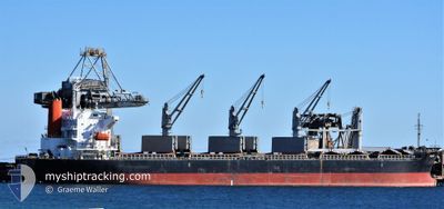
Bulk Carrier
Current Trip
| Time Travelled | 1 day |
|---|---|
| Remaining Time | --- |
| Distance Travelled | 353.18 nm |
| Remaining Distance | --- |
| AVG Speed | 10.1 Noeuds |
| MAX Speed | 14 Noeuds |
| AVG Wind | 17.8 knots |
| MAX Wind | 33.9 knots |
| MIN Temp | 7.4°C / 45.32°F |
| MAX Temp | 19°C / 66.2°F |
| Tirant d eau | 9.7 m |
| Position reçue | 1 d depuis |
Current Position
| Longitude | 121.76458° |
|---|---|
| Latitude | 25.21004° |
| Etat | Under way using engine |
| Vitesse | 10.6 Noeuds |
| Parcours | 16.3° |
| Zone | Eastern China Sea |
| Station | T-AIS |
| Position reçue | 1 d depuis |
Info
Information
The current position of FUGA is in Eastern China Sea with coordinates 25.21004° / 121.76458° as reported on 2025-02-12 11:11 by AIS to our vessel tracker app. The vessel's current speed is 10.6 Noeuds and is heading at the port of ZHENJIANG. The estimated time of arrival as calculated by MyShipTracking vessel tracking app is 2025-02-13 19:00 LT
The vessel FUGA (IMO: 9624615, MMSI: 373680000) is a Bulk Carrier that was built in 2012 ( 13 Age ). It's sailing under the flag of [PA] Panama.
In this page you can find informations about the vessels current position, last detected port calls, and current voyage information. If the vessels is not in coverage by AIS you will find the latest position.
The current position of FUGA is detected by our AIS receivers and we are not responsible for the reliability of the data. The last position was recorded while the vessel was in Coverage by the Ais receivers of our vessel tracking app.
The current draught of FUGA as reported by AIS is 9.7 meters
Weather
| Temperature | 7.7°C / 45.86°F |
|---|---|
| Wind Speed | 6 knots |
| Direction | 127° SE |
| Pressure | 1022.8 hPa |
| Humidity | 60.8 % |
| Cloud Coverage | 87 % |
Featured Company
Last Port Calls
| Port | Arrival | Departure | Time In Port |
|---|---|---|---|
| 2025-02-09 03:29 | 2025-02-12 10:53 | 3 d | |
| 2025-01-25 04:41 | 2025-01-27 08:51 | 2 d | |
| 2025-01-20 20:37 | 2025-01-23 01:54 | 2 d | |
| 2025-01-07 03:22 | 2025-01-12 17:59 | 5 d | |
| 2024-12-13 04:16 | 2024-12-25 02:55 | 11 d | |
| 2024-12-01 09:28 |
Last Trips
| Origin | Departure | Destination | Arrival | Distance | |
|---|---|---|---|---|---|
| 2025-01-27 16:51 | 2025-02-09 11:29 | 3630.53 nm | |||
| 2025-01-23 09:54 | 2025-01-25 12:41 | 248.79 nm | |||
| 2025-01-13 01:59 | 2025-01-21 04:37 | 2336.06 nm | |||
| 2024-12-25 11:55 | 2025-01-07 11:22 | 3559.23 nm | |||
| 2024-12-01 17:28 | 2024-12-13 13:16 | 1957.72 nm |
Events
| Heure | Evenement | Détails | Position/ Destination | Info |
|---|---|---|---|---|
| 2025-02-14 03:20 | Arret |
31.19539 / 123.21607
CNZHE
|
Vitesse: 0.2 kn Parcours: 131° |
|
| 2025-02-12 11:17 | Etat Changé | Default Under way using engine |
25.22778 / 121.77006
CNZHE
|
Vitesse: 10.6 kn Parcours: 16.3° |
| 2025-02-12 11:11 | Hors de la zone couverte |
25.21004 / 121.76458
Eastern China Sea
CNZHE
|
Vitesse: 10.6 kn Parcours: 16.3° |
|
| 2025-02-12 11:00 | Tirant d'eau modifié | 9.7 9.6 |
25.17874 / 121.75696
CNZHE
|
Vitesse: 8.2 kn Parcours: 4.8° |
| 2025-02-12 11:00 | Changement de destination | CNZHE TWKEL |
25.17874 / 121.75696
CNZHE
|
Vitesse: 8.2 kn Parcours: 4.8° |
| 2025-02-12 11:00 | Changement d'ETA | 2025/02/13 19:00 2025/02/08 22:00 |
25.17874 / 121.75696
CNZHE
|
Vitesse: 8.2 kn Parcours: 4.8° |
| 2025-02-12 10:59 | Changement de zone | Taiwanese part of the Eastern China Sea Philippines part of the South China Sea |
25.17705 / 121.75656
Eastern China Sea
|
Vitesse: 8.1 kn Parcours: 27.6° |
| 2025-02-12 10:58 | Etat Changé | Under way using engine Default |
25.17498 / 121.75404
TWKEL
|
Vitesse: 10.1 kn Parcours: 357° |
| 2025-02-12 10:53 | PORT DE DEPART |
|
25.16685 / 121.75034
TWKEL
|
Vitesse: 7.8 kn Parcours: 347° |
| 2025-02-12 10:41 | Dans la zone couverte |
25.17705 / 121.75656
Eastern China Sea
|
Vitesse: 8.1 kn Parcours: 27.6° |