
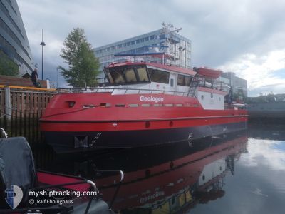
GEOLOGEN
Not available
Current Trip
| Trip Time | 7 h, 32 mins |
|---|---|
| Trip Distance | 45.35 nm |
| AVG Speed | 6.9 Noeuds |
| MAX Speed | 6.9 Noeuds |
| Tirant d eau | 1.5 m |
| AVG Wind | 2.8 knots |
| MAX Wind | 4.8 knots |
| MIN Temp | -0.6°C / 30.92°F |
| MAX Temp | 0.9°C / 33.62°F |
| Position reçue | Maintenant |
Current Position
| Longitude | 10.39874° |
|---|---|
| Latitude | 63.43835° |
| Etat | Moored |
| Vitesse | |
| Parcours | 46° |
| Zone | Norwegian Sea |
| Station | T-AIS |
| Position reçue | Maintenant |
Info
Information
The current position of GEOLOGEN is in Norwegian Sea with coordinates 63.43835° / 10.39874° as reported on 2025-02-05 04:00 by AIS to our vessel tracker app. The vessel's current speed is 0 Noeuds and is currently inside the port of TRONDHEIM.
The vessel GEOLOGEN (IMO: 9946788, MMSI: 257053170) is a Not available It's sailing under the flag of [NO] Norway.
In this page you can find informations about the vessels current position, last detected port calls, and current voyage information. If the vessels is not in coverage by AIS you will find the latest position.
The current position of GEOLOGEN is detected by our AIS receivers and we are not responsible for the reliability of the data. The last position was recorded while the vessel was in Coverage by the Ais receivers of our vessel tracking app.
The current draught of GEOLOGEN as reported by AIS is 1.5 meters
Weather
| Temperature | 0.1°C / 32.18°F |
|---|---|
| Wind Speed | 4 knots |
| Direction | 50° NE |
| Pressure | 1003.5 hPa |
| Humidity | 99.4 % |
| Cloud Coverage | 100 % |
Featured Company
Most Visited Ports (Last year)
| Port | Arrivals | |
|---|---|---|
| 68 |
Events
| Heure | Evenement | Détails | Position/ Destination | Info |
|---|---|---|---|---|
| 2025-01-28 14:57 | Etat Changé | Moored Under way using engine |
63.43832 / 10.39870
[NO] TRONDHEIM
|
Vitesse: Parcours: 45° |
| 2025-01-28 14:51 | Arret |
63.43831 / 10.39874
[NO] TRONDHEIM
|
Vitesse: 0.3 kn Parcours: 48° |
|
| 2025-01-28 14:51 | Port d'arrivée |
|
63.43831 / 10.39870
[NO] TRONDHEIM
|
Vitesse: 0.6 kn Parcours: 57° |
| 2025-01-28 12:43 | Démarrage | 8.83 nm, North East of TRONDHEIM |
63.56149 / 10.56273
TRONDHEIM-TRONDHEIM
|
Vitesse: 4.3 kn Parcours: 38° |
| 2025-01-28 12:31 | Arret | 8.72 nm, North East of TRONDHEIM |
63.56054 / 10.55890
TRONDHEIM-TRONDHEIM
|
Vitesse: 0.3 kn Parcours: 106° |
| 2025-01-28 10:44 | Démarrage | 4.89 nm, North of TRONDHEIM |
63.51508 / 10.34004
TRONDHEIM-TRONDHEIM
|
Vitesse: 8 kn Parcours: 250.8° |
| 2025-01-28 10:20 | Arret | 4.87 nm, North of TRONDHEIM |
63.51518 / 10.34449
TRONDHEIM-TRONDHEIM
|
Vitesse: Parcours: 297° |
| 2025-01-28 09:21 | Démarrage | 4.49 nm, North of TRONDHEIM |
63.51038 / 10.36034
TRONDHEIM-TRONDHEIM
|
Vitesse: 6.4 kn Parcours: 80.5° |
| 2025-01-28 09:14 | Arret | 4.53 nm, North of TRONDHEIM |
63.51070 / 10.35580
TRONDHEIM-TRONDHEIM
|
Vitesse: 0.3 kn Parcours: 24° |
| 2025-01-28 07:59 | Démarrage | 2.43 nm, North of TRONDHEIM |
63.47661 / 10.37422
TRONDHEIM-TRONDHEIM
|
Vitesse: 6.3 kn Parcours: 11.4° |