
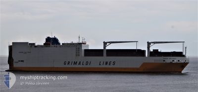
GRANDE SAN PAOLO
Ro-Ro Cargo
Current Trip
PTLEI>SNDKR
| Time Travelled | 1 day |
|---|---|
| Remaining Time | --- |
| Distance Travelled | 736.30 nm |
| Remaining Distance | --- |
| AVG Speed | 16.7 Noeuds |
| MAX Speed | 17.7 Noeuds |
| AVG Wind | 12 knots |
| MAX Wind | 19.8 knots |
| MIN Temp | 18.9°C / 66.02°F |
| MAX Temp | 28.4°C / 83.12°F |
| Tirant d eau | 9.5 m |
| Position reçue | 5 d depuis |
Current Position
| Longitude | -16.84467° |
|---|---|
| Latitude | 26.39033° |
| Etat | Under way using engine |
| Vitesse | 16.5 Noeuds |
| Parcours | 194° |
| Zone | North Atlantic Ocean |
| Station | T-AIS |
| Position reçue | 5 d depuis |
Info
Information
The current position of GRANDE SAN PAOLO is in North Atlantic Ocean with coordinates 26.39033° / -16.84467° as reported on 2025-02-06 23:56 by AIS to our vessel tracker app. The vessel's current speed is 16.5 Noeuds
The vessel GRANDE SAN PAOLO (IMO: 9253208, MMSI: 247091500) is a Ro-Ro Cargo that was built in 2003 ( 22 Age ). It's sailing under the flag of [IT] Italy.
In this page you can find informations about the vessels current position, last detected port calls, and current voyage information. If the vessels is not in coverage by AIS you will find the latest position.
The current position of GRANDE SAN PAOLO is detected by our AIS receivers and we are not responsible for the reliability of the data. The last position was recorded while the vessel was in Coverage by the Ais receivers of our vessel tracking app.
The current draught of GRANDE SAN PAOLO as reported by AIS is 9.5 meters
Weather
| Temperature | 28.4°C / 83.12°F |
|---|---|
| Wind Speed | 4 knots |
| Direction | 315° NW |
| Pressure | 1010.5 hPa |
| Humidity | 73 % |
| Cloud Coverage | 81 % |
Featured Company
Last Port Calls
| Port | Arrival | Departure | Time In Port |
|---|---|---|---|
| 2025-02-08 22:55 | 2025-02-10 15:35 | 1 d | |
| 2025-02-03 19:18 | 2025-02-04 03:25 | 8 h | |
| 2025-01-29 01:38 | 2025-01-30 00:01 | 22 h | |
| 2025-01-26 11:09 | 2025-01-26 22:53 | 11 h | |
| 2025-01-16 16:54 | 2025-01-25 02:36 | 8 d | |
| 2025-01-01 16:20 | 2025-01-03 14:09 | 1 d | |
| 2024-12-29 19:13 | 2024-12-31 16:33 | 1 d | |
| 2024-12-28 06:49 | 2024-12-28 17:01 | 10 h | |
| 2024-12-26 07:53 | 2024-12-27 16:41 | 1 d | |
| 2024-12-23 17:25 | 2024-12-24 08:42 | 15 h |
Last Trips
| Origin | Departure | Destination | Arrival | Distance | |
|---|---|---|---|---|---|
| 2025-02-04 03:25 | 2025-02-08 22:55 | 1804.25 nm | |||
| 2025-01-30 01:01 | 2025-02-03 19:18 | 972.37 nm | |||
| 2025-01-26 23:53 | 2025-01-29 02:38 | 723.76 nm | |||
| 2025-01-25 03:36 | 2025-01-26 12:09 | 460.12 nm | |||
| 2025-01-03 15:09 | 2025-01-16 17:54 | 4669.62 nm | |||
| 2024-12-31 17:33 | 2025-01-01 17:20 | 283.83 nm | |||
| 2024-12-28 18:01 | 2024-12-29 20:13 | 68.03 nm | |||
| 2024-12-27 17:41 | 2024-12-28 07:49 | 185.35 nm | |||
| 2024-12-24 08:42 | 2024-12-26 08:53 | 615.86 nm | |||
| 2024-12-20 17:30 | 2024-12-23 17:25 | 1146.39 nm |
Events
| Heure | Evenement | Détails | Position/ Destination | Info |
|---|---|---|---|---|
| 2025-02-10 15:35 | PORT DE DEPART |
|
14.67767 / -17.41867
PTLEI>SNDKR
|
Vitesse: 3.4 kn Parcours: 77° |
| 2025-02-10 15:31 | Démarrage |
14.67733 / -17.42367
[SN] DAKAR
|
Vitesse: 3.4 kn Parcours: 77° |
|
| 2025-02-08 23:15 | Arret |
14.67450 / -17.42567
[SN] DAKAR
|
Vitesse: 0.1 kn Parcours: 22° |
|
| 2025-02-08 22:55 | Port d'arrivée |
|
14.67800 / -17.42150
[SN] DAKAR
|
Vitesse: 7.2 kn Parcours: 271° |
| 2025-02-07 00:02 | Etat Changé | Default Under way using engine |
26.36650 / -16.85133
PTLEI>SNDKR
|
Vitesse: 16.5 kn Parcours: 194° |
| 2025-02-06 23:56 | Hors de la zone couverte |
26.39033 / -16.84467
North Atlantic Ocean
PTLEI>SNDKR
|
Vitesse: 16.5 kn Parcours: 194° |
|
| 2025-02-06 23:47 | Etat Changé | Under way using engine Default |
26.43417 / -16.83250
PTLEI>SNDKR
|
Vitesse: 16.5 kn Parcours: 194° |
| 2025-02-06 23:41 | Dans la zone couverte |
26.43417 / -16.83250
North Atlantic Ocean
PTLEI>SNDKR
|
Vitesse: 16.7 kn Parcours: 194° |
|
| 2025-02-06 19:18 | Etat Changé | Default Under way using engine |
27.63967 / -16.51400
PTLEI>SNDKR
|
Vitesse: 16.3 kn Parcours: 193° |
| 2025-02-06 19:13 | Hors de la zone couverte |
27.66100 / -16.50867
North Atlantic Ocean
PTLEI>SNDKR
|
Vitesse: 16.3 kn Parcours: 193° |