

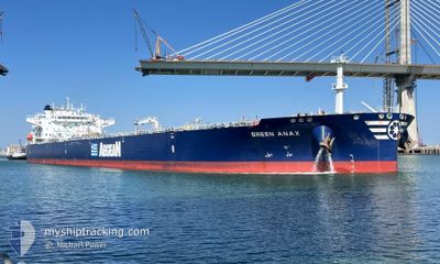
GREEN ANAX
Tanker

Current Trip
| Time Travelled | 3 days |
|---|---|
| Remaining Time | --- |
| Distance Travelled | 481.63 nm |
| Remaining Distance | --- |
| AVG Speed | 11.1 Noeuds |
| MAX Speed | 14.7 Noeuds |
| AVG Wind | 13.7 knots |
| MAX Wind | 25 knots |
| MIN Temp | 17.5°C / 63.5°F |
| MAX Temp | 29.1°C / 84.38°F |
| Tirant d eau | 9 m |
| Position reçue | 1 m depuis |
Current Position
| Longitude | 23.39056° |
|---|---|
| Latitude | 36.29651° |
| Etat | Under way using engine |
| Vitesse | 12.1 Noeuds |
| Parcours | 215.5° |
| Zone | Aegean Sea |
| Station | T-AIS |
| Position reçue | 1 m depuis |
Information
The current position of GREEN ANAX is in Aegean Sea with coordinates 36.29651° / 23.39056° as reported on 2025-06-10 17:10 by AIS to our vessel tracker app. The vessel's current speed is 12.1 Noeuds and is heading at the port of SKIKDA. The estimated time of arrival as calculated by MyShipTracking vessel tracking app is 2025-06-13 15:00 LT
The vessel GREEN ANAX (IMO: 9927213, MMSI: 636020832) is a Tanker It's sailing under the flag of [LR] Liberia.
In this page you can find informations about the vessels current position, last detected port calls, and current voyage information. If the vessels is not in coverage by AIS you will find the latest position.
The current position of GREEN ANAX is detected by our AIS receivers and we are not responsible for the reliability of the data. The last position was recorded while the vessel was in Coverage by the Ais receivers of our vessel tracking app.
The current draught of GREEN ANAX as reported by AIS is 9 meters
Weather
| Temperature | 25.2°C / 77.36°F |
|---|---|
| Wind Speed | 20 knots |
| Direction | 19° NNE |
| Pressure | 1012.2 hPa |
| Humidity | 64.3 % |
| Cloud Coverage | --- |


Featured Company
Last Port Calls
| Port | Arrival | Departure | Time In Port |
|---|---|---|---|
| 2025-06-07 12:38 | 2025-06-07 13:50 | 1 h | |
| 2025-05-22 18:10 | 2025-05-23 20:06 | 1 d | |
| 2025-05-03 21:22 | 2025-05-04 21:14 | 23 h | |
| 2025-04-11 13:54 | 2025-04-13 14:11 | 2 d | |
| 2025-04-10 09:22 | 2025-04-11 08:35 | 23 h |
Most Visited Ports (Last year)
| Port | Arrivals | |
|---|---|---|
| 4 | ||
| 2 | ||
| 2 | ||
| 1 | ||
| 1 | ||
| 1 |
Last Trips
| Origin | Departure | Destination | Arrival | Distance | |
|---|---|---|---|---|---|
| 2025-05-23 20:06 | 2025-06-07 12:38 | 1584.66 nm | |||
| 2025-05-04 21:14 | 2025-05-22 18:10 | 1752.24 nm | |||
| 2025-04-13 14:11 | 2025-05-03 21:22 | 1384.84 nm | |||
| 2025-04-11 08:35 | 2025-04-11 13:54 | 31.78 nm | |||
| 2025-03-23 00:22 | 2025-04-10 09:22 | 3507.99 nm |
Events
| Heure | Evenement | Détails | Position/ Destination | Info |
|---|---|---|---|---|
| 2025-06-10 10:01 | Changement d'ETA | 2025/06/13 14:00 2026/01/01 14:00 |
37.67260 / 23.70271
SKIKDA
|
Vitesse: 11.7 kn Parcours: 155.5° |
| 2025-06-10 09:55 | Changement d'ETA | 2026/01/01 14:00 2025/06/13 14:00 |
37.69044 / 23.69232
SKIKDA
|
Vitesse: 11.8 kn Parcours: 153.2° |
| 2025-06-10 08:45 | Démarrage | 3.73 nm, South East of MAROUDI |
37.83537 / 23.52040
SKIKDA
|
Vitesse: 4.8 kn Parcours: 98° |
| 2025-06-10 08:38 | Changement d'ETA | 2025/06/13 14:00 2026/01/01 13:00 |
37.83412 / 23.51461
SKIKDA
|
Vitesse: 1.8 kn Parcours: 50° |
| 2025-06-10 08:37 | Etat Changé | Under way using engine At anchor |
37.83378 / 23.51459
SKIKDA
|
Vitesse: 1.1 kn Parcours: 30° |
| 2025-06-10 08:37 | Changement d'ETA | 2026/01/01 13:00 2025/06/13 13:00 |
37.83329 / 23.51473
SKIKDA
|
Vitesse: 1.1 kn Parcours: 30° |
| 2025-06-10 08:19 | Changement d'ETA | 2025/06/13 13:00 2025/06/13 11:00 |
37.83280 / 23.51507
SKIKDA
|
Vitesse: 0.1 kn Parcours: 57° |
| 2025-06-10 08:18 | Changement de destination | SKIKDA PIRAEUS ANCHORAGE |
37.83278 / 23.51506
SKIKDA
|
Vitesse: 0.1 kn Parcours: 57° |
| 2025-06-10 08:18 | Changement d'ETA | 2025/06/13 11:00 2025/06/09 23:00 |
37.83278 / 23.51506
SKIKDA
|
Vitesse: 0.1 kn Parcours: 57° |
| 2025-06-10 07:12 | Etat Changé | At anchor Default |
37.83277 / 23.51525
PIRAEUS ANCHORAGE
|
Vitesse: 0.1 kn Parcours: 50° |