
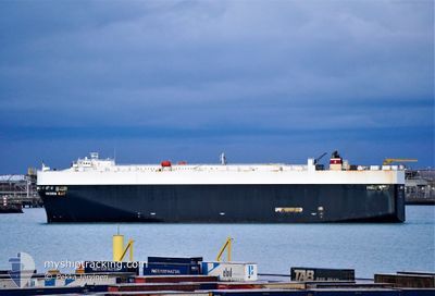
GREEN BAY
Vehicles Carrier
Current Trip
| Trip Time | 14 h, 19 mins |
|---|---|
| Trip Distance | 188.46 nm |
| AVG Speed | 13.5 Noeuds |
| MAX Speed | 16.5 Noeuds |
| Tirant d eau | 8.4 m |
| AVG Wind | 15.7 knots |
| MAX Wind | 26.3 knots |
| MIN Temp | 10.1°C / 50.18°F |
| MAX Temp | 15.4°C / 59.72°F |
| Position reçue | 16 h, 43 m depuis |
Current Position
| Longitude | 141.17247° |
|---|---|
| Latitude | 35.63713° |
| Etat | Under way using engine |
| Vitesse | 12.3 Noeuds |
| Parcours | 5.7° |
| Zone | North Pacific Ocean |
| Station | T-AIS |
| Position reçue | 16 h, 43 m depuis |
Info
Information
The current position of GREEN BAY is in North Pacific Ocean with coordinates 35.63713° / 141.17247° as reported on 2025-02-15 16:51 by AIS to our vessel tracker app. The vessel's current speed is 12.3 Noeuds and is currently inside the port of HITACHINAKA.
The vessel GREEN BAY (IMO: 9339818, MMSI: 338009000) is a Vehicles Carrier that was built in 2007 ( 18 Age ). It's sailing under the flag of [US] USA.
In this page you can find informations about the vessels current position, last detected port calls, and current voyage information. If the vessels is not in coverage by AIS you will find the latest position.
The current position of GREEN BAY is detected by our AIS receivers and we are not responsible for the reliability of the data. The last position was recorded while the vessel was in Coverage by the Ais receivers of our vessel tracking app.
The current draught of GREEN BAY as reported by AIS is 8.4 meters
Weather
| Temperature | 10.3°C / 50.54°F |
|---|---|
| Wind Speed | 4 knots |
| Direction | 111° ESE |
| Pressure | 1010 hPa |
| Humidity | 54.6 % |
| Cloud Coverage | 100 % |
Featured Company
Last Port Calls
| Port | Arrival | Departure | Time In Port |
|---|---|---|---|
| 2025-02-16 06:45 | |||
| 2025-02-14 07:28 | 2025-02-15 16:26 | 1 d | |
| 2025-01-24 06:23 | 2025-01-24 18:03 | 11 h | |
| 2025-01-16 21:24 | 2025-01-17 17:11 | 19 h | |
| 2025-01-14 16:47 | 2025-01-15 17:09 | 1 d | |
| 2025-01-13 03:24 | 2025-01-14 04:33 | 1 d | |
| 2024-12-28 10:42 | 2024-12-28 17:22 | 6 h | |
| 2024-12-26 08:20 | 2024-12-27 14:13 | 1 d | |
| 2024-12-25 13:43 | 2024-12-25 20:34 | 6 h | |
| 2024-12-22 09:30 | 2024-12-24 17:03 | 2 d |
Last Trips
| Origin | Departure | Destination | Arrival | Distance | |
|---|---|---|---|---|---|
| 2025-02-15 16:26 | 2025-02-16 06:45 | 188.46 nm | |||
| 2025-01-24 18:03 | 2025-02-14 07:28 | 5905.32 nm | |||
| 2025-01-17 17:11 | 2025-01-24 06:23 | 1267.31 nm | |||
| 2025-01-15 17:09 | 2025-01-16 21:24 | 410.00 nm | |||
| 2025-01-14 04:33 | 2025-01-14 16:47 | 181.12 nm | |||
| 2024-12-28 17:22 | 2025-01-13 03:24 | 6197.67 nm | |||
| 2024-12-27 14:13 | 2024-12-28 10:42 | 319.67 nm | |||
| 2024-12-25 20:34 | 2024-12-26 08:20 | 182.15 nm | |||
| 2024-12-24 17:03 | 2024-12-25 13:43 | 208.79 nm | |||
| 2024-12-21 11:12 | 2024-12-22 09:30 | 317.42 nm |
Events
| Heure | Evenement | Détails | Position/ Destination | Info |
|---|---|---|---|---|
| 2025-02-15 22:33 | Arret |
36.42740 / 140.61746
[JP] HITACHINAKA
|
Vitesse: Parcours: 90° |
|
| 2025-02-15 21:45 | Port d'arrivée |
|
36.41144 / 140.63225
[JP] HITACHINAKA
|
Vitesse: 10.8 kn Parcours: 338° |
| 2025-02-15 16:55 | Etat Changé | Default Under way using engine |
35.65132 / 141.17403
JP HIC
|
Vitesse: 12.3 kn Parcours: 5.7° |
| 2025-02-15 16:51 | Hors de la zone couverte |
35.63713 / 141.17247
North Pacific Ocean
JP HIC
|
Vitesse: 12.3 kn Parcours: 5.7° |
|
| 2025-02-15 16:47 | Etat Changé | Under way using engine Default |
35.62523 / 141.17100
JP HIC
|
Vitesse: 13.2 kn Parcours: 26° |
| 2025-02-15 16:15 | Etat Changé | Default Under way using engine |
35.51471 / 141.10892
JP HIC
|
Vitesse: 14.8 kn Parcours: 28.6° |
| 2025-02-15 10:19 | Etat Changé | Under way using engine Default |
34.84793 / 139.75666
JP HIC
|
Vitesse: 16.5 kn Parcours: 164° |
| 2025-02-15 10:01 | Dans la zone couverte |
34.84516 / 139.75856
North Pacific Ocean
JP HIC
|
Vitesse: 16.3 kn Parcours: 150.5° |
|
| 2025-02-15 08:30 | Etat Changé | Default Under way using engine |
35.26320 / 139.76639
JP HIC
|
Vitesse: 12.9 kn Parcours: 144.4° |
| 2025-02-15 08:24 | Hors de la zone couverte |
35.28082 / 139.75131
North Pacific Ocean
JP HIC
|
Vitesse: 12.9 kn Parcours: 144.4° |