
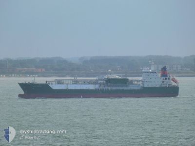
HAPPY KESTREL
Tanker D
Current Trip
| Time Travelled | 2 days |
|---|---|
| Remaining Time | 3 days |
| Distance Travelled | 769.37 nm |
| Remaining Distance | 929.86 nm |
| AVG Speed | 12.1 Noeuds |
| MAX Speed | 13.5 Noeuds |
| AVG Wind | 7.4 knots |
| MAX Wind | 21.9 knots |
| MIN Temp | 13.5°C / 56.3°F |
| MAX Temp | 21.3°C / 70.34°F |
| Tirant d eau | 7.9 m |
| Position reçue | 17 h, 46 m depuis |
Current Position
| Longitude | 11.93518° |
|---|---|
| Latitude | 37.33645° |
| Etat | Under way using engine |
| Vitesse | 12.6 Noeuds |
| Parcours | 292.1° |
| Zone | Mediterranean Sea - Eastern Basin |
| Station | T-AIS |
| Position reçue | 17 h, 46 m depuis |
Info
Information
The current position of HAPPY KESTREL is in Mediterranean Sea - Eastern Basin with coordinates 37.33645° / 11.93518° as reported on 2025-02-18 11:53 by AIS to our vessel tracker app. The vessel's current speed is 12.6 Noeuds and is heading at the port of SINES. The estimated time of arrival as calculated by MyShipTracking vessel tracking app is 2025-02-22 06:46 LT
The vessel HAPPY KESTREL (IMO: 9543043, MMSI: 219221000) is a Tanker D It's sailing under the flag of [DK] Denmark.
In this page you can find informations about the vessels current position, last detected port calls, and current voyage information. If the vessels is not in coverage by AIS you will find the latest position.
The current position of HAPPY KESTREL is detected by our AIS receivers and we are not responsible for the reliability of the data. The last position was recorded while the vessel was in Coverage by the Ais receivers of our vessel tracking app.
The current draught of HAPPY KESTREL as reported by AIS is 7.9 meters
Weather
| Temperature | 15.5°C / 59.9°F |
|---|---|
| Wind Speed | 11 knots |
| Direction | 139° SE |
| Pressure | 1018.1 hPa |
| Humidity | 83.4 % |
| Cloud Coverage | 98 % |
Featured Company
Last Trips
| Origin | Departure | Destination | Arrival | Distance | |
|---|---|---|---|---|---|
| 2025-01-31 11:02 | 2025-02-15 08:53 | 1353.47 nm | |||
| 2025-01-25 16:22 | 2025-01-28 18:01 | 705.74 nm | |||
| 2024-12-13 05:39 | 2025-01-24 09:08 | 2532.12 nm | |||
| 2024-12-08 17:12 | 2024-12-12 12:10 | 1158.77 nm | |||
| 2024-11-19 04:25 | 2024-12-03 23:57 | 517.31 nm |
Events
| Heure | Evenement | Détails | Position/ Destination | Info |
|---|---|---|---|---|
| 2025-02-18 12:37 | Etat Changé | Default Under way using engine |
37.39510 / 11.76177
PTSIE
|
Vitesse: 12.6 kn Parcours: 292.1° |
| 2025-02-18 11:53 | Hors de la zone couverte |
37.33645 / 11.93518
Mediterranean Sea - Eastern Basin
PTSIE
|
Vitesse: 12.6 kn Parcours: 292.1° |
|
| 2025-02-18 11:48 | Etat Changé | Under way using engine Default |
37.33015 / 11.95469
PTSIE
|
Vitesse: 12.8 kn Parcours: 294° |
| 2025-02-18 11:00 | Etat Changé | Default Under way using engine |
37.26051 / 12.15136
PTSIE
|
Vitesse: 12.7 kn Parcours: 291.1° |
| 2025-02-18 10:53 | Changement de zone | Italian part of the Mediterranean Sea - Eastern Basin Maltese part of the Mediterranean Sea - Eastern Basin |
37.25156 / 12.18024
Mediterranean Sea - Eastern Basin
PTSIE
|
Vitesse: 12.7 kn Parcours: 290.6° |
| 2025-02-18 10:53 | Etat Changé | Under way using engine Default |
37.25156 / 12.18024
PTSIE
|
Vitesse: 12.5 kn Parcours: 285° |
| 2025-02-18 10:45 | Dans la zone couverte |
37.25156 / 12.18024
Mediterranean Sea - Eastern Basin
PTSIE
|
Vitesse: 12.7 kn Parcours: 290.6° |
|
| 2025-02-18 01:44 | Etat Changé | Default Under way using engine |
36.44813 / 14.27449
PTSIE
|
Vitesse: 12.5 kn Parcours: 295.8° |
| 2025-02-18 01:40 | Hors de la zone couverte |
36.44293 / 14.28762
Mediterranean Sea - Eastern Basin
PTSIE
|
Vitesse: 12.5 kn Parcours: 295.8° |
|
| 2025-02-18 00:39 | Tirant d'eau modifié | 7.9 6.5 |
36.35476 / 14.52184
PTSIE
|
Vitesse: 12.4 kn Parcours: 295.1° |