

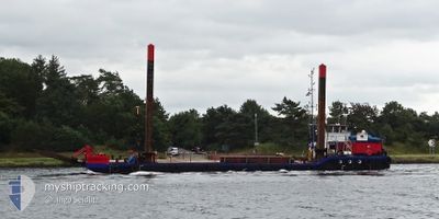
HENRIETTE
Dredging or underwater ops

Current Trip
| Trip Time | 7 h, 6 mins |
|---|---|
| Trip Distance | 51.16 nm |
| AVG Speed | 7.7 Noeuds |
| MAX Speed | 9.5 Noeuds |
| Tirant d eau | 1.5 m |
| AVG Wind | 10.1 knots |
| MAX Wind | 12.8 knots |
| MIN Temp | 4°C / 39.2°F |
| MAX Temp | 6.9°C / 44.42°F |
| Position reçue | 3 m depuis |
Current Position
| Longitude | 8.57580° |
|---|---|
| Latitude | 53.52392° |
| Etat | Moored |
| Vitesse | |
| Parcours | 1° |
| Zone | North Sea |
| Station | T-AIS |
| Position reçue | 3 m depuis |
Information
The current position of HENRIETTE is in North Sea with coordinates 53.52392° / 8.57580° as reported on 2025-04-02 19:20 by AIS to our vessel tracker app. The vessel's current speed is 0 Noeuds and is currently inside the port of BREMERHAVEN.
The vessel HENRIETTE (MMSI: 211294420) is a Dredging or underwater ops It's sailing under the flag of [DE] Germany.
In this page you can find informations about the vessels current position, last detected port calls, and current voyage information. If the vessels is not in coverage by AIS you will find the latest position.
The current position of HENRIETTE is detected by our AIS receivers and we are not responsible for the reliability of the data. The last position was recorded while the vessel was in Coverage by the Ais receivers of our vessel tracking app.
The current draught of HENRIETTE as reported by AIS is 1.5 meters
Weather
| Temperature | 8.6°C / 47.48°F |
|---|---|
| Wind Speed | 11 knots |
| Direction | 69° ENE |
| Pressure | 1027.4 hPa |
| Humidity | 82 % |
| Cloud Coverage | 6 % |


Featured Company
Last Port Calls
| Port | Arrival | Departure | Time In Port |
|---|---|---|---|
| 2025-03-27 08:06 | |||
| 2025-03-26 18:15 | 2025-03-27 01:00 | 6 h | |
| 2025-03-26 11:54 |
Most Visited Ports (Last year)
| Port | Arrivals | |
|---|---|---|
| 92 | ||
| 6 | ||
| 4 | ||
| 3 | ||
| 2 | ||
| 1 |
Last Trips
| Origin | Departure | Destination | Arrival | Distance | |
|---|---|---|---|---|---|
| 2025-03-27 01:00 | 2025-03-27 08:06 | 51.16 nm | |||
| 2025-03-26 11:54 | 2025-03-26 18:15 | 50.24 nm |
Events
| Heure | Evenement | Détails | Position/ Destination | Info |
|---|---|---|---|---|
| 2025-04-01 00:04 | Changement d'ETA | 2026/03/27 09:00 2025/03/27 09:00 |
53.52348 / 8.57587
[DE] BREMERHAVEN
|
Vitesse: Parcours: 2° |
| 2025-03-27 10:46 | Etat Changé | Moored Under way using engine |
53.52295 / 8.57570
[DE] BREMERHAVEN
|
Vitesse: Parcours: 1° |
| 2025-03-27 08:04 | Arret |
53.52301 / 8.57516
[DE] BREMERHAVEN
|
Vitesse: 0.1 kn Parcours: 28° |
|
| 2025-03-27 07:57 | Démarrage |
53.53045 / 8.57742
[DE] BREMERHAVEN
|
Vitesse: 5.8 kn Parcours: 195° |
|
| 2025-03-27 07:46 | Arret |
53.53233 / 8.57766
[DE] BREMERHAVEN
|
Vitesse: Parcours: 186° |
|
| 2025-03-27 07:06 | Port d'arrivée |
|
53.60283 / 8.49960
[DE] BREMERHAVEN
|
Vitesse: 9.6 kn Parcours: 142.5° |
| 2025-03-27 04:00 | Dans la zone couverte |
53.87714 / 8.10675
North Sea
BREMERHAVEN
|
Vitesse: 6.3 kn Parcours: 158.7° |
|
| 2025-03-27 02:27 | Hors de la zone couverte |
53.98645 / 8.22578
North Sea
BREMERHAVEN
|
Vitesse: 6.2 kn Parcours: 260.8° |
|
| 2025-03-27 00:00 | PORT DE DEPART |
|
53.87210 / 8.71541
BREMERHAVEN
|
Vitesse: 7.7 kn Parcours: 321° |
| 2025-03-26 23:55 | Changement de destination | BREMERHAVEN CUXHAVEN |
53.86431 / 8.71495
[DE] CUXHAVEN
|
Vitesse: 4.3 kn Parcours: 19° |