
HORIZON GEODISCOVERY
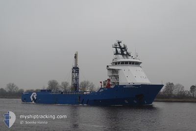
Offshore Supply Ship
Current Trip
| Trip Time | 4 h, 30 mins |
|---|---|
| Trip Distance | 19.38 nm |
| AVG Speed | 7.4 Noeuds |
| MAX Speed | 11 Noeuds |
| Tirant d eau | 5.1 m |
| AVG Wind | 10 knots |
| MAX Wind | 13 knots |
| MIN Temp | 2.3°C / 36.14°F |
| MAX Temp | 6°C / 42.8°F |
| Position reçue | 3 m depuis |
Current Position
| Longitude | -3.16693° |
|---|---|
| Latitude | 55.98262° |
| Etat | Moored |
| Vitesse | |
| Parcours | 301° |
| Zone | North Sea |
| Station | T-AIS |
| Position reçue | 3 m depuis |
Info
Information
The current position of HORIZON GEODISCOVERY is in North Sea with coordinates 55.98262° / -3.16693° as reported on 2025-02-13 20:42 by AIS to our vessel tracker app. The vessel's current speed is 0 Noeuds and is currently inside the port of LEITH.
The vessel HORIZON GEODISCOVERY (IMO: 9263514, MMSI: 355847000) is a Offshore Supply Ship that was built in 2002 ( 23 Age ). It's sailing under the flag of [PA] Panama.
In this page you can find informations about the vessels current position, last detected port calls, and current voyage information. If the vessels is not in coverage by AIS you will find the latest position.
The current position of HORIZON GEODISCOVERY is detected by our AIS receivers and we are not responsible for the reliability of the data. The last position was recorded while the vessel was in Coverage by the Ais receivers of our vessel tracking app.
The current draught of HORIZON GEODISCOVERY as reported by AIS is 5.1 meters
Weather
| Temperature | 4°C / 39.2°F |
|---|---|
| Wind Speed | 8 knots |
| Direction | 94° E |
| Pressure | 1026.7 hPa |
| Humidity | 61.4 % |
| Cloud Coverage | 100 % |
Featured Company
Events
| Heure | Evenement | Détails | Position/ Destination | Info |
|---|---|---|---|---|
| 2025-02-07 14:51 | Etat Changé | Moored Under way using engine |
55.98259 / -3.16699
[GB] LEITH
|
Vitesse: Parcours: 301° |
| 2025-02-07 13:50 | Arret |
55.98776 / -3.17952
[GB] LEITH
|
Vitesse: 0.3 kn Parcours: 322° |
|
| 2025-02-07 13:41 | Port d'arrivée |
|
55.99107 / -3.18371
[GB] LEITH
|
Vitesse: 2 kn Parcours: 326° |
| 2025-02-07 13:31 | Démarrage | 0.85 nm, North West of LEITH |
55.99754 / -3.19241
GBLEI
|
Vitesse: 4.9 kn Parcours: 332° |
| 2025-02-07 13:29 | Arret | 0.97 nm, North West of LEITH |
55.99938 / -3.19400
GBLEI
|
Vitesse: 0.3 kn Parcours: 329° |
| 2025-02-07 12:13 | Démarrage | 5.92 nm, South East of WEST WEMYSS |
56.06132 / -2.98313
GBLEI
|
Vitesse: 3.1 kn Parcours: 224° |
| 2025-02-07 12:07 | Etat Changé | Under way using engine Restricted manoeuverability |
56.06278 / -2.97988
GBLEI
|
Vitesse: 0.4 kn Parcours: 168° |
| 2025-02-07 11:05 | Arret | 6.19 nm, South East of WEST WEMYSS |
56.06039 / -2.97241
GBLEI
|
Vitesse: 0.3 kn Parcours: 161° |
| 2025-02-07 10:15 | Etat Changé | Restricted manoeuverability Under way using engine |
56.05748 / -2.95840
GBLEI
|
Vitesse: 2.1 kn Parcours: 89° |
| 2025-02-07 09:11 | PORT DE DEPART |
|
55.99226 / -3.18585
GBLEI
|
Vitesse: 5 kn Parcours: 140° |