
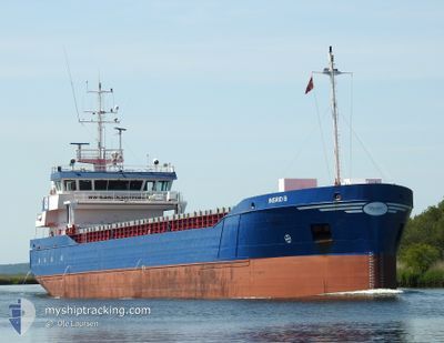
INGRID B
General Cargo
Current Trip
| Time Travelled | 20 h, 4 mins |
|---|---|
| Remaining Time | --- |
| Distance Travelled | 150.76 nm |
| Remaining Distance | --- |
| AVG Speed | 8.2 Noeuds |
| MAX Speed | 8.6 Noeuds |
| AVG Wind | 12.1 knots |
| MAX Wind | 21 knots |
| MIN Temp | 16.5°C / 61.7°F |
| MAX Temp | 17.7°C / 63.86°F |
| Tirant d eau | 5.5 m |
| Position reçue | 17 h, 25 m depuis |
Current Position
| Longitude | -8.76930° |
|---|---|
| Latitude | 33.43045° |
| Etat | Under way using engine |
| Vitesse | 8.4 Noeuds |
| Parcours | 353.7° |
| Zone | North Atlantic Ocean |
| Station | T-AIS |
| Position reçue | 17 h, 25 m depuis |
Info
Information
The current position of INGRID B is in North Atlantic Ocean with coordinates 33.43045° / -8.76930° as reported on 2025-02-10 16:17 by AIS to our vessel tracker app. The vessel's current speed is 8.4 Noeuds and is heading at the port of BAYONNE. The estimated time of arrival as calculated by MyShipTracking vessel tracking app is 2025-02-15 07:00 LT
The vessel INGRID B (IMO: 9279020, MMSI: 257211000) is a General Cargo that was built in 2005 ( 20 Age ). It's sailing under the flag of [NO] Norway.
In this page you can find informations about the vessels current position, last detected port calls, and current voyage information. If the vessels is not in coverage by AIS you will find the latest position.
The current position of INGRID B is detected by our AIS receivers and we are not responsible for the reliability of the data. The last position was recorded while the vessel was in Coverage by the Ais receivers of our vessel tracking app.
The current draught of INGRID B as reported by AIS is 5.5 meters
Weather
| Temperature | 16.5°C / 61.7°F |
|---|---|
| Wind Speed | 21 knots |
| Direction | 202° SSW |
| Pressure | 1014.8 hPa |
| Humidity | 86 % |
| Cloud Coverage | --- |
Featured Company
Last Port Calls
| Port | Arrival | Departure | Time In Port |
|---|---|---|---|
| 2025-02-05 09:30 | 2025-02-10 14:38 | 5 d | |
| 2025-01-15 06:33 | 2025-01-15 22:20 | 15 h | |
| 2025-01-05 19:05 | 2025-01-05 22:10 | 3 h | |
| 2025-01-03 07:02 | 2025-01-03 07:41 | 39 m | |
| 2024-12-30 00:26 | 2025-01-02 23:25 | 3 d | |
| 2024-12-29 17:29 | 2024-12-29 17:44 | 14 m | |
| 2024-12-27 04:42 | 2024-12-27 18:10 | 13 h | |
| 2024-12-26 10:54 | 2024-12-26 13:38 | 2 h | |
| 2024-12-21 02:58 | 2024-12-24 18:00 | 3 d | |
| 2024-12-17 23:30 | 2024-12-20 15:18 | 2 d |
Most Visited Ports (Last year)
| Port | Arrivals | |
|---|---|---|
| 4 | ||
| 4 | ||
| 4 | ||
| 3 | ||
| 3 | ||
| 3 |
Last Trips
| Origin | Departure | Destination | Arrival | Distance | |
|---|---|---|---|---|---|
| 2025-01-15 22:20 | 2025-02-05 09:30 | 504.49 nm | |||
| 2025-01-05 22:10 | 2025-01-15 06:33 | 1669.41 nm | |||
| 2025-01-03 07:41 | 2025-01-05 19:05 | 508.38 nm | |||
| 2025-01-02 23:25 | 2025-01-03 07:02 | 65.48 nm | |||
| 2024-12-29 17:44 | 2024-12-30 00:26 | 65.88 nm | |||
| 2024-12-27 18:10 | 2024-12-29 17:29 | 456.24 nm | |||
| 2024-12-26 13:38 | 2024-12-27 04:42 | 99.41 nm | |||
| 2024-12-24 18:00 | 2024-12-26 10:54 | 358.18 nm | |||
| 2024-12-20 15:18 | 2024-12-21 02:58 | 65.56 nm | |||
| 2024-12-13 16:49 | 2024-12-17 23:30 | 664.47 nm |
Events
| Heure | Evenement | Détails | Position/ Destination | Info |
|---|---|---|---|---|
| 2025-02-10 16:21 | Etat Changé | Default Under way using engine |
33.43950 / -8.77024
FRBAY
|
Vitesse: 8.4 kn Parcours: 353.7° |
| 2025-02-10 16:17 | Hors de la zone couverte |
33.43045 / -8.76930
North Atlantic Ocean
FRBAY
|
Vitesse: 8.4 kn Parcours: 353.7° |
|
| 2025-02-10 16:09 | Etat Changé | Under way using engine Default |
33.41085 / -8.76728
FRBAY
|
Vitesse: 8.5 kn Parcours: 358° |
| 2025-02-10 15:54 | Etat Changé | Default Under way using engine |
33.37633 / -8.76591
FRBAY
|
Vitesse: 8.3 kn Parcours: 353.6° |
| 2025-02-10 15:36 | Etat Changé | Under way using engine Default |
33.33367 / -8.76278
FRBAY
|
Vitesse: 8.2 kn Parcours: 359° |
| 2025-02-10 15:21 | Etat Changé | Default Under way using engine |
33.29725 / -8.76182
FRBAY
|
Vitesse: 8.2 kn Parcours: 358.4° |
| 2025-02-10 14:59 | Etat Changé | Under way using engine Default |
33.24741 / -8.75899
FRBAY
|
Vitesse: 7.9 kn Parcours: 355° |
| 2025-02-10 14:59 | Dans la zone couverte |
33.25276 / -8.75966
North Atlantic Ocean
FRBAY
|
Vitesse: 8.2 kn Parcours: 354° |
|
| 2025-02-10 14:08 | Tirant d'eau modifié | 5.5 3.8 |
33.14318 / -8.70858
FRBAY
|
Vitesse: 8.1 kn Parcours: 306° |
| 2025-02-10 13:54 | Hors de la zone couverte |
33.13164 / -8.68784
North Atlantic Ocean
FRBAY
|
Vitesse: 7.9 kn Parcours: 301.2° |