
IRINI
Tanker
Current Trip
| Time Travelled | 9 days |
|---|---|
| Remaining Time | 2 days |
| Distance Travelled | 360.39 nm |
| Remaining Distance | 294.46 nm |
| AVG Speed | 5.6 Noeuds |
| MAX Speed | 11.7 Noeuds |
| AVG Wind | 9.7 knots |
| MAX Wind | 22 knots |
| MIN Temp | 15.9°C / 60.62°F |
| MAX Temp | 18.4°C / 65.12°F |
| Tirant d eau | 9.9 m |
| Position reçue | 16 d depuis |
Current Position
| Longitude | -3.97264° |
|---|---|
| Latitude | 36.09874° |
| Etat | Under way using engine |
| Vitesse | 13.3 Noeuds |
| Parcours | 79.5° |
| Zone | Alboran Sea |
| Station | T-AIS |
| Position reçue | 16 d depuis |
Info
Information
The current position of IRINI is in Alboran Sea with coordinates 36.09874° / -3.97264° as reported on 2025-01-18 17:40 by AIS to our vessel tracker app. The vessel's current speed is 13.3 Noeuds and is heading at the port of MISURATA. The estimated time of arrival as calculated by MyShipTracking vessel tracking app is 2025-02-05 21:42 LT
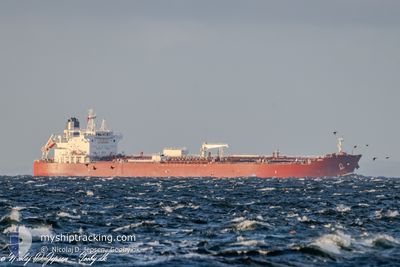
The vessel IRINI (IMO: 9934890, MMSI: 241797000) is a Tanker It's sailing under the flag of [GR] Greece.
In this page you can find informations about the vessels current position, last detected port calls, and current voyage information. If the vessels is not in coverage by AIS you will find the latest position.
The current position of IRINI is detected by our AIS receivers and we are not responsible for the reliability of the data. The last position was recorded while the vessel was in Coverage by the Ais receivers of our vessel tracking app.
The current draught of IRINI as reported by AIS is 9.9 meters
Weather
| Temperature | 16.5°C / 61.7°F |
|---|---|
| Wind Speed | 13 knots |
| Direction | 321° NW |
| Pressure | 1019.1 hPa |
| Humidity | 73.2 % |
| Cloud Coverage | --- |
Featured Company
Last Port Calls
| Port | Arrival | Departure | Time In Port |
|---|---|---|---|
| 2025-01-23 23:24 | 2025-01-25 17:41 | 1 d | |
| 2025-01-07 03:55 | 2025-01-08 11:28 | 1 d | |
| 2024-12-21 19:30 | 2024-12-24 02:59 | 2 d | |
| 2024-12-16 16:48 | 2024-12-18 00:12 | 1 d | |
| 2024-12-04 08:20 | 2024-12-09 09:36 | 5 d | |
| 2024-12-01 15:42 | 2024-12-02 15:45 | 1 d |
Most Visited Ports (Last year)
| Port | Arrivals | |
|---|---|---|
| 3 | ||
| 2 | ||
| 2 | ||
| 1 | ||
| 1 | ||
| 1 |
Last Trips
| Origin | Departure | Destination | Arrival | Distance | |
|---|---|---|---|---|---|
| 2025-01-08 14:28 | 2025-01-24 01:24 | 4220.00 nm | |||
| 2024-12-24 03:59 | 2025-01-07 06:55 | 3426.11 nm | |||
| 2024-12-18 01:12 | 2024-12-21 20:30 | 412.08 nm | |||
| 2024-12-09 10:36 | 2024-12-16 17:48 | 561.97 nm | |||
| 2024-12-02 16:45 | 2024-12-04 09:20 | 352.91 nm | |||
| 2024-11-14 11:28 | 2024-12-01 16:42 | 3944.46 nm |
Events
| Heure | Evenement | Détails | Position/ Destination | Info |
|---|---|---|---|---|
| 2025-02-02 21:01 | Arret |
33.41000 / 20.46666
MISURATA
|
Vitesse: Parcours: -1° |
|
| 2025-01-29 01:05 | Arret |
32.81296 / 19.72294
MISURATA
|
Vitesse: 0.1 kn Parcours: 252° |
|
| 2025-01-28 22:43 | Démarrage |
32.71261 / 19.87483
MISURATA
|
Vitesse: 4.3 kn Parcours: 298° |
|
| 2025-01-28 17:45 | Arret |
32.75989 / 19.75230
MISURATA
|
Vitesse: 0.2 kn Parcours: 269° |
|
| 2025-01-28 02:07 | Arret |
32.83167 / 19.70500
MISURATA
|
Vitesse: Parcours: -1° |
|
| 2025-01-26 22:43 | Arret |
32.83167 / 19.61500
MISURATA
|
Vitesse: Parcours: -1° |
|
| 2025-01-25 17:41 | PORT DE DEPART |
|
32.10267 / 19.99313
MISURATA
|
Vitesse: 6 kn Parcours: 245° |
| 2025-01-25 17:26 | Démarrage |
32.11605 / 20.03429
[LY] BENGHAZI
|
Vitesse: 4.5 kn Parcours: 245° |