
ISPRINS
Passenger
Current Trip
SVARTISEN
| Time Travelled | 9 days |
|---|---|
| Remaining Time | --- |
| Distance Travelled | 60.29 nm |
| Remaining Distance | --- |
| AVG Speed | 8 Noeuds |
| MAX Speed | 9.1 Noeuds |
| AVG Wind | 9.8 knots |
| MAX Wind | 15.5 knots |
| MIN Temp | -16.7°C / 1.94°F |
| MAX Temp | 0.7°C / 33.26°F |
| Tirant d eau | 3 m |
| Position reçue | 3 d depuis |
Current Position
| Longitude | 13.69823° |
|---|---|
| Latitude | 66.70971° |
| Etat | Default |
| Vitesse | 6.4 Noeuds |
| Parcours | 94.7° |
| Zone | Norwegian Sea |
| Station | T-AIS |
| Position reçue | 3 d depuis |
Info
Information
The current position of ISPRINS is in Norwegian Sea with coordinates 66.70971° / 13.69823° as reported on 2026-01-05 11:50 by AIS to our vessel tracker app. The vessel's current speed is 6.4 Noeuds
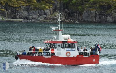
The vessel ISPRINS (MMSI: 257297700) is a Passenger It's sailing under the flag of [NO] Norway.
In this page you can find informations about the vessels current position, last detected port calls, and current voyage information. If the vessels is not in coverage by AIS you will find the latest position.
The current position of ISPRINS is detected by our AIS receivers and we are not responsible for the reliability of the data. The last position was recorded while the vessel was in Coverage by the Ais receivers of our vessel tracking app.
The current draught of ISPRINS as reported by AIS is 3 meters
Weather
| Temperature | -13°C / 8.6°F |
|---|---|
| Wind Speed | 13 knots |
| Direction | 124° SE |
| Pressure | 1017.2 hPa |
| Humidity | 69.4 % |
| Cloud Coverage | 100 % |
Featured Company
Most Visited Ports (Last year)
| Port | Arrivals | |
|---|---|---|
| 12 |
Events
| Heure | Evenement | Détails | Position/ Destination | Info |
|---|---|---|---|---|
| 2026-01-06 14:46 | Arret | 7.84 nm, South West of GLOMFJORD |
66.72346 / 13.67433
SVARTISEN
|
Vitesse: Parcours: -1° |
| 2026-01-06 12:25 | Démarrage | 8.04 nm, South West of GLOMFJORD |
66.71793 / 13.67561
SVARTISEN
|
Vitesse: 3.1 kn Parcours: -1° |
| 2026-01-05 11:50 | Hors de la zone couverte |
66.70971 / 13.69823
Norwegian Sea
|
Vitesse: 6.4 kn Parcours: 94.7° |
|
| 2026-01-05 11:50 | Dans la zone couverte |
66.70971 / 13.69823
Norwegian Sea
|
Vitesse: 6.4 kn Parcours: 94.7° |
|
| 2026-01-02 16:44 | Hors de la zone couverte |
66.70888 / 13.59137
Norwegian Sea
|
Vitesse: 8 kn Parcours: 85° |
|
| 2026-01-02 16:32 | Dans la zone couverte |
66.70888 / 13.59137
Norwegian Sea
|
Vitesse: 8 kn Parcours: 85° |
|
| 2026-01-02 15:23 | Hors de la zone couverte |
66.70113 / 13.63189
Norwegian Sea
|
Vitesse: 8.5 kn Parcours: 2.3° |
|
| 2026-01-02 15:23 | Dans la zone couverte |
66.70113 / 13.63189
Norwegian Sea
|
Vitesse: 8.5 kn Parcours: 2.3° |
|
| 2025-12-30 23:49 | Arret | 7.85 nm, South West of GLOMFJORD |
66.72345 / 13.67430
SVARTISEN
|
Vitesse: Parcours: -1° |
| 2025-12-30 22:53 | Hors de la zone couverte |
66.72848 / 13.52457
Norwegian Sea
|
Vitesse: 7.8 kn Parcours: 122.4° |