
KARVUNA
Bulk Carrier
Current Trip
| Time Travelled | 7 days |
|---|---|
| Remaining Time | --- |
| Distance Travelled | 1579.85 nm |
| Remaining Distance | --- |
| AVG Speed | 9.8 Noeuds |
| MAX Speed | 12.7 Noeuds |
| AVG Wind | 9.4 knots |
| MAX Wind | 27.3 knots |
| MIN Temp | 12.8°C / 55.04°F |
| MAX Temp | 19.1°C / 66.38°F |
| Tirant d eau | 6 m |
| Position reçue | 4 d depuis |
Current Position
| Longitude | -7.48895° |
|---|---|
| Latitude | 35.81009° |
| Etat | Under way using engine |
| Vitesse | 9.5 Noeuds |
| Parcours | 260.2° |
| Zone | North Atlantic Ocean |
| Station | T-AIS |
| Position reçue | 4 d depuis |
Info
Information
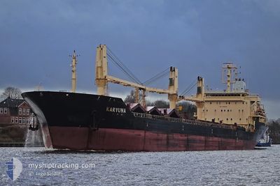
The current position of KARVUNA is in North Atlantic Ocean with coordinates 35.81009° / -7.48895° as reported on 2025-02-10 20:22 by AIS to our vessel tracker app. The vessel's current speed is 9.5 Noeuds and is heading at the port of TAMPA. The estimated time of arrival as calculated by MyShipTracking vessel tracking app is 2025-02-28 08:00 LT
The vessel KARVUNA (IMO: 9468619, MMSI: 249885000) is a Bulk Carrier that was built in 2010 ( 15 Age ). It's sailing under the flag of [MT] Malta.
In this page you can find informations about the vessels current position, last detected port calls, and current voyage information. If the vessels is not in coverage by AIS you will find the latest position.
The current position of KARVUNA is detected by our AIS receivers and we are not responsible for the reliability of the data. The last position was recorded while the vessel was in Coverage by the Ais receivers of our vessel tracking app.
The current draught of KARVUNA as reported by AIS is 6 meters
Weather
| Temperature | 18.9°C / 66.02°F |
|---|---|
| Wind Speed | 14 knots |
| Direction | 321° NW |
| Pressure | 1015.5 hPa |
| Humidity | 63.9 % |
| Cloud Coverage | 62 % |
Featured Company
Last Port Calls
| Port | Arrival | Departure | Time In Port |
|---|---|---|---|
| 2025-02-01 10:40 | 2025-02-07 11:18 | 6 d | |
| 2025-01-16 12:29 | 2025-01-20 16:27 | 4 d | |
| 2024-12-01 10:40 | 2025-01-05 11:49 |
Most Visited Ports (Last year)
| Port | Arrivals | |
|---|---|---|
| 2 | ||
| 2 | ||
| 2 | ||
| 1 | ||
| 1 | ||
| 1 |
Last Trips
| Origin | Departure | Destination | Arrival | Distance | |
|---|---|---|---|---|---|
| 2025-01-20 18:27 | 2025-02-01 11:40 | 1886.48 nm | |||
| 2025-01-05 13:49 | 2025-01-16 14:29 | 211.99 nm | |||
| 2024-11-22 22:18 | 2024-12-01 12:40 | 2190.17 nm |
Events
| Heure | Evenement | Détails | Position/ Destination | Info |
|---|---|---|---|---|
| 2025-02-10 20:24 | Etat Changé | Default Under way using engine |
35.80946 / -7.49443
US TPA
|
Vitesse: 9.5 kn Parcours: 260.2° |
| 2025-02-10 20:22 | Hors de la zone couverte |
35.81009 / -7.48895
North Atlantic Ocean
US TPA
|
Vitesse: 9.5 kn Parcours: 260.2° |
|
| 2025-02-10 20:16 | Démarrage |
35.81291 / -7.47544
US TPA
|
Vitesse: 3.7 kn Parcours: 230° |
|
| 2025-02-10 20:11 | Arret |
35.81422 / -7.47377
US TPA
|
Vitesse: 0.3 kn Parcours: 212° |
|
| 2025-02-10 19:59 | Etat Changé | Under way using engine Default |
35.81486 / -7.46931
US TPA
|
Vitesse: 2.9 kn Parcours: 258° |
| 2025-02-10 19:47 | Etat Changé | Default Under way using engine |
35.81651 / -7.45418
US TPA
|
Vitesse: 8.5 kn Parcours: 264.5° |
| 2025-02-10 18:52 | Etat Changé | Under way using engine Default |
35.84206 / -7.25362
US TPA
|
Vitesse: 11.7 kn Parcours: 261° |
| 2025-02-10 18:39 | Etat Changé | Default Under way using engine |
35.84839 / -7.20217
US TPA
|
Vitesse: 11.5 kn Parcours: 262.1° |
| 2025-02-10 18:29 | Etat Changé | Under way using engine Default |
35.85123 / -7.16567
US TPA
|
Vitesse: 11.5 kn Parcours: 265° |
| 2025-02-10 18:27 | Etat Changé | Default Under way using engine |
35.85181 / -7.15712
US TPA
|
Vitesse: 11.3 kn Parcours: 266.2° |