

KILLU
General Cargo
Current Trip
| Time Travelled | 2 days |
|---|---|
| Remaining Time | 5 h, 29 mins |
| Distance Travelled | 261.44 nm |
| Remaining Distance | 53.06 nm |
| AVG Speed | 10.4 Noeuds |
| MAX Speed | 14 Noeuds |
| AVG Wind | 6.6 knots |
| MAX Wind | 16 knots |
| MIN Temp | 2.8°C / 37.04°F |
| MAX Temp | 10.7°C / 51.26°F |
| Tirant d eau | 6.4 m |
| Position reçue | 1 m depuis |
Current Position
| Longitude | 1.36582° |
|---|---|
| Latitude | 51.47434° |
| Etat | Under way using engine |
| Vitesse | 11 Noeuds |
| Parcours | 280° |
| Zone | North Sea |
| Station | T-AIS |
| Position reçue | 1 m depuis |
Information
The current position of KILLU is in North Sea with coordinates 51.47434° / 1.36582° as reported on 2025-03-07 12:37 by AIS to our vessel tracker app. The vessel's current speed is 11 Noeuds and is heading at the port of ERITH. The estimated time of arrival as calculated by MyShipTracking vessel tracking app is 2025-03-07 18:08 LT
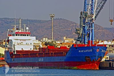
The vessel KILLU (IMO: 9454826, MMSI: 304625000) is a General Cargo that was built in 2009 ( 16 Age ). It's sailing under the flag of [AG] Antigua Barbuda.
In this page you can find informations about the vessels current position, last detected port calls, and current voyage information. If the vessels is not in coverage by AIS you will find the latest position.
The current position of KILLU is detected by our AIS receivers and we are not responsible for the reliability of the data. The last position was recorded while the vessel was in Coverage by the Ais receivers of our vessel tracking app.
The current draught of KILLU as reported by AIS is 6.4 meters
Weather
| Temperature | 10.3°C / 50.54°F |
|---|---|
| Wind Speed | 14 knots |
| Direction | 173° S |
| Pressure | 1013.7 hPa |
| Humidity | 77 % |
| Cloud Coverage | 36 % |
Featured Company
Last Port Calls
| Port | Arrival | Departure | Time In Port |
|---|---|---|---|
| 2025-03-04 11:27 | 2025-03-05 05:14 | 17 h | |
| 2025-02-26 06:47 | 2025-03-01 01:47 | 2 d | |
| 2025-02-10 16:18 | |||
| 2025-02-10 14:08 | |||
| 2025-01-29 14:37 | 2025-01-30 14:19 | 23 h | |
| 2025-01-08 04:27 | 2025-01-09 04:50 | 1 d |
Most Visited Ports (Last year)
| Port | Arrivals | |
|---|---|---|
| 12 | ||
| 4 | ||
| 3 | ||
| 3 | ||
| 3 | ||
| 2 |
Last Trips
| Origin | Departure | Destination | Arrival | Distance | |
|---|---|---|---|---|---|
| 2025-03-01 02:47 | 2025-03-04 12:27 | 643.24 nm | |||
| 2025-02-10 17:08 | 2025-02-10 19:18 | 12.91 nm | |||
| 2025-01-09 04:50 | 2025-01-29 14:37 | 496.53 nm | |||
| 2024-12-28 20:39 | 2025-01-08 04:27 | 2327.55 nm |
Events
| Heure | Evenement | Détails | Position/ Destination | Info |
|---|---|---|---|---|
| 2025-03-07 11:38 | Démarrage | 5.87 nm, North of RAMSGATE |
51.42288 / 1.43673
GB ERI
|
Vitesse: 3.1 kn Parcours: 40° |
| 2025-03-07 11:31 | Etat Changé | Under way using engine At anchor |
51.42168 / 1.43918
GB ERI
|
Vitesse: 0.3 kn Parcours: 263° |
| 2025-03-06 08:02 | Etat Changé | At anchor Under way using engine |
51.42025 / 1.43933
GB ERI
|
Vitesse: 1.3 kn Parcours: 231° |
| 2025-03-06 07:57 | Arret | 5.77 nm, North of RAMSGATE |
51.42115 / 1.43791
GB ERI
|
Vitesse: 0.2 kn Parcours: 256° |
| 2025-03-06 02:10 | Detecté en mer | United Kingdom part of the North Sea |
51.05508 / 1.59491
North Sea
GB ERI
|
Vitesse: 10.4 kn Parcours: 41.6° |
| 2025-03-06 02:01 | Changement de zone | French part of the North Sea French part of the English Channel |
51.03577 / 1.56762
North Sea
GB ERI
|
Vitesse: 10.2 kn Parcours: 41.5° |
| 2025-03-05 23:01 | Etat Changé | Under way using engine Default |
50.66472 / 1.25380
GB ERI
|
Vitesse: 8.8 kn Parcours: 47° |
| 2025-03-05 22:54 | Etat Changé | Default Under way using engine |
50.65204 / 1.23367
GB ERI
|
Vitesse: 8.5 kn Parcours: 40° |
| 2025-03-05 22:37 | Etat Changé | Under way using engine Default |
50.62272 / 1.19321
GB ERI
|
Vitesse: 8.4 kn Parcours: 43° |
| 2025-03-05 22:33 | Etat Changé | Default Under way using engine |
50.61599 / 1.18368
GB ERI
|
Vitesse: 8.4 kn Parcours: 48.3° |