

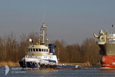
KOOLE 31
Tug

Current Trip
K10030
| Time Travelled | 21 h, 38 mins |
|---|---|
| Remaining Time | --- |
| Distance Travelled | 44.73 nm |
| Remaining Distance | --- |
| AVG Speed | 7.4 Noeuds |
| MAX Speed | 10.4 Noeuds |
| AVG Wind | 13.4 knots |
| MAX Wind | 14.9 knots |
| MIN Temp | 29.1°C / 84.38°F |
| MAX Temp | 31.3°C / 88.34°F |
| Tirant d eau | 3.5 m |
| Position reçue | 2 m depuis |
Current Position
| Longitude | 54.85489° |
|---|---|
| Latitude | 25.59032° |
| Etat | At anchor |
| Vitesse | 2.1 Noeuds |
| Parcours | 242° |
| Zone | Persian Gulf |
| Station | T-AIS |
| Position reçue | 2 m depuis |
Information
The current position of KOOLE 31 is in Persian Gulf with coordinates 25.59032° / 54.85489° as reported on 2025-06-05 04:12 by AIS to our vessel tracker app. The vessel's current speed is 2.1 Noeuds
The vessel KOOLE 31 (IMO: 9431903, MMSI: 245039000) is a Tug that was built in 2008 ( 17 Age ). It's sailing under the flag of [NL] Netherlands.
In this page you can find informations about the vessels current position, last detected port calls, and current voyage information. If the vessels is not in coverage by AIS you will find the latest position.
The current position of KOOLE 31 is detected by our AIS receivers and we are not responsible for the reliability of the data. The last position was recorded while the vessel was in Coverage by the Ais receivers of our vessel tracking app.
The current draught of KOOLE 31 as reported by AIS is 3.5 meters
Weather
| Temperature | 29.4°C / 84.92°F |
|---|---|
| Wind Speed | 8 knots |
| Direction | 235° SW |
| Pressure | 1002.6 hPa |
| Humidity | 64.1 % |
| Cloud Coverage | 8 % |


Featured Company
Last Port Calls
| Port | Arrival | Departure | Time In Port |
|---|---|---|---|
| 2025-06-04 06:51 | 2025-06-04 10:37 | 3 h | |
| 2025-05-30 14:53 | 2025-05-30 19:15 | 4 h | |
| 2025-05-28 07:43 | 2025-05-28 22:41 | 14 h | |
| 2025-05-09 09:14 | 2025-05-09 18:34 | 9 h | |
| 2025-04-28 07:38 | 2025-04-28 16:00 | 8 h | |
| 2025-04-22 14:29 | 2025-04-23 23:44 | 1 d | |
| 2025-04-16 06:46 | 2025-04-16 17:36 | 10 h |
Most Visited Ports (Last year)
| Port | Arrivals | |
|---|---|---|
| 9 | ||
| 3 | ||
| 1 | ||
| 1 | ||
| 1 |
Last Trips
| Origin | Departure | Destination | Arrival | Distance | |
|---|---|---|---|---|---|
| 2025-05-30 19:15 | 2025-06-04 06:51 | 85.71 nm | |||
| 2025-05-28 22:41 | 2025-05-30 14:53 | 62.11 nm | |||
| 2025-05-09 18:34 | 2025-05-28 07:43 | 87.59 nm | |||
| 2025-04-28 16:00 | 2025-05-09 09:14 | 71.69 nm | |||
| 2025-04-23 23:44 | 2025-04-28 07:38 | 63.46 nm | |||
| 2025-04-16 17:36 | 2025-04-22 14:29 | 73.71 nm | |||
| 2025-03-22 14:13 | 2025-04-16 06:46 | 218.90 nm |
Events
| Heure | Evenement | Détails | Position/ Destination | Info |
|---|---|---|---|---|
| 2025-06-05 02:36 | Etat Changé | At anchor Default |
25.59035 / 54.85509
K10030
|
Vitesse: 1.1 kn Parcours: 261° |
| 2025-06-05 02:24 | Etat Changé | Default At anchor |
25.59027 / 54.85513
K10030
|
Vitesse: 0.9 kn Parcours: 270° |
| 2025-06-05 01:06 | Etat Changé | At anchor Default |
25.59013 / 54.85525
K10030
|
Vitesse: 0.8 kn Parcours: 281° |
| 2025-06-05 00:57 | Etat Changé | Default At anchor |
25.59004 / 54.85531
K10030
|
Vitesse: 0.7 kn Parcours: 265° |
| 2025-06-05 00:21 | Etat Changé | At anchor Default |
25.59012 / 54.85533
K10030
|
Vitesse: 1.1 kn Parcours: 262° |
| 2025-06-05 00:12 | Etat Changé | Default At anchor |
25.59013 / 54.85531
K10030
|
Vitesse: 1.1 kn Parcours: 262° |
| 2025-06-05 00:09 | Etat Changé | At anchor Default |
25.59011 / 54.85530
K10030
|
Vitesse: 1.2 kn Parcours: 270° |
| 2025-06-05 00:03 | Etat Changé | Default At anchor |
25.59003 / 54.85532
K10030
|
Vitesse: 1.4 kn Parcours: 259° |
| 2025-06-04 23:51 | Etat Changé | At anchor Default |
25.59005 / 54.85531
K10030
|
Vitesse: 0.9 kn Parcours: 275° |
| 2025-06-04 23:45 | Etat Changé | Default At anchor |
25.59004 / 54.85532
K10030
|
Vitesse: 0.7 kn Parcours: 278° |