
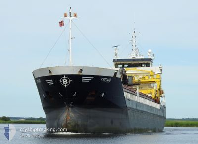
KVITSAND
General Cargo
Current Trip
| Time Travelled | 2 days |
|---|---|
| Remaining Time | 19 h, 27 mins |
| Distance Travelled | 607.80 nm |
| Remaining Distance | 170.62 nm |
| AVG Speed | 10.8 Noeuds |
| MAX Speed | 14 Noeuds |
| AVG Wind | 10.2 knots |
| MAX Wind | 26 knots |
| MIN Temp | -4.3°C / 24.26°F |
| MAX Temp | 4.8°C / 40.64°F |
| Tirant d eau | 6.5 m |
| Position reçue | 1 m depuis |
Current Position
| Longitude | 10.59426° |
|---|---|
| Latitude | 57.80606° |
| Etat | Under way using engine |
| Vitesse | 8.2 Noeuds |
| Parcours | 95.2° |
| Zone | Skaggerak |
| Station | T-AIS |
| Position reçue | 1 m depuis |
Info
Information
The current position of KVITSAND is in Skaggerak with coordinates 57.80606° / 10.59426° as reported on 2025-02-11 08:05 by AIS to our vessel tracker app. The vessel's current speed is 8.2 Noeuds and is heading at the port of FREDERICIA. The estimated time of arrival as calculated by MyShipTracking vessel tracking app is 2025-02-12 03:33 LT
The vessel KVITSAND (IMO: 9313797, MMSI: 257754000) is a General Cargo that was built in 2005 ( 20 Age ). It's sailing under the flag of [NO] Norway.
In this page you can find informations about the vessels current position, last detected port calls, and current voyage information. If the vessels is not in coverage by AIS you will find the latest position.
The current position of KVITSAND is detected by our AIS receivers and we are not responsible for the reliability of the data. The last position was recorded while the vessel was in Coverage by the Ais receivers of our vessel tracking app.
The current draught of KVITSAND as reported by AIS is 6.5 meters
Weather
| Temperature | 1.6°C / 34.88°F |
|---|---|
| Wind Speed | 16 knots |
| Direction | 96° E |
| Pressure | 1038.9 hPa |
| Humidity | 79.9 % |
| Cloud Coverage | 9 % |
Featured Company
Last Port Calls
| Port | Arrival | Departure | Time In Port |
|---|---|---|---|
| 2025-02-07 07:34 | 2025-02-08 11:50 | 1 d | |
| 2025-02-04 11:50 | 2025-02-04 21:32 | 9 h | |
| 2025-01-27 19:18 | 2025-01-27 21:21 | 2 h | |
| 2025-01-23 00:15 | 2025-01-23 15:47 | 15 h | |
| 2025-01-21 11:41 | 2025-01-21 19:15 | 7 h | |
| 2025-01-14 07:32 | 2025-01-15 05:27 | 21 h | |
| 2025-01-12 05:18 | 2025-01-12 23:27 | 18 h | |
| 2025-01-11 05:32 | 2025-01-11 21:21 | 15 h | |
| 2025-01-09 06:10 | 2025-01-09 08:18 | 2 h | |
| 2025-01-07 07:15 | 2025-01-08 20:40 | 1 d |
Last Trips
| Origin | Departure | Destination | Arrival | Distance | |
|---|---|---|---|---|---|
| 2025-02-04 22:32 | 2025-02-07 08:34 | 477.35 nm | |||
| 2025-01-27 22:21 | 2025-02-04 12:50 | 940.33 nm | |||
| 2025-01-23 16:47 | 2025-01-27 20:18 | 709.38 nm | |||
| 2025-01-21 20:15 | 2025-01-23 01:15 | 3.22 nm | |||
| 2025-01-15 06:27 | 2025-01-21 12:41 | 1287.38 nm | |||
| 2025-01-13 00:27 | 2025-01-14 08:32 | 331.41 nm | |||
| 2025-01-11 22:21 | 2025-01-12 06:18 | 82.92 nm | |||
| 2025-01-09 09:18 | 2025-01-11 06:32 | 422.12 nm | |||
| 2025-01-08 21:40 | 2025-01-09 07:10 | 93.14 nm | |||
| 2025-01-06 21:59 | 2025-01-07 08:15 | 126.96 nm |
Events
| Heure | Evenement | Détails | Position/ Destination | Info |
|---|---|---|---|---|
| 2025-02-11 02:52 | Detecté en mer | Danish part of the Skaggerak |
57.84778 / 9.14561
Skaggerak
FREDERICIA
|
Vitesse: 9.1 kn Parcours: 91.5° |
| 2025-02-10 19:00 | Detecté en mer | Norwegian part of the Skaggerak |
57.91906 / 7.14316
Skaggerak
FREDERICIA
|
Vitesse: 7.8 kn Parcours: 92.5° |
| 2025-02-10 06:11 | Démarrage | 2.47 nm, North of JELSA |
59.37393 / 6.03820
FREDERICIA
|
Vitesse: 5.8 kn Parcours: 233.5° |
| 2025-02-10 05:45 | Tirant d'eau modifié | 6.5 3.8 |
59.37320 / 6.04383
FREDERICIA
|
Vitesse: Parcours: 3° |
| 2025-02-10 05:45 | Changement d'ETA | 2025/02/12 05:00 2025/02/09 20:00 |
59.37320 / 6.04383
FREDERICIA
|
Vitesse: Parcours: 3° |
| 2025-02-10 05:42 | Etat Changé | Under way using engine Moored |
59.37319 / 6.04382
FREDERICIA
|
Vitesse: Parcours: 3° |
| 2025-02-10 05:39 | Changement de destination | FREDERICIA JELSA |
59.37318 / 6.04386
FREDERICIA
|
Vitesse: Parcours: 3° |
| 2025-02-09 20:29 | Etat Changé | Moored Under way using engine |
59.37310 / 6.04382
JELSA
|
Vitesse: Parcours: 2° |
| 2025-02-09 20:21 | Arret | 2.43 nm, North of JELSA |
59.37303 / 6.04360
JELSA
|
Vitesse: 0.3 kn Parcours: 7° |
| 2025-02-09 07:12 | Changement de zone | Norwegian part of the North Sea German part of the North Sea |
57.06952 / 6.19990
North Sea
JELSA
|
Vitesse: 8.7 kn Parcours: 343.7° |