
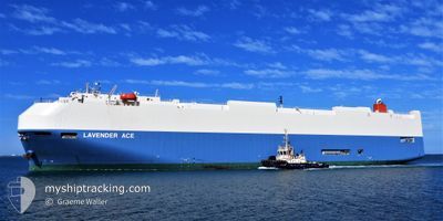
LAVENDER ACE
Vehicles Carrier
Current Trip
| Time Travelled | 7 days |
|---|---|
| Remaining Time | --- |
| Distance Travelled | 3149.75 nm |
| Remaining Distance | --- |
| AVG Speed | 17.7 Noeuds |
| MAX Speed | 20.8 Noeuds |
| AVG Wind | 14.4 knots |
| MAX Wind | 29 knots |
| MIN Temp | 19.2°C / 66.56°F |
| MAX Temp | 28°C / 82.4°F |
| Tirant d eau | 9.3 m |
| Position reçue | 6 d depuis |
Current Position
| Longitude | 17.76006° |
|---|---|
| Latitude | -34.11742° |
| Etat | Under way using engine |
| Vitesse | 18.3 Noeuds |
| Parcours | 321.6° |
| Zone | South Atlantic Ocean |
| Station | T-AIS |
| Position reçue | 6 d depuis |
Info
Information
The current position of LAVENDER ACE is in South Atlantic Ocean with coordinates -34.11742° / 17.76006° as reported on 2025-02-25 02:35 by AIS to our vessel tracker app. The vessel's current speed is 18.3 Noeuds and is heading at the port of VIGO. The estimated time of arrival as calculated by MyShipTracking vessel tracking app is 2025-03-09 09:00 LT
The vessel LAVENDER ACE (IMO: 9363948, MMSI: 353332000) is a Vehicles Carrier that was built in 2008 ( 17 Age ). It's sailing under the flag of [PA] Panama.
In this page you can find informations about the vessels current position, last detected port calls, and current voyage information. If the vessels is not in coverage by AIS you will find the latest position.
The current position of LAVENDER ACE is detected by our AIS receivers and we are not responsible for the reliability of the data. The last position was recorded while the vessel was in Coverage by the Ais receivers of our vessel tracking app.
The current draught of LAVENDER ACE as reported by AIS is 9.3 meters
Weather
| Temperature | 27.4°C / 81.32°F |
|---|---|
| Wind Speed | 5 knots |
| Direction | 198° SSW |
| Pressure | 1008.6 hPa |
| Humidity | 78.2 % |
| Cloud Coverage | 100 % |
Featured Company
Last Port Calls
| Port | Arrival | Departure | Time In Port |
|---|---|---|---|
| 2025-02-23 06:48 | 2025-02-23 18:24 | 11 h | |
| 2025-02-17 17:12 | 2025-02-22 14:20 | 4 d | |
| 2025-02-07 01:42 | 2025-02-07 11:55 | 10 h | |
| 2025-01-29 23:25 | 2025-01-30 16:41 | 17 h | |
| 2025-01-27 01:44 | 2025-01-27 13:00 | 11 h | |
| 2025-01-22 19:53 | 2025-01-23 11:49 | 15 h | |
| 2025-01-21 09:16 | 2025-01-21 23:04 | 13 h | |
| 2025-01-19 00:29 | 2025-01-19 14:38 | 14 h | |
| 2025-01-16 00:53 | 2025-01-16 13:09 | 12 h | |
| 2025-01-13 18:53 | 2025-01-15 08:43 | 1 d |
Last Trips
| Origin | Departure | Destination | Arrival | Distance | |
|---|---|---|---|---|---|
| 2025-02-22 16:20 | 2025-02-23 08:48 | 278.80 nm | |||
| 2025-02-07 15:55 | 2025-02-17 19:12 | 1682.46 nm | |||
| 2025-01-30 22:11 | 2025-02-07 05:42 | 2649.52 nm | |||
| 2025-01-27 18:30 | 2025-01-30 04:55 | 496.96 nm | |||
| 2025-01-23 17:19 | 2025-01-27 07:14 | 1063.98 nm | |||
| 2025-01-22 04:34 | 2025-01-23 01:23 | 203.99 nm | |||
| 2025-01-19 20:08 | 2025-01-21 14:46 | 298.37 nm | |||
| 2025-01-16 17:09 | 2025-01-19 05:59 | 748.66 nm | |||
| 2025-01-15 12:43 | 2025-01-16 04:53 | 270.53 nm | |||
| 2025-01-12 16:11 | 2025-01-13 22:53 | 485.01 nm |
Events
| Heure | Evenement | Détails | Position/ Destination | Info |
|---|---|---|---|---|
| 2025-02-25 02:40 | Etat Changé | Default Under way using engine |
-34.09564 / 17.73935
ES VGO
|
Vitesse: 18.3 kn Parcours: 321.6° |
| 2025-02-25 02:35 | Hors de la zone couverte |
-34.11742 / 17.76006
South Atlantic Ocean
ES VGO
|
Vitesse: 18.3 kn Parcours: 321.6° |
|
| 2025-02-25 02:27 | Etat Changé | Under way using engine Default |
-34.14726 / 17.78799
ES VGO
|
Vitesse: 18.2 kn Parcours: 324° |
| 2025-02-25 02:22 | Etat Changé | Default Under way using engine |
-34.16779 / 17.80667
ES VGO
|
Vitesse: 18 kn Parcours: 323.2° |
| 2025-02-25 01:21 | Etat Changé | Under way using engine Default |
-34.41300 / 18.02971
ES VGO
|
Vitesse: 18.8 kn Parcours: 322° |
| 2025-02-25 01:19 | Etat Changé | Default Under way using engine |
-34.42227 / 18.03818
ES VGO
|
Vitesse: 18.8 kn Parcours: 322.6° |
| 2025-02-25 01:14 | Etat Changé | Under way using engine Default |
-34.44468 / 18.05923
ES VGO
|
Vitesse: 18.7 kn Parcours: 323° |
| 2025-02-25 01:11 | Etat Changé | Default Under way using engine |
-34.45328 / 18.06731
ES VGO
|
Vitesse: 18.9 kn Parcours: 321.3° |
| 2025-02-25 00:59 | Etat Changé | Under way using engine Default |
-34.50500 / 18.11681
ES VGO
|
Vitesse: 19.1 kn Parcours: 318° |
| 2025-02-25 00:55 | Etat Changé | Default Under way using engine |
-34.52081 / 18.13340
ES VGO
|
Vitesse: 19.2 kn Parcours: 320.7° |