
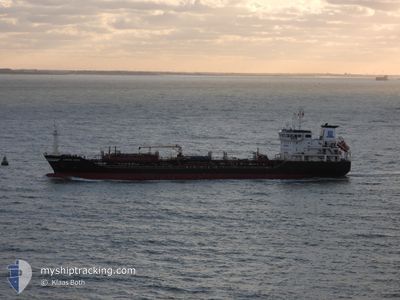
LESSOW SWAN
Oil/Chemical Tanker
Current Trip
| Time Travelled | 14 h, 17 mins |
|---|---|
| Remaining Time | 2 days |
| Distance Travelled | 98.94 nm |
| Remaining Distance | 855.19 nm |
| AVG Speed | 10.9 Noeuds |
| MAX Speed | 12.9 Noeuds |
| AVG Wind | 14.9 knots |
| MAX Wind | 26.9 knots |
| MIN Temp | 9.8°C / 49.64°F |
| MAX Temp | 14.1°C / 57.38°F |
| Tirant d eau | 6.2 m |
| Position reçue | 12 h, 40 m depuis |
Current Position
| Longitude | -9.09022° |
|---|---|
| Latitude | 42.45898° |
| Etat | Moored |
| Vitesse | 12.3 Noeuds |
| Parcours | 282° |
| Zone | North Atlantic Ocean |
| Station | T-AIS |
| Position reçue | 12 h, 40 m depuis |
Info
Information
The current position of LESSOW SWAN is in North Atlantic Ocean with coordinates 42.45898° / -9.09022° as reported on 2025-02-11 06:23 by AIS to our vessel tracker app. The vessel's current speed is 12.3 Noeuds and is heading at the port of MOERDIJK. The estimated time of arrival as calculated by MyShipTracking vessel tracking app is 2025-02-14 11:08 LT
The vessel LESSOW SWAN (IMO: 9386378, MMSI: 219479000) is a Oil/Chemical Tanker that was built in 2008 ( 17 Age ). It's sailing under the flag of [DK] Denmark.
In this page you can find informations about the vessels current position, last detected port calls, and current voyage information. If the vessels is not in coverage by AIS you will find the latest position.
The current position of LESSOW SWAN is detected by our AIS receivers and we are not responsible for the reliability of the data. The last position was recorded while the vessel was in Coverage by the Ais receivers of our vessel tracking app.
The current draught of LESSOW SWAN as reported by AIS is 6.2 meters
Weather
| Temperature | 12.9°C / 55.22°F |
|---|---|
| Wind Speed | 13 knots |
| Direction | 233° SW |
| Pressure | 1010.2 hPa |
| Humidity | 72.3 % |
| Cloud Coverage | 51 % |
Featured Company
Last Port Calls
| Port | Arrival | Departure | Time In Port |
|---|---|---|---|
| 2025-02-10 04:00 | 2025-02-11 04:46 | 1 d | |
| 2025-02-07 19:08 | 2025-02-08 00:06 | 4 h | |
| 2025-01-29 06:25 | 2025-02-03 09:29 | 5 d | |
| 2025-01-14 06:13 | 2025-01-14 12:05 | 5 h | |
| 2024-12-31 04:09 | 2025-01-05 05:05 | 5 d | |
| 2024-12-20 16:29 | 2024-12-23 06:32 | 2 d | |
| 2024-12-13 16:37 | 2024-12-13 22:06 | 5 h | |
| 2024-12-06 19:44 | 2024-12-07 22:06 | 1 d | |
| 2024-12-03 07:55 | 2024-12-04 13:12 | 1 d |
Last Trips
| Origin | Departure | Destination | Arrival | Distance | |
|---|---|---|---|---|---|
| 2025-02-08 01:06 | 2025-02-10 05:00 | 571.42 nm | |||
| 2025-02-03 10:29 | 2025-02-07 20:08 | 1064.52 nm | |||
| 2025-01-14 13:05 | 2025-01-29 07:25 | 2669.21 nm | |||
| 2025-01-05 07:05 | 2025-01-14 07:13 | 2212.94 nm | |||
| 2024-12-23 07:32 | 2024-12-31 06:09 | 1029.36 nm | |||
| 2024-12-13 23:06 | 2024-12-20 17:29 | 1440.10 nm | |||
| 2024-12-07 23:06 | 2024-12-13 17:37 | 1707.67 nm | |||
| 2024-12-04 14:12 | 2024-12-06 20:44 | 14.17 nm | |||
| 2024-11-28 16:09 | 2024-12-03 08:55 | 1340.11 nm |
Events
| Heure | Evenement | Détails | Position/ Destination | Info |
|---|---|---|---|---|
| 2025-02-11 06:31 | Etat Changé | Default Moored |
42.46646 / -9.12545
ESVIL>NLMOE
|
Vitesse: 12.3 kn Parcours: 282° |
| 2025-02-11 06:23 | Hors de la zone couverte |
42.45898 / -9.09022
North Atlantic Ocean
ESVIL>NLMOE
|
Vitesse: 12.3 kn Parcours: 282° |
|
| 2025-02-11 06:18 | Etat Changé | Moored Default |
42.45557 / -9.06880
ESVIL>NLMOE
|
Vitesse: 12.7 kn Parcours: 282° |
| 2025-02-11 06:15 | Etat Changé | Default Moored |
42.45345 / -9.05582
ESVIL>NLMOE
|
Vitesse: 12.7 kn Parcours: 283° |
| 2025-02-11 05:26 | Changement d'ETA | 2025/02/14 07:01 2025/02/15 11:00 |
42.55238 / -8.92568
ESVIL>NLMOE
|
Vitesse: 12 kn Parcours: 215° |
| 2025-02-11 05:26 | Etat Changé | Moored Under way using engine |
42.55238 / -8.92568
ESVIL>NLMOE
|
Vitesse: 12 kn Parcours: 216° |
| 2025-02-11 05:13 | Tirant d'eau modifié | 6.2 7.2 |
42.57677 / -8.90150
ESVIL>NLMOE
|
Vitesse: 7.6 kn Parcours: 225° |
| 2025-02-11 05:13 | Changement de destination | ESVIL>NLMOE ESCEU>ESVIL |
42.57677 / -8.90150
ESVIL>NLMOE
|
Vitesse: 7.6 kn Parcours: 225° |
| 2025-02-11 05:13 | Changement d'ETA | 2025/02/15 11:00 2025/02/10 03:00 |
42.57677 / -8.90150
ESVIL>NLMOE
|
Vitesse: 7.6 kn Parcours: 225° |
| 2025-02-11 04:46 | Etat Changé | Under way using engine Default |
42.59963 / -8.79470
ESCEU>ESVIL
|
Vitesse: 3.5 kn Parcours: 264° |