
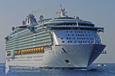
LIBERTY OF THE SEAS
Passengers Ship
Current Trip
BS CO
| Time Travelled | 13 h, 26 mins |
|---|---|
| Remaining Time | --- |
| Distance Travelled | 69.31 nm |
| Remaining Distance | --- |
| AVG Speed | 5.5 Noeuds |
| MAX Speed | 11 Noeuds |
| AVG Wind | 8.9 knots |
| MAX Wind | 12 knots |
| MIN Temp | 21.5°C / 70.7°F |
| MAX Temp | 22.5°C / 72.5°F |
| Tirant d eau | 9.1 m |
| Position reçue | 1 m depuis |
Current Position
| Longitude | -77.87930° |
|---|---|
| Latitude | 25.85272° |
| Etat | Under way using engine |
| Vitesse | 6.4 Noeuds |
| Parcours | 254.3° |
| Zone | North Atlantic Ocean |
| Station | T-AIS |
| Position reçue | 1 m depuis |
Info
Information
The current position of LIBERTY OF THE SEAS is in North Atlantic Ocean with coordinates 25.85272° / -77.87930° as reported on 2026-01-04 11:38 by AIS to our vessel tracker app. The vessel's current speed is 6.4 Noeuds
The vessel LIBERTY OF THE SEAS (IMO: 9330032, MMSI: 309436000) is a Passengers Ship that was built in 2007 ( 19 Age ). It's sailing under the flag of [BS] Bahamas.
In this page you can find informations about the vessels current position, last detected port calls, and current voyage information. If the vessels is not in coverage by AIS you will find the latest position.
The current position of LIBERTY OF THE SEAS is detected by our AIS receivers and we are not responsible for the reliability of the data. The last position was recorded while the vessel was in Coverage by the Ais receivers of our vessel tracking app.
The current draught of LIBERTY OF THE SEAS as reported by AIS is 9.1 meters
Weather
| Temperature | 22.4°C / 72.32°F |
|---|---|
| Wind Speed | 12 knots |
| Direction | 260° W |
| Pressure | 1014.5 hPa |
| Humidity | 64.8 % |
| Cloud Coverage | 4 % |
Featured Company
Last Port Calls
| Port | Arrival | Departure | Time In Port |
|---|---|---|---|
| 2026-01-03 06:55 | 2026-01-03 17:13 | 10 h | |
| 2026-01-02 06:07 | 2026-01-02 16:19 | 10 h | |
| 2025-12-31 05:46 | 2025-12-31 17:18 | 11 h | |
| 2025-12-29 05:58 | 2025-12-29 16:24 | 10 h | |
| 2025-12-27 06:57 | 2025-12-27 17:30 | 10 h | |
| 2025-12-26 06:16 | 2025-12-26 16:33 | 10 h | |
| 2025-12-24 06:33 | 2025-12-24 17:37 | 11 h | |
| 2025-12-22 05:56 | 2025-12-22 16:24 | 10 h | |
| 2025-12-20 06:33 | 2025-12-20 17:31 | 10 h | |
| 2025-12-19 06:03 | 2025-12-19 17:22 | 11 h |
Most Visited Ports (Last year)
| Port | Arrivals | |
|---|---|---|
| 54 | ||
| 51 | ||
| 30 | ||
| 9 | ||
| 6 | ||
| 5 |
Last Trips
| Origin | Departure | Destination | Arrival | Distance | |
|---|---|---|---|---|---|
| 2026-01-02 16:19 | 2026-01-03 06:55 | 184.90 nm | |||
| 2025-12-31 17:18 | 2026-01-02 06:07 | 210.96 nm | |||
| 2025-12-29 16:24 | 2025-12-31 05:46 | 352.46 nm | |||
| 2025-12-27 17:30 | 2025-12-29 05:58 | 202.67 nm | |||
| 2025-12-26 16:33 | 2025-12-27 06:57 | 183.53 nm | |||
| 2025-12-24 17:37 | 2025-12-26 06:16 | 350.59 nm | |||
| 2025-12-22 16:24 | 2025-12-24 06:33 | 190.09 nm | |||
| 2025-12-20 17:31 | 2025-12-22 05:56 | 191.07 nm | |||
| 2025-12-19 17:22 | 2025-12-20 06:33 | 184.20 nm | |||
| 2025-12-17 17:49 | 2025-12-19 06:03 | 191.22 nm |
Events
| Heure | Evenement | Détails | Position/ Destination | Info |
|---|---|---|---|---|
| 2026-01-04 09:31 | Etat Changé | Under way using engine Default |
25.80797 / -77.65310
BS CO
|
Vitesse: 6 kn Parcours: 316° |
| 2026-01-04 09:31 | Dans la zone couverte |
25.80797 / -77.65310
North Atlantic Ocean
|
Vitesse: 5.9 kn Parcours: 315.9° |
|
| 2026-01-04 03:04 | Etat Changé | Default Under way using engine |
25.40491 / -77.44740
BS CO
|
Vitesse: 3.8 kn Parcours: 327° |
| 2026-01-04 03:02 | Hors de la zone couverte |
25.40347 / -77.44670
North Atlantic Ocean
|
Vitesse: 3.8 kn Parcours: 337.1° |
|
| 2026-01-04 02:59 | Etat Changé | Under way using engine Default |
25.40057 / -77.44537
BS CO
|
Vitesse: 4 kn Parcours: -1° |
| 2026-01-04 02:43 | Dans la zone couverte |
25.40250 / -77.44625
North Atlantic Ocean
|
Vitesse: 3.8 kn Parcours: 337° |
|
| 2026-01-04 01:41 | Etat Changé | Default Under way using engine |
25.31500 / -77.42167
BS CO
|
Vitesse: 4 kn Parcours: 334° |
| 2026-01-04 01:37 | Hors de la zone couverte |
25.31089 / -77.42020
North Atlantic Ocean
|
Vitesse: 4 kn Parcours: 343.1° |
|
| 2026-01-03 22:13 | PORT DE DEPART |
|
25.08872 / -77.35545
BS CO
|
Vitesse: 7 kn Parcours: 319° |
| 2026-01-03 22:07 | Démarrage |
25.08294 / -77.34538
[BS] NASSAU
|
Vitesse: 3.8 kn Parcours: 281° |