
LOLO GATE
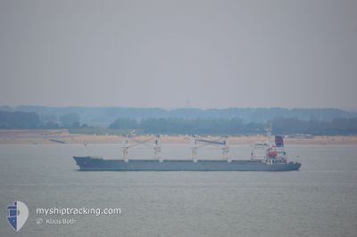
Bulk Carrier
Current Trip
| Time Travelled | 2 days |
|---|---|
| Remaining Time | 1 day |
| Distance Travelled | 484.59 nm |
| Remaining Distance | 263.58 nm |
| AVG Speed | 9.7 Noeuds |
| MAX Speed | 12.8 Noeuds |
| AVG Wind | 26.9 knots |
| MAX Wind | 37 knots |
| MIN Temp | 2.1°C / 35.78°F |
| MAX Temp | 11.4°C / 52.52°F |
| Tirant d eau | 9.8 m |
| Position reçue | 1 h, 6 m depuis |
Current Position
| Longitude | 27.74033° |
|---|---|
| Latitude | 35.14701° |
| Etat | Under way using engine |
| Vitesse | 10.2 Noeuds |
| Parcours | 156° |
| Zone | Mediterranean Sea - Eastern Basin |
| Station | T-AIS |
| Position reçue | 1 h, 6 m depuis |
Info
Information
The current position of LOLO GATE is in Mediterranean Sea - Eastern Basin with coordinates 35.14701° / 27.74033° as reported on 2025-02-06 07:03 by AIS to our vessel tracker app. The vessel's current speed is 10.2 Noeuds and is heading at the port of ALEXANDRIA. The estimated time of arrival as calculated by MyShipTracking vessel tracking app is 2025-02-07 08:17 LT
The vessel LOLO GATE (IMO: 9128104, MMSI: 542399110) is a Bulk Carrier that was built in 1997 ( 28 Age ). It's sailing under the flag of [NU] Niue.
In this page you can find informations about the vessels current position, last detected port calls, and current voyage information. If the vessels is not in coverage by AIS you will find the latest position.
The current position of LOLO GATE is detected by our AIS receivers and we are not responsible for the reliability of the data. The last position was recorded while the vessel was in Coverage by the Ais receivers of our vessel tracking app.
The current draught of LOLO GATE as reported by AIS is 9.8 meters
Weather
| Temperature | 9.5°C / 49.1°F |
|---|---|
| Wind Speed | 30 knots |
| Direction | 346° NNW |
| Pressure | 1022 hPa |
| Humidity | 55.7 % |
| Cloud Coverage | 1 % |
Featured Company
Last Port Calls
| Port | Arrival | Departure | Time In Port |
|---|---|---|---|
| 2025-02-03 10:50 | 2025-02-03 12:16 | 1 h | |
| 2025-01-12 19:45 | 2025-01-20 16:46 | 7 d | |
| 2025-01-11 03:28 | 2025-01-11 04:52 | 1 h | |
| 2024-12-22 00:19 | 2024-12-22 01:53 | 1 h | |
| 2024-12-09 14:15 | 2024-12-13 05:31 | 3 d | |
| 2024-12-02 19:30 |
Most Visited Ports (Last year)
| Port | Arrivals | |
|---|---|---|
| 9 | ||
| 4 | ||
| 3 | ||
| 2 | ||
| 2 | ||
| 2 |
Last Trips
| Origin | Departure | Destination | Arrival | Distance | |
|---|---|---|---|---|---|
| 2025-01-20 19:46 | 2025-02-03 13:50 | 835.92 nm | |||
| 2025-01-11 07:52 | 2025-01-12 22:45 | 290.13 nm | |||
| 2024-12-22 04:53 | 2025-01-11 06:28 | 676.64 nm | |||
| 2024-12-13 06:31 | 2024-12-22 03:19 | 2127.21 nm | |||
| 2024-12-02 19:30 | 2024-12-09 15:15 | 1796.84 nm |
Events
| Heure | Evenement | Détails | Position/ Destination | Info |
|---|---|---|---|---|
| 2025-02-06 07:03 | Hors de la zone couverte |
35.14701 / 27.74033
Mediterranean Sea - Eastern Basin
EG/ALY
|
Vitesse: 10.2 kn Parcours: 156° |
|
| 2025-02-06 03:28 | Detecté en mer | Greek part of the Mediterranean Sea - Eastern Basin |
35.71237 / 27.43314
Mediterranean Sea - Eastern Basin
EG/ALY
|
Vitesse: 10 kn Parcours: 158° |
| 2025-02-05 10:05 | Etat Changé | Under way using engine Default |
38.05174 / 25.75316
EG/ALY
|
Vitesse: 10.2 kn Parcours: 177° |
| 2025-02-05 09:47 | Etat Changé | Default Under way using engine |
38.10402 / 25.74743
EG/ALY
|
Vitesse: 10.4 kn Parcours: 178° |
| 2025-02-05 09:39 | Etat Changé | Under way using engine Default |
38.12547 / 25.74534
EG/ALY
|
Vitesse: 10.2 kn Parcours: 177° |
| 2025-02-05 09:29 | Dans la zone couverte |
38.12547 / 25.74534
Aegean Sea
EG/ALY
|
Vitesse: 10.2 kn Parcours: 175.8° |
|
| 2025-02-05 08:42 | Etat Changé | Default Under way using engine |
38.28941 / 25.72893
EG/ALY
|
Vitesse: 10.6 kn Parcours: 175.2° |
| 2025-02-05 08:27 | Hors de la zone couverte |
38.33381 / 25.72480
Aegean Sea
EG/ALY
|
Vitesse: 10.6 kn Parcours: 175.2° |
|
| 2025-02-04 23:24 | Changement de zone | Greek part of the Aegean Sea Turkish part of the Aegean Sea |
39.89217 / 25.82925
Aegean Sea
EG/ALY
|
Vitesse: 10.7 kn Parcours: 220° |
| 2025-02-04 23:24 | Etat Changé | Under way using engine Default |
39.89217 / 25.82925
EG/ALY
|
Vitesse: 10.7 kn Parcours: 220° |