
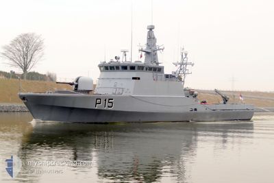
LTU WARSHIP P15
Military ops
Current Trip
| Time Travelled | 7 h, 27 mins |
|---|---|
| Remaining Time | 3 days |
| Distance Travelled | 70.41 nm |
| Remaining Distance | 457.70 nm |
| AVG Speed | 9.9 Noeuds |
| MAX Speed | 16.2 Noeuds |
| AVG Wind | 18.5 knots |
| MAX Wind | 26 knots |
| MIN Temp | 1.9°C / 35.42°F |
| MAX Temp | 4°C / 39.2°F |
| Tirant d eau | 0 m |
| Position reçue | 1 m depuis |
Current Position
| Longitude | 9.14387° |
|---|---|
| Latitude | 53.89336° |
| Etat | Under way using engine |
| Vitesse | 0.1 Noeuds |
| Parcours | 47° |
| Zone | North Sea |
| Station | T-AIS |
| Position reçue | 1 m depuis |
Info
Information
The current position of LTU WARSHIP P15 is in North Sea with coordinates 53.89336° / 9.14387° as reported on 2025-02-10 16:34 by AIS to our vessel tracker app. The vessel's current speed is 0.1 Noeuds and is heading at the port of KLAIPEDA. The estimated time of arrival as calculated by MyShipTracking vessel tracking app is 2025-02-13 22:27 LT
The vessel LTU WARSHIP P15 (MMSI: 277227000) is a Military ops It's sailing under the flag of [LT] Lithuania.
In this page you can find informations about the vessels current position, last detected port calls, and current voyage information. If the vessels is not in coverage by AIS you will find the latest position.
The current position of LTU WARSHIP P15 is detected by our AIS receivers and we are not responsible for the reliability of the data. The last position was recorded while the vessel was in Coverage by the Ais receivers of our vessel tracking app.
Weather
| Temperature | 2.4°C / 36.32°F |
|---|---|
| Wind Speed | 14 knots |
| Direction | 83° E |
| Pressure | 1030 hPa |
| Humidity | 64.5 % |
| Cloud Coverage | 69 % |
Featured Company
Last Port Calls
| Port | Arrival | Departure | Time In Port |
|---|---|---|---|
| 2025-02-05 07:29 | 2025-02-10 09:09 | 5 d | |
| 2025-01-27 11:29 |
Most Visited Ports (Last year)
| Port | Arrivals | |
|---|---|---|
| 1 |
Last Trips
| Origin | Departure | Destination | Arrival | Distance | |
|---|---|---|---|---|---|
| 2025-01-27 13:29 | 2025-02-05 08:29 | 542.67 nm |
Events
| Heure | Evenement | Détails | Position/ Destination | Info |
|---|---|---|---|---|
| 2025-02-10 16:31 | Arret | 0.81 nm, South West of BRUNSBUETTEL |
53.89336 / 9.14385
KLAIPEDA
|
Vitesse: 0.2 kn Parcours: 45° |
| 2025-02-10 16:13 | Démarrage | 2.12 nm, South West of BRUNSBUETTEL |
53.88393 / 9.10975
KLAIPEDA
|
Vitesse: 3.2 kn Parcours: 81° |
| 2025-02-10 16:02 | Arret | 2.44 nm, South West of BRUNSBUETTEL |
53.88223 / 9.10070
KLAIPEDA
|
Vitesse: 0.1 kn Parcours: 80° |
| 2025-02-10 13:31 | Dans la zone couverte |
53.96081 / 8.58739
North Sea
|
Vitesse: 10.9 kn Parcours: 101.2° |
|
| 2025-02-10 11:01 | Hors de la zone couverte |
53.91878 / 7.95260
North Sea
|
Vitesse: 12 kn Parcours: 11° |
|
| 2025-02-10 09:09 | PORT DE DEPART |
|
53.61330 / 8.15428
KLAIPEDA
|
Vitesse: 12.3 kn Parcours: 347° |
| 2025-02-10 09:07 | Etat Changé | Under way using engine Moored |
53.60454 / 8.15804
[DE] WILHELMSHAVEN
|
Vitesse: 12.3 kn Parcours: 346° |
| 2025-02-10 08:41 | Démarrage |
53.52990 / 8.16087
[DE] WILHELMSHAVEN
|
Vitesse: 5.3 kn Parcours: 31° |
|
| 2025-02-10 08:05 | Arret |
53.52832 / 8.15929
[DE] WILHELMSHAVEN
|
Vitesse: 0.2 kn Parcours: 28° |
|
| 2025-02-10 07:45 | Démarrage |
53.51944 / 8.13213
[DE] WILHELMSHAVEN
|
Vitesse: 3.4 kn Parcours: 101° |