
LUNE B
Cargo
Current Trip
RU_TUA
| Time Travelled | --- |
|---|---|
| Remaining Time | --- |
| Distance Travelled | --- |
| Remaining Distance | --- |
| AVG Speed | --- |
| MAX Speed | --- |
| AVG Wind | --- |
| MAX Wind | --- |
| MIN Temp | --- |
| MAX Temp | --- |
| Tirant d eau | 6 m |
| Position reçue | 12 d depuis |
Current Position
| Longitude | 32.20686° |
|---|---|
| Latitude | 42.31796° |
| Etat | Under way using engine |
| Vitesse | 13.1 Noeuds |
| Parcours | 72.3° |
| Zone | Black Sea |
| Station | T-AIS |
| Position reçue | 12 d depuis |
Info
Information
The current position of LUNE B is in Black Sea with coordinates 42.31796° / 32.20686° as reported on 2025-01-23 13:03 by AIS to our vessel tracker app. The vessel's current speed is 13.1 Noeuds
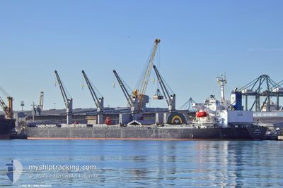
The vessel LUNE B (MMSI: 511100592) is a Cargo It's sailing under the flag of [PW] Palau.
In this page you can find informations about the vessels current position, last detected port calls, and current voyage information. If the vessels is not in coverage by AIS you will find the latest position.
The current position of LUNE B is detected by our AIS receivers and we are not responsible for the reliability of the data. The last position was recorded while the vessel was in Coverage by the Ais receivers of our vessel tracking app.
The current draught of LUNE B as reported by AIS is 6 meters
Weather
| Temperature | 4.5°C / 40.1°F |
|---|---|
| Wind Speed | 4 knots |
| Direction | 32° NNE |
| Pressure | 1024.9 hPa |
| Humidity | 50.2 % |
| Cloud Coverage | 100 % |
Featured Company
Last Port Calls
| Port | Arrival | Departure | Time In Port |
|---|---|---|---|
| 2025-01-30 21:44 | 2025-01-31 17:21 | 19 h | |
| 2025-01-30 13:09 | 2025-01-30 21:10 | 8 h | |
| 2025-01-26 13:47 | 2025-01-27 10:21 | 20 h | |
| 2025-01-25 13:25 | 2025-01-26 13:46 | 1 d | |
| 2025-01-17 10:36 | 2025-01-19 13:25 | 2 d | |
| 2025-01-09 21:57 | 2025-01-14 07:54 | 4 d | |
| 2024-12-25 13:07 | 2024-12-25 14:29 | 1 h | |
| 2024-12-05 13:01 | 2024-12-16 16:05 | 11 d |
Most Visited Ports (Last year)
| Port | Arrivals | |
|---|---|---|
| 10 | ||
| 7 | ||
| 5 | ||
| 3 | ||
| 3 | ||
| 2 |
Last Trips
| Origin | Departure | Destination | Arrival | Distance | |
|---|---|---|---|---|---|
| 2025-01-31 00:10 | 2025-01-31 00:44 | 14.72 nm | |||
| 2025-01-27 13:21 | 2025-01-30 16:09 | 6.86 nm | |||
| 2025-01-26 16:46 | 2025-01-26 16:47 | 0.51 nm | |||
| 2025-01-19 16:25 | 2025-01-25 16:25 | 468.17 nm | |||
| 2025-01-14 10:54 | 2025-01-17 13:36 | 334.12 nm | |||
| 2024-12-25 17:29 | 2025-01-10 00:57 | 1053.20 nm | |||
| 2024-12-16 19:05 | 2024-12-25 16:07 | 489.40 nm |
Events
| Heure | Evenement | Détails | Position/ Destination | Info |
|---|---|---|---|---|
| 2025-01-31 17:26 | Démarrage | 3.78 nm, South East of TUAPSE |
44.03746 / 39.11825
RU_TUA
|
Vitesse: 46.8 kn Parcours: 41° |
| 2025-01-31 17:21 | PORT DE DEPART |
|
44.03746 / 39.11825
RU_TUA
|
Vitesse: 3 kn Parcours: 41° |
| 2025-01-30 21:44 | Port d'arrivée |
|
44.09327 / 39.05953
[RU] TUAPSE
|
Vitesse: 53 kn Parcours: 44° |
| 2025-01-30 21:10 | PORT DE DEPART |
|
44.26468 / 38.81549
RU_TUA
|
Vitesse: Parcours: 43° |
| 2025-01-30 13:37 | Arret |
44.09326 / 39.05953
[RU] TUAPSE
|
Vitesse: Parcours: 42° |
|
| 2025-01-30 13:09 | Port d'arrivée |
|
44.08669 / 39.06753
[RU] TUAPSE
|
Vitesse: 6.7 kn Parcours: 4° |
| 2025-01-30 12:41 | Démarrage | 2.55 nm, South of TUAPSE |
44.04662 / 39.06085
RU_TUA
|
Vitesse: 3.3 kn Parcours: 351° |
| 2025-01-27 11:02 | Arret | 2.62 nm, South of TUAPSE |
44.04573 / 39.07738
RU_TUA
|
Vitesse: 0.1 kn Parcours: 269° |
| 2025-01-27 10:21 | PORT DE DEPART |
|
44.06851 / 39.06356
RU_TUA
|
Vitesse: 3.2 kn Parcours: 152° |
| 2025-01-27 10:03 | Démarrage |
44.09033 / 39.06106
[RU] TUAPSE
|
Vitesse: 5.1 kn Parcours: 110° |