

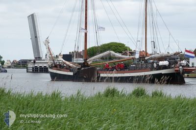
LUTGERDINA
Dredging or underwater ops

Current Trip
| Trip Time | 4 h, 45 mins |
|---|---|
| Trip Distance | 17.76 nm |
| AVG Speed | 6.9 Noeuds |
| MAX Speed | 9.9 Noeuds |
| Tirant d eau | 0 m |
| AVG Wind | 22.4 knots |
| MAX Wind | 24 knots |
| MIN Temp | 13.3°C / 55.94°F |
| MAX Temp | 13.8°C / 56.84°F |
| Position reçue | 3 m depuis |
Current Position
| Longitude | 5.41119° |
|---|---|
| Latitude | 53.17192° |
| Etat | Moored |
| Vitesse | |
| Parcours | --- |
| Zone | North Sea |
| Station | T-AIS |
| Position reçue | 3 m depuis |
Information
The current position of LUTGERDINA is in North Sea with coordinates 53.17192° / 5.41119° as reported on 2025-06-10 22:56 by AIS to our vessel tracker app. The vessel's current speed is 0 Noeuds and is currently inside the port of HARLINGEN.
The vessel LUTGERDINA (IMO: 8748763, MMSI: 246326000) is a Dredging or underwater ops It's sailing under the flag of [NL] Netherlands.
In this page you can find informations about the vessels current position, last detected port calls, and current voyage information. If the vessels is not in coverage by AIS you will find the latest position.
The current position of LUTGERDINA is detected by our AIS receivers and we are not responsible for the reliability of the data. The last position was recorded while the vessel was in Coverage by the Ais receivers of our vessel tracking app.
Weather
| Temperature | 12.7°C / 54.86°F |
|---|---|
| Wind Speed | 13 knots |
| Direction | 317° NW |
| Pressure | 1018.8 hPa |
| Humidity | 79.4 % |
| Cloud Coverage | 8 % |


Featured Company
Last Port Calls
| Port | Arrival | Departure | Time In Port |
|---|---|---|---|
| 2025-06-10 20:53 | |||
| 2025-06-09 12:31 | 2025-06-10 16:08 | 1 d | |
| 2025-06-08 15:36 | 2025-06-09 07:44 | 16 h | |
| 2025-06-06 13:19 | 2025-06-07 16:04 | 1 d | |
| 2025-06-05 16:17 | 2025-06-06 11:12 | 18 h | |
| 2025-06-04 18:25 | 2025-06-05 10:54 | 16 h | |
| 2025-06-04 17:57 | 2025-06-04 18:11 | 13 m | |
| 2025-06-03 14:34 | 2025-06-04 10:43 | 20 h | |
| 2025-06-02 16:26 | 2025-06-03 11:36 | 19 h | |
| 2025-06-01 15:00 | 2025-06-02 12:58 | 21 h |
Last Trips
| Origin | Departure | Destination | Arrival | Distance | |
|---|---|---|---|---|---|
| 2025-06-10 16:08 | 2025-06-10 20:53 | 17.76 nm | |||
| 2025-06-09 07:44 | 2025-06-09 12:31 | 23.48 nm | |||
| 2025-06-07 16:04 | 2025-06-08 15:36 | 35.18 nm | |||
| 2025-06-06 11:12 | 2025-06-06 13:19 | 10.05 nm | |||
| 2025-06-05 10:54 | 2025-06-05 16:17 | 30.26 nm | |||
| 2025-06-04 18:11 | 2025-06-04 18:25 | 0.93 nm | |||
| 2025-06-04 10:43 | 2025-06-04 17:57 | 17.57 nm | |||
| 2025-06-03 11:36 | 2025-06-03 14:34 | 9.90 nm | |||
| 2025-06-02 12:58 | 2025-06-02 16:26 | 17.40 nm | |||
| 2025-06-01 12:33 | 2025-06-01 15:00 | 12.12 nm |
Events
| Heure | Evenement | Détails | Position/ Destination | Info |
|---|---|---|---|---|
| 2025-06-10 21:55 | Etat Changé | Moored Default |
53.17198 / 5.41127
[NL] HARLINGEN
|
Vitesse: Parcours: -1° |
| 2025-06-10 21:44 | Etat Changé | Default Moored |
53.17194 / 5.41116
[NL] HARLINGEN
|
Vitesse: Parcours: 511° |
| 2025-06-10 19:05 | Etat Changé | Moored Under way sailing |
53.17200 / 5.41117
[NL] HARLINGEN
|
Vitesse: Parcours: 511° |
| 2025-06-10 18:55 | Arret |
53.17198 / 5.41122
[NL] HARLINGEN
|
Vitesse: 0.2 kn Parcours: 511° |
|
| 2025-06-10 18:53 | Port d'arrivée |
|
53.17168 / 5.41072
[NL] HARLINGEN
|
Vitesse: 1.2 kn Parcours: 511° |
| 2025-06-10 17:41 | Etat Changé | Under way sailing Under way using engine |
53.22362 / 5.27266
DEPENDINGONTHEWIND
|
Vitesse: 6.2 kn Parcours: 117.7° |
| 2025-06-10 17:33 | Etat Changé | Under way using engine At anchor |
53.22154 / 5.25723
DEPENDINGONTHEWIND
|
Vitesse: 4.5 kn Parcours: 349.5° |
| 2025-06-10 17:30 | Démarrage | 6.5 nm, West of HARLINGEN |
53.21895 / 5.25835
DEPENDINGONTHEWIND
|
Vitesse: 3.3 kn Parcours: 339.3° |
| 2025-06-10 16:34 | Etat Changé | At anchor Default |
53.21905 / 5.25603
DEPENDINGONTHEWIND
|
Vitesse: 0.3 kn Parcours: -1° |
| 2025-06-10 16:26 | Etat Changé | Default At anchor |
53.21940 / 5.25566
DEPENDINGONTHEWIND
|
Vitesse: 0.3 kn Parcours: 511° |