

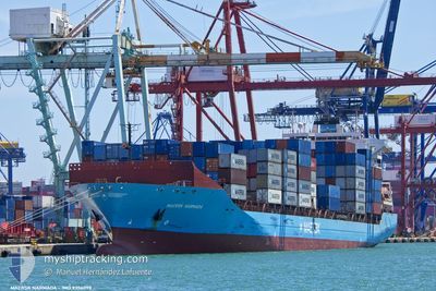
MAERSK NARMADA
Container Ship
Current Trip
| Time Travelled | 22 h, 9 mins |
|---|---|
| Remaining Time | 2 days |
| Distance Travelled | 298.42 nm |
| Remaining Distance | 1261.65 nm |
| AVG Speed | 16.3 Noeuds |
| MAX Speed | 17.5 Noeuds |
| AVG Wind | 9.5 knots |
| MAX Wind | 11 knots |
| MIN Temp | 23°C / 73.4°F |
| MAX Temp | 24.5°C / 76.1°F |
| Tirant d eau | 8.7 m |
| Position reçue | 4 h, 0 m depuis |
Current Position
| Longitude | 24.42127° |
|---|---|
| Latitude | 33.12768° |
| Etat | Under way using engine |
| Vitesse | 17.3 Noeuds |
| Parcours | 290.6° |
| Zone | Mediterranean Sea - Eastern Basin |
| Station | T-AIS |
| Position reçue | 4 h, 0 m depuis |
Information
The current position of MAERSK NARMADA is in Mediterranean Sea - Eastern Basin with coordinates 33.12768° / 24.42127° as reported on 2025-06-10 17:47 by AIS to our vessel tracker app. The vessel's current speed is 17.3 Noeuds and is heading at the port of VALENCIA. The estimated time of arrival as calculated by MyShipTracking vessel tracking app is 2025-06-13 23:09 LT
The vessel MAERSK NARMADA (IMO: 9356098, MMSI: 477552700) is a Container Ship that was built in 2008 ( 17 Age ). It's sailing under the flag of [HK] Hong Kong.
In this page you can find informations about the vessels current position, last detected port calls, and current voyage information. If the vessels is not in coverage by AIS you will find the latest position.
The current position of MAERSK NARMADA is detected by our AIS receivers and we are not responsible for the reliability of the data. The last position was recorded while the vessel was in Coverage by the Ais receivers of our vessel tracking app.
The current draught of MAERSK NARMADA as reported by AIS is 8.7 meters
Weather
| Temperature | 22.7°C / 72.86°F |
|---|---|
| Wind Speed | 15 knots |
| Direction | 349° N |
| Pressure | 1011.6 hPa |
| Humidity | 80.8 % |
| Cloud Coverage | --- |
Featured Company
Last Port Calls
| Port | Arrival | Departure | Time In Port |
|---|---|---|---|
| 2025-06-09 06:45 | 2025-06-10 01:38 | 18 h | |
| 2025-06-05 17:13 | 2025-06-07 23:21 | 2 d | |
| 2025-06-03 21:53 | 2025-06-04 13:46 | 15 h | |
| 2025-05-26 12:50 | 2025-05-27 06:35 | 17 h | |
| 2025-05-24 01:24 | 2025-05-25 08:57 | 1 d | |
| 2025-05-19 13:29 | 2025-05-20 00:43 | 11 h | |
| 2025-05-17 04:48 | 2025-05-18 04:07 | 23 h | |
| 2025-05-12 12:22 | 2025-05-13 13:10 | 1 d | |
| 2025-05-09 21:16 | 2025-05-11 10:29 | 1 d | |
| 2025-05-06 09:03 | 2025-05-08 05:40 | 1 d |
Last Trips
| Origin | Departure | Destination | Arrival | Distance | |
|---|---|---|---|---|---|
| 2025-06-07 23:21 | 2025-06-09 06:45 | 453.22 nm | |||
| 2025-06-04 13:46 | 2025-06-05 17:13 | 285.46 nm | |||
| 2025-05-27 06:35 | 2025-06-03 21:53 | 2113.86 nm | |||
| 2025-05-25 08:57 | 2025-05-26 12:50 | 230.64 nm | |||
| 2025-05-20 00:43 | 2025-05-24 01:24 | 727.00 nm | |||
| 2025-05-18 04:07 | 2025-05-19 13:29 | 177.54 nm | |||
| 2025-05-13 13:10 | 2025-05-17 04:48 | 1556.75 nm | |||
| 2025-05-11 10:29 | 2025-05-12 12:22 | 327.76 nm | |||
| 2025-05-08 05:40 | 2025-05-09 21:16 | 310.38 nm | |||
| 2025-05-05 15:17 | 2025-05-06 09:03 | 286.24 nm |
Events
| Heure | Evenement | Détails | Position/ Destination | Info |
|---|---|---|---|---|
| 2025-06-10 17:54 | Etat Changé | Default Under way using engine |
33.14091 / 24.37944
EGALY>ESVLC
|
Vitesse: 17.3 kn Parcours: 290.6° |
| 2025-06-10 17:47 | Etat Changé | Under way using engine Default |
33.12768 / 24.42127
EGALY>ESVLC
|
Vitesse: 17.4 kn Parcours: 291° |
| 2025-06-10 17:47 | Hors de la zone couverte |
33.12768 / 24.42127
Mediterranean Sea - Eastern Basin
EGALY>ESVLC
|
Vitesse: 17.3 kn Parcours: 290.6° |
|
| 2025-06-10 17:31 | Etat Changé | Default Under way using engine |
33.09994 / 24.50778
EGALY>ESVLC
|
Vitesse: 17.2 kn Parcours: 289.4° |
| 2025-06-10 16:47 | Etat Changé | Under way using engine Default |
33.02616 / 24.74116
EGALY>ESVLC
|
Vitesse: 16.9 kn Parcours: 291° |
| 2025-06-10 16:47 | Dans la zone couverte |
33.02922 / 24.73230
Mediterranean Sea - Eastern Basin
EGALY>ESVLC
|
Vitesse: 17 kn Parcours: 292.4° |
|
| 2025-06-10 15:21 | Etat Changé | Default Under way using engine |
32.87941 / 25.18349
EGALY>ESVLC
|
Vitesse: 16.4 kn Parcours: 291.6° |
| 2025-06-10 15:17 | Hors de la zone couverte |
32.87365 / 25.20008
Mediterranean Sea - Eastern Basin
EGALY>ESVLC
|
Vitesse: 16.4 kn Parcours: 291.6° |
|
| 2025-06-10 15:12 | Etat Changé | Under way using engine Default |
32.86542 / 25.22439
EGALY>ESVLC
|
Vitesse: 16.5 kn Parcours: 292° |
| 2025-06-10 15:07 | Etat Changé | Default Under way using engine |
32.85527 / 25.25476
EGALY>ESVLC
|
Vitesse: 16.4 kn Parcours: 291.8° |