

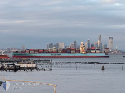
MAERSK SELETAR
Container Ship

Current Trip
| Time Travelled | 29 days |
|---|---|
| Remaining Time | --- |
| Distance Travelled | 11346.54 nm |
| Remaining Distance | --- |
| AVG Speed | 15.7 Noeuds |
| MAX Speed | 24 Noeuds |
| AVG Wind | 14.7 knots |
| MAX Wind | 34.8 knots |
| MIN Temp | 9.2°C / 48.56°F |
| MAX Temp | 28.4°C / 83.12°F |
| Tirant d eau | 14 m |
| Position reçue | 7 d depuis |
Current Position
| Longitude | 18.37019° |
|---|---|
| Latitude | -34.54690° |
| Etat | Under way using engine |
| Vitesse | 16.1 Noeuds |
| Parcours | 127.8° |
| Zone | South Atlantic Ocean |
| Station | T-AIS |
| Position reçue | 7 d depuis |
Information
The current position of MAERSK SELETAR is in South Atlantic Ocean with coordinates -34.54690° / 18.37019° as reported on 2025-06-02 07:16 by AIS to our vessel tracker app. The vessel's current speed is 16.1 Noeuds and is heading at the port of MUNDRA. The estimated time of arrival as calculated by MyShipTracking vessel tracking app is 2025-06-14 20:00 LT
The vessel MAERSK SELETAR (IMO: 9315197, MMSI: 369309000) is a Container Ship that was built in 2007 ( 18 Age ). It's sailing under the flag of [US] USA.
In this page you can find informations about the vessels current position, last detected port calls, and current voyage information. If the vessels is not in coverage by AIS you will find the latest position.
The current position of MAERSK SELETAR is detected by our AIS receivers and we are not responsible for the reliability of the data. The last position was recorded while the vessel was in Coverage by the Ais receivers of our vessel tracking app.
The current draught of MAERSK SELETAR as reported by AIS is 14 meters
Weather
| Temperature | 27.3°C / 81.14°F |
|---|---|
| Wind Speed | 16 knots |
| Direction | 154° SSE |
| Pressure | 1013.3 hPa |
| Humidity | 78.1 % |
| Cloud Coverage | 16 % |


Featured Company
Last Port Calls
| Port | Arrival | Departure | Time In Port |
|---|---|---|---|
| 2025-05-10 09:31 | 2025-05-11 11:08 | 1 d | |
| 2025-05-08 18:12 | 2025-05-09 10:06 | 15 h | |
| 2025-05-02 10:24 | 2025-05-04 15:22 | 2 d | |
| 2025-04-26 09:45 | 2025-04-27 13:46 | 1 d | |
| 2025-04-25 03:48 | 2025-04-25 19:52 | 16 h | |
| 2025-04-22 07:27 | 2025-04-23 17:23 | 1 d |
Last Trips
| Origin | Departure | Destination | Arrival | Distance | |
|---|---|---|---|---|---|
| 2025-05-09 10:06 | 2025-05-10 09:31 | 306.63 nm | |||
| 2025-05-04 15:22 | 2025-05-08 18:12 | 1760.31 nm | |||
| 2025-04-27 13:46 | 2025-05-02 10:24 | 1373.18 nm | |||
| 2025-04-25 19:52 | 2025-04-26 09:45 | 139.51 nm | |||
| 2025-04-23 17:23 | 2025-04-25 03:48 | 633.38 nm |
Events
| Heure | Evenement | Détails | Position/ Destination | Info |
|---|---|---|---|---|
| 2025-06-02 07:20 | Etat Changé | Default Under way using engine |
-34.55569 / 18.38376
MUNDRA
|
Vitesse: 16.1 kn Parcours: 127.8° |
| 2025-06-02 07:16 | Hors de la zone couverte |
-34.54690 / 18.37019
South Atlantic Ocean
MUNDRA
|
Vitesse: 16.1 kn Parcours: 127.8° |
|
| 2025-06-02 06:47 | Changement de destination | MUNDRA OMSLL |
-34.46451 / 18.24820
MUNDRA
|
Vitesse: 15.5 kn Parcours: 143.1° |
| 2025-06-02 06:47 | Changement d'ETA | 2025/06/14 14:30 2025/06/13 14:30 |
-34.46451 / 18.24820
MUNDRA
|
Vitesse: 15.5 kn Parcours: 143.1° |
| 2025-06-02 06:40 | Etat Changé | Under way using engine Default |
-34.43998 / 18.22567
OMSLL
|
Vitesse: 15.4 kn Parcours: 141° |
| 2025-06-02 06:36 | Etat Changé | Default Under way using engine |
-34.42865 / 18.21507
OMSLL
|
Vitesse: 15.4 kn Parcours: 142.4° |
| 2025-06-02 06:30 | Etat Changé | Under way using engine Default |
-34.40850 / 18.19581
OMSLL
|
Vitesse: 15.5 kn Parcours: 141° |
| 2025-06-02 06:24 | Etat Changé | Default Under way using engine |
-34.38493 / 18.17311
OMSLL
|
Vitesse: 15.4 kn Parcours: 141.9° |
| 2025-06-02 05:34 | Changement de zone | South African part of the South Atlantic Ocean Moroccan part of the North Atlantic Ocean |
-34.22476 / 18.00649
South Atlantic Ocean
OMSLL
|
Vitesse: 15.1 kn Parcours: 138.6° |
| 2025-06-02 05:34 | Etat Changé | Under way using engine Default |
-34.22476 / 18.00649
OMSLL
|
Vitesse: 14.7 kn Parcours: 139° |