

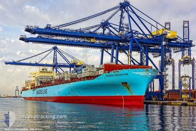
MAERSK SERANGOON
Container Ship

Current Trip
| Time Travelled | 3 days |
|---|---|
| Remaining Time | --- |
| Distance Travelled | 1078.10 nm |
| Remaining Distance | --- |
| AVG Speed | 12 Noeuds |
| MAX Speed | 16.5 Noeuds |
| AVG Wind | 9.3 knots |
| MAX Wind | 18.8 knots |
| MIN Temp | 23°C / 73.4°F |
| MAX Temp | 30.3°C / 86.54°F |
| Tirant d eau | 10.2 m |
| Position reçue | 3 d depuis |
Current Position
| Longitude | -80.03185° |
|---|---|
| Latitude | 31.98896° |
| Etat | Under way using engine |
| Vitesse | 14 Noeuds |
| Parcours | 83° |
| Zone | North Atlantic Ocean |
| Station | T-AIS |
| Position reçue | 3 d depuis |
Information
The current position of MAERSK SERANGOON is in North Atlantic Ocean with coordinates 31.98896° / -80.03185° as reported on 2025-06-09 03:32 by AIS to our vessel tracker app. The vessel's current speed is 14 Noeuds and is heading at the port of TANGER MED. The estimated time of arrival as calculated by MyShipTracking vessel tracking app is 2025-06-21 22:30 LT
The vessel MAERSK SERANGOON (IMO: 9315214, MMSI: 565449000) is a Container Ship that was built in 2007 ( 18 Age ). It's sailing under the flag of [SG] Singapore.
In this page you can find informations about the vessels current position, last detected port calls, and current voyage information. If the vessels is not in coverage by AIS you will find the latest position.
The current position of MAERSK SERANGOON is detected by our AIS receivers and we are not responsible for the reliability of the data. The last position was recorded while the vessel was in Coverage by the Ais receivers of our vessel tracking app.
The current draught of MAERSK SERANGOON as reported by AIS is 10.2 meters
Weather
| Temperature | 23.1°C / 73.58°F |
|---|---|
| Wind Speed | 15 knots |
| Direction | 246° WSW |
| Pressure | 1022.9 hPa |
| Humidity | 89.9 % |
| Cloud Coverage | 1 % |


Featured Company
Last Port Calls
| Port | Arrival | Departure | Time In Port |
|---|---|---|---|
| 2025-06-07 10:45 | 2025-06-08 19:10 | 1 d | |
| 2025-06-05 03:56 | 2025-06-05 21:30 | 17 h | |
| 2025-06-02 03:36 | 2025-06-02 19:45 | 16 h | |
| 2025-05-30 15:07 | 2025-05-31 08:38 | 17 h | |
| 2025-05-28 03:23 | 2025-05-29 07:16 | 1 d | |
| 2025-05-14 05:25 | 2025-05-16 02:38 | 1 d | |
| 2025-05-12 05:26 | 2025-05-13 03:09 | 21 h | |
| 2025-05-04 20:23 | 2025-05-05 07:34 | 11 h | |
| 2025-04-21 21:49 | 2025-04-23 00:39 | 1 d | |
| 2025-04-19 14:37 | 2025-04-20 05:35 | 14 h |
Most Visited Ports (Last year)
| Port | Arrivals | |
|---|---|---|
| 11 | ||
| 6 | ||
| 6 | ||
| 5 | ||
| 5 | ||
| 4 |
Last Trips
| Origin | Departure | Destination | Arrival | Distance | |
|---|---|---|---|---|---|
| 2025-06-05 21:30 | 2025-06-07 10:45 | 114.73 nm | |||
| 2025-06-02 19:45 | 2025-06-05 03:56 | 580.77 nm | |||
| 2025-05-31 08:38 | 2025-06-02 03:36 | 206.05 nm | |||
| 2025-05-29 07:16 | 2025-05-30 15:07 | 333.72 nm | |||
| 2025-05-16 02:38 | 2025-05-28 03:23 | 4110.79 nm | |||
| 2025-05-13 03:09 | 2025-05-14 05:25 | 33.70 nm | |||
| 2025-05-05 07:34 | 2025-05-12 05:26 | 1061.43 nm | |||
| 2025-04-23 00:39 | 2025-05-04 20:23 | 3749.80 nm | |||
| 2025-04-20 05:35 | 2025-04-21 21:49 | 125.26 nm | |||
| 2025-04-18 00:09 | 2025-04-19 14:37 | 597.19 nm |
Events
| Heure | Evenement | Détails | Position/ Destination | Info |
|---|---|---|---|---|
| 2025-06-09 03:37 | Etat Changé | Default Under way using engine |
31.99118 / -80.00818
USSAV>MAPTM
|
Vitesse: 14 kn Parcours: 83° |
| 2025-06-09 03:32 | Hors de la zone couverte |
31.98896 / -80.03185
North Atlantic Ocean
USSAV>MAPTM
|
Vitesse: 14 kn Parcours: 83° |
|
| 2025-06-09 03:14 | Etat Changé | Under way using engine Default |
31.98162 / -80.11003
USSAV>MAPTM
|
Vitesse: 13.9 kn Parcours: 83° |
| 2025-06-09 02:49 | Etat Changé | Default Under way using engine |
31.97168 / -80.22605
USSAV>MAPTM
|
Vitesse: 13.7 kn Parcours: 83.5° |
| 2025-06-09 02:34 | Etat Changé | Under way using engine Default |
31.96538 / -80.29273
USSAV>MAPTM
|
Vitesse: 13.7 kn Parcours: 85° |
| 2025-06-09 02:28 | Etat Changé | Default Under way using engine |
31.96341 / -80.31712
USSAV>MAPTM
|
Vitesse: 13.8 kn Parcours: 84.8° |
| 2025-06-08 23:55 | Tirant d'eau modifié | 10.2 10 |
32.05812 / -80.94253
USSAV>MAPTM
|
Vitesse: 14 kn Parcours: 139.3° |
| 2025-06-08 23:55 | Changement d'ETA | 2025/06/21 21:30 |
32.05812 / -80.94253
USSAV>MAPTM
|
Vitesse: 14 kn Parcours: 139.3° |
| 2025-06-08 23:49 | Tirant d'eau modifié | 10 10.2 |
32.07218 / -80.96097
USSAV>MAPTM
|
Vitesse: 11.5 kn Parcours: 106.8° |
| 2025-06-08 23:10 | PORT DE DEPART |
|
32.08021 / -81.05153
USSAV>MAPTM
|
Vitesse: 8.5 kn Parcours: 90° |