
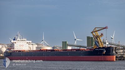
MAMA STRENGTH
Cargo
Current Trip
| Time Travelled | 3 h, 42 mins |
|---|---|
| Remaining Time | --- |
| Distance Travelled | 6.39 nm |
| Remaining Distance | --- |
| AVG Speed | 10.6 Noeuds |
| MAX Speed | 11 Noeuds |
| AVG Wind | 17.1 knots |
| MAX Wind | 17.7 knots |
| MIN Temp | -0.5°C / 31.1°F |
| MAX Temp | -0.3°C / 31.46°F |
| Tirant d eau | 12.9 m |
| Position reçue | Maintenant |
Current Position
| Longitude | 27.69609° |
|---|---|
| Latitude | 60.18024° |
| Etat | Under way using engine |
| Vitesse | 11.3 Noeuds |
| Parcours | 240.9° |
| Zone | Gulf of Finland |
| Station | T-AIS |
| Position reçue | Maintenant |
Info
Information
The current position of MAMA STRENGTH is in Gulf of Finland with coordinates 60.18024° / 27.69609° as reported on 2025-02-12 05:28 by AIS to our vessel tracker app. The vessel's current speed is 11.3 Noeuds
The vessel MAMA STRENGTH (IMO: 9673525, MMSI: 538010084) is a Cargo It's sailing under the flag of [MH] Marshall Is.
In this page you can find informations about the vessels current position, last detected port calls, and current voyage information. If the vessels is not in coverage by AIS you will find the latest position.
The current position of MAMA STRENGTH is detected by our AIS receivers and we are not responsible for the reliability of the data. The last position was recorded while the vessel was in Coverage by the Ais receivers of our vessel tracking app.
The current draught of MAMA STRENGTH as reported by AIS is 12.9 meters
Weather
| Temperature | -0.5°C / 31.1°F |
|---|---|
| Wind Speed | 17 knots |
| Direction | 269° W |
| Pressure | 1032.4 hPa |
| Humidity | 88 % |
| Cloud Coverage | 11 % |
Featured Company
Most Visited Ports (Last year)
| Port | Arrivals | |
|---|---|---|
| 6 | ||
| 5 | ||
| 2 | ||
| 2 | ||
| 2 | ||
| 1 |
Events
| Heure | Evenement | Détails | Position/ Destination | Info |
|---|---|---|---|---|
| 2025-02-12 05:21 | Tirant d'eau modifié | 12.9 8.4 |
60.19076 / 27.73406
DK SKA
|
Vitesse: 10.8 kn Parcours: 242.1° |
| 2025-02-12 05:21 | Changement de destination | DK SKA UST LUGA,RUSSIA |
60.19076 / 27.73406
DK SKA
|
Vitesse: 10.8 kn Parcours: 242.1° |
| 2025-02-12 05:21 | Changement d'ETA | 2025/02/14 08:00 2025/02/04 12:00 |
60.19076 / 27.73406
DK SKA
|
Vitesse: 10.8 kn Parcours: 242.1° |
| 2025-02-12 04:46 | Dans la zone couverte |
60.18253 / 27.93654
Gulf of Finland
|
Vitesse: 11 kn Parcours: 286.7° |
|
| 2025-02-12 01:47 | PORT DE DEPART |
|
60.18253 / 27.93654
UST LUGA,RUSSIA
|
Vitesse: Parcours: 181° |
| 2025-02-05 07:32 | Arret |
59.69086 / 28.42078
[RU] UST-LUGA
|
Vitesse: Parcours: 181° |
|
| 2025-02-04 22:19 | Etat Changé | Default Under way using engine |
59.70671 / 28.42217
[RU] UST-LUGA
|
Vitesse: 5.1 kn Parcours: 182° |
| 2025-02-04 22:17 | Etat Changé | Under way using engine Default |
59.70975 / 28.42240
[RU] UST-LUGA
|
Vitesse: 5.2 kn Parcours: 182° |
| 2025-02-04 22:17 | Hors de la zone couverte |
59.70975 / 28.42240
Gulf of Finland
[RU] UST-LUGA
|
Vitesse: 5.1 kn Parcours: 181.6° |
|
| 2025-02-04 22:05 | Etat Changé | Default Under way using engine |
59.72734 / 28.42269
[RU] UST-LUGA
|
Vitesse: 6.3 kn Parcours: 158.2° |