
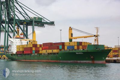
MANDO
Container Ship
Current Trip
| Time Travelled | 3 days |
|---|---|
| Remaining Time | 16 h, 3 mins |
| Distance Travelled | 1311.71 nm |
| Remaining Distance | 282.76 nm |
| AVG Speed | 15.9 Noeuds |
| MAX Speed | 17 Noeuds |
| AVG Wind | 12.4 knots |
| MAX Wind | 21.8 knots |
| MIN Temp | 18.4°C / 65.12°F |
| MAX Temp | 25.4°C / 77.72°F |
| Tirant d eau | 8.8 m |
| Position reçue | 19 h, 52 m depuis |
Current Position
| Longitude | 13.96039° |
|---|---|
| Latitude | 36.62261° |
| Etat | Under way using engine |
| Vitesse | 15.8 Noeuds |
| Parcours | 289.4° |
| Zone | Mediterranean Sea - Eastern Basin |
| Station | T-AIS |
| Position reçue | 19 h, 52 m depuis |
Information
The current position of MANDO is in Mediterranean Sea - Eastern Basin with coordinates 36.62261° / 13.96039° as reported on 2025-05-24 07:26 by AIS to our vessel tracker app. The vessel's current speed is 15.8 Noeuds and is heading at the port of ALGER. The estimated time of arrival as calculated by MyShipTracking vessel tracking app is 2025-05-25 19:22 LT
The vessel MANDO (IMO: 9175705, MMSI: 304490000) is a Container Ship that was built in 1999 ( 26 Age ). It's sailing under the flag of [AG] Antigua Barbuda.
In this page you can find informations about the vessels current position, last detected port calls, and current voyage information. If the vessels is not in coverage by AIS you will find the latest position.
The current position of MANDO is detected by our AIS receivers and we are not responsible for the reliability of the data. The last position was recorded while the vessel was in Coverage by the Ais receivers of our vessel tracking app.
The current draught of MANDO as reported by AIS is 8.8 meters
Weather
| Temperature | 18.8°C / 65.84°F |
|---|---|
| Wind Speed | 21 knots |
| Direction | 314° NW |
| Pressure | 1018.4 hPa |
| Humidity | 62.5 % |
| Cloud Coverage | --- |
Featured Company
Last Port Calls
| Port | Arrival | Departure | Time In Port |
|---|---|---|---|
| 2025-05-21 01:20 | 2025-05-21 14:42 | 13 h | |
| 2025-05-17 11:40 | 2025-05-17 20:51 | 9 h | |
| 2025-05-16 01:41 | 2025-05-16 11:52 | 10 h | |
| 2025-05-13 16:50 | 2025-05-14 14:01 | 21 h | |
| 2025-05-09 09:15 | 2025-05-10 21:52 | 1 d | |
| 2025-05-07 01:54 | 2025-05-07 11:58 | 10 h | |
| 2025-05-01 14:46 | 2025-05-02 11:57 | 21 h | |
| 2025-04-26 12:42 | 2025-04-29 20:41 | 3 d | |
| 2025-04-20 14:20 | 2025-04-21 12:56 | 22 h | |
| 2025-04-13 13:34 | 2025-04-19 14:09 | 6 d |
Most Visited Ports (Last year)
| Port | Arrivals | |
|---|---|---|
| 12 | ||
| 10 | ||
| 9 | ||
| 9 | ||
| 9 | ||
| 9 |
Last Trips
| Origin | Departure | Destination | Arrival | Distance | |
|---|---|---|---|---|---|
| 2025-05-17 23:51 | 2025-05-21 04:20 | 621.92 nm | |||
| 2025-05-16 14:52 | 2025-05-17 14:40 | 302.04 nm | |||
| 2025-05-14 17:01 | 2025-05-16 04:41 | 129.54 nm | |||
| 2025-05-11 01:52 | 2025-05-13 19:50 | 685.25 nm | |||
| 2025-05-07 14:58 | 2025-05-09 13:15 | 638.40 nm | |||
| 2025-05-02 13:57 | 2025-05-07 04:54 | 999.32 nm | |||
| 2025-04-29 21:41 | 2025-05-01 16:46 | 623.38 nm | |||
| 2025-04-21 14:56 | 2025-04-26 13:42 | 569.42 nm | |||
| 2025-04-19 15:09 | 2025-04-20 16:20 | 380.44 nm | |||
| 2025-04-10 18:56 | 2025-04-13 14:34 | 407.72 nm |
Events
| Heure | Evenement | Détails | Position/ Destination | Info |
|---|---|---|---|---|
| 2025-05-24 07:32 | Etat Changé | Default Under way using engine |
36.63084 / 13.92990
ALGER
|
Vitesse: 15.8 kn Parcours: 289.4° |
| 2025-05-24 07:26 | Hors de la zone couverte |
36.62261 / 13.96039
Mediterranean Sea - Eastern Basin
ALGER
|
Vitesse: 15.8 kn Parcours: 289.4° |
|
| 2025-05-24 07:16 | Etat Changé | Under way using engine Default |
36.60880 / 14.01095
ALGER
|
Vitesse: 15.8 kn Parcours: 290° |
| 2025-05-24 06:58 | Etat Changé | Default Under way using engine |
36.58234 / 14.10436
ALGER
|
Vitesse: 16.1 kn Parcours: 289° |
| 2025-05-24 06:52 | Etat Changé | Under way using engine Default |
36.57234 / 14.14006
ALGER
|
Vitesse: 16 kn Parcours: 288° |
| 2025-05-24 06:27 | Etat Changé | Default Under way using engine |
36.53779 / 14.27116
ALGER
|
Vitesse: 16.1 kn Parcours: 287° |
| 2025-05-24 06:20 | Etat Changé | Under way using engine Default |
36.52853 / 14.30879
ALGER
|
Vitesse: 16.1 kn Parcours: 287° |
| 2025-05-24 06:18 | Etat Changé | Default Under way using engine |
36.52669 / 14.31626
ALGER
|
Vitesse: 16.1 kn Parcours: 286.2° |
| 2025-05-24 05:15 | Etat Changé | Under way using engine Default |
36.44453 / 14.64764
ALGER
|
Vitesse: 15.6 kn Parcours: 282° |
| 2025-05-24 04:54 | Etat Changé | Default Under way using engine |
36.43491 / 14.76274
ALGER
|
Vitesse: 15.7 kn Parcours: 274.5° |