
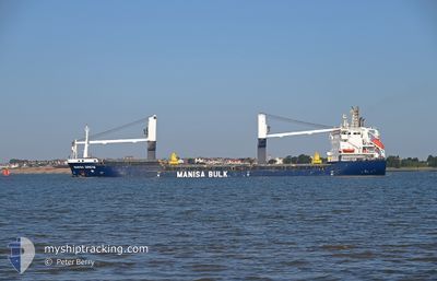
MANISA GRETA
General Cargo
Current Trip
| Time Travelled | 1 day |
|---|---|
| Remaining Time | 6 h, 21 mins |
| Distance Travelled | 263.41 nm |
| Remaining Distance | 68.54 nm |
| AVG Speed | 10.2 Noeuds |
| MAX Speed | 16 Noeuds |
| AVG Wind | 12.7 knots |
| MAX Wind | 19.4 knots |
| MIN Temp | 11.7°C / 53.06°F |
| MAX Temp | 15.3°C / 59.54°F |
| Tirant d eau | 4.8 m |
| Position reçue | 1 m depuis |
Current Position
| Longitude | -0.04309° |
|---|---|
| Latitude | 38.18537° |
| Etat | Under way using engine |
| Vitesse | 10 Noeuds |
| Parcours | 219.6° |
| Zone | Mediterranean Sea - Western Basin |
| Station | T-AIS |
| Position reçue | 1 m depuis |
Info
Information
The current position of MANISA GRETA is in Mediterranean Sea - Western Basin with coordinates 38.18537° / -0.04309° as reported on 2025-02-08 17:44 by AIS to our vessel tracker app. The vessel's current speed is 10 Noeuds and is heading at the port of CARTAGENA. The estimated time of arrival as calculated by MyShipTracking vessel tracking app is 2025-02-09 01:06 LT
The vessel MANISA GRETA (IMO: 9391024, MMSI: 255806248) is a General Cargo that was built in 2007 ( 18 Age ). It's sailing under the flag of [PT] Portugal.
In this page you can find informations about the vessels current position, last detected port calls, and current voyage information. If the vessels is not in coverage by AIS you will find the latest position.
The current position of MANISA GRETA is detected by our AIS receivers and we are not responsible for the reliability of the data. The last position was recorded while the vessel was in Coverage by the Ais receivers of our vessel tracking app.
The current draught of MANISA GRETA as reported by AIS is 4.8 meters
Weather
| Temperature | 14.5°C / 58.1°F |
|---|---|
| Wind Speed | 12 knots |
| Direction | 106° ESE |
| Pressure | 1022.1 hPa |
| Humidity | 69.3 % |
| Cloud Coverage | 5 % |
Featured Company
Last Port Calls
| Port | Arrival | Departure | Time In Port |
|---|---|---|---|
| 2025-02-05 09:13 | 2025-02-07 15:08 | 2 d | |
| 2025-01-31 18:46 | 2025-02-01 14:51 | 20 h | |
| 2025-01-22 19:24 | 2025-01-26 10:17 | 3 d | |
| 2025-01-15 21:06 | 2025-01-18 03:49 | 2 d | |
| 2025-01-06 08:10 | 2025-01-08 08:48 | 2 d | |
| 2025-01-02 08:42 | 2025-01-04 00:07 | 1 d | |
| 2024-12-28 21:22 | 2024-12-30 01:35 | 1 d | |
| 2024-12-22 09:21 | 2024-12-23 19:13 | 1 d | |
| 2024-12-14 12:46 | 2024-12-17 20:51 | 3 d | |
| 2024-12-13 06:20 | 2024-12-13 21:05 | 14 h |
Most Visited Ports (Last year)
| Port | Arrivals | |
|---|---|---|
| 5 | ||
| 4 | ||
| 4 | ||
| 3 | ||
| 3 | ||
| 3 |
Last Trips
| Origin | Departure | Destination | Arrival | Distance | |
|---|---|---|---|---|---|
| 2025-02-01 14:51 | 2025-02-05 09:13 | 826.61 nm | |||
| 2025-01-26 10:17 | 2025-01-31 18:46 | 814.14 nm | |||
| 2025-01-18 03:49 | 2025-01-22 19:24 | 802.75 nm | |||
| 2025-01-08 08:48 | 2025-01-15 21:06 | 461.24 nm | |||
| 2025-01-04 00:07 | 2025-01-06 08:10 | 502.81 nm | |||
| 2024-12-30 01:35 | 2025-01-02 08:42 | 448.66 nm | |||
| 2024-12-23 19:13 | 2024-12-28 21:22 | 975.59 nm | |||
| 2024-12-17 20:51 | 2024-12-22 09:21 | 1011.97 nm | |||
| 2024-12-13 21:05 | 2024-12-14 12:46 | 131.61 nm | |||
| 2024-12-06 20:48 | 2024-12-13 06:20 | 1332.28 nm |
Events
| Heure | Evenement | Détails | Position/ Destination | Info |
|---|---|---|---|---|
| 2025-02-08 17:42 | Changement d'ETA | 2026/01/09 02:00 2026/01/09 11:00 |
38.18968 / -.03861
ES CAR
|
Vitesse: 9.9 kn Parcours: 219.7° |
| 2025-02-08 17:33 | Etat Changé | Under way using engine Default |
38.20887 / -.01901
ES CAR
|
Vitesse: 10.1 kn Parcours: 217° |
| 2025-02-08 17:20 | Etat Changé | Default Under way using engine |
38.23746 / .00880
ES CAR
|
Vitesse: 10.2 kn Parcours: 209.2° |
| 2025-02-08 17:10 | Changement de zone | Spanish part of the Mediterranean Sea - Western Basin Spanish part of the Balearic Sea |
38.26029 / .02729
Mediterranean Sea - Western Basin
|
Vitesse: 10.3 kn Parcours: 209.8° |
| 2025-02-08 17:10 | Etat Changé | Under way using engine Default |
38.26029 / .02729
ES CAR
|
Vitesse: 10.3 kn Parcours: 209° |
| 2025-02-08 17:09 | Dans la zone couverte |
38.26029 / .02729
Mediterranean Sea - Western Basin
|
Vitesse: 10.3 kn Parcours: 209.8° |
|
| 2025-02-07 19:47 | Etat Changé | Default Under way using engine |
41.06495 / 2.44802
ES CAR
|
Vitesse: 10.5 kn Parcours: 211.5° |
| 2025-02-07 19:44 | Hors de la zone couverte |
41.07082 / 2.45277
Balearic Sea
|
Vitesse: 10.5 kn Parcours: 211.5° |
|
| 2025-02-07 19:07 | Etat Changé | Under way using engine Default |
41.16110 / 2.52827
ES CAR
|
Vitesse: 10.3 kn Parcours: 214° |
| 2025-02-07 19:05 | Etat Changé | Default Under way using engine |
41.16737 / 2.53385
ES CAR
|
Vitesse: 10.3 kn Parcours: 213.6° |