
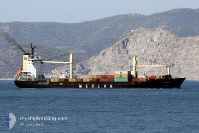
MED DENIZLI
Container Ship
Current Trip
| Trip Time | 5 h, 18 mins |
|---|---|
| Trip Distance | 60.57 nm |
| AVG Speed | 11.1 Noeuds |
| MAX Speed | 13 Noeuds |
| Tirant d eau | 7.1 m |
| AVG Wind | 9.8 knots |
| MAX Wind | 15.5 knots |
| MIN Temp | -2.2°C / 28.04°F |
| MAX Temp | 3°C / 37.4°F |
| Position reçue | 1 m depuis |
Current Position
| Longitude | 29.10341° |
|---|---|
| Latitude | 40.41899° |
| Etat | Under way using engine |
| Vitesse | 1.5 Noeuds |
| Parcours | 117° |
| Zone | Sea of Marmara |
| Station | T-AIS |
| Position reçue | 1 m depuis |
Info
Information
The current position of MED DENIZLI is in Sea of Marmara with coordinates 40.41899° / 29.10341° as reported on 2025-02-20 23:06 by AIS to our vessel tracker app. The vessel's current speed is 1.5 Noeuds and is currently inside the port of GEMLIK.
The vessel MED DENIZLI (IMO: 9106493, MMSI: 271044398) is a Container Ship that was built in 1996 ( 29 Age ). It's sailing under the flag of [TR] Turkey.
In this page you can find informations about the vessels current position, last detected port calls, and current voyage information. If the vessels is not in coverage by AIS you will find the latest position.
The current position of MED DENIZLI is detected by our AIS receivers and we are not responsible for the reliability of the data. The last position was recorded while the vessel was in Coverage by the Ais receivers of our vessel tracking app.
The current draught of MED DENIZLI as reported by AIS is 7.1 meters
Weather
| Temperature | -2.6°C / 27.32°F |
|---|---|
| Wind Speed | 6 knots |
| Direction | 60° ENE |
| Pressure | 1032 hPa |
| Humidity | 84.9 % |
| Cloud Coverage | 38 % |
Featured Company
Last Port Calls
| Port | Arrival | Departure | Time In Port |
|---|---|---|---|
| 2025-02-20 22:56 | |||
| 2025-02-19 16:50 | 2025-02-20 17:38 | 1 d | |
| 2025-02-18 14:31 | 2025-02-19 07:49 | 17 h | |
| 2025-02-16 08:34 | 2025-02-17 06:18 | 21 h | |
| 2025-02-12 16:51 | 2025-02-13 21:36 | 1 d | |
| 2025-02-11 13:32 | 2025-02-12 04:40 | 15 h | |
| 2025-02-09 19:49 | 2025-02-10 16:07 | 20 h | |
| 2025-02-08 05:42 | 2025-02-08 21:18 | 15 h | |
| 2025-02-07 01:03 | 2025-02-07 16:33 | 15 h | |
| 2025-02-04 11:24 | 2025-02-05 22:00 | 1 d |
Last Trips
| Origin | Departure | Destination | Arrival | Distance | |
|---|---|---|---|---|---|
| 2025-02-20 20:38 | 2025-02-21 01:56 | 60.57 nm | |||
| 2025-02-19 10:49 | 2025-02-19 19:50 | 97.13 nm | |||
| 2025-02-17 09:18 | 2025-02-18 17:31 | 211.10 nm | |||
| 2025-02-14 00:36 | 2025-02-16 11:34 | 243.93 nm | |||
| 2025-02-12 07:40 | 2025-02-12 19:51 | 56.47 nm | |||
| 2025-02-10 19:07 | 2025-02-11 16:32 | 208.47 nm | |||
| 2025-02-09 00:18 | 2025-02-09 22:49 | 254.46 nm | |||
| 2025-02-07 19:33 | 2025-02-08 08:42 | 71.14 nm | |||
| 2025-02-06 01:00 | 2025-02-07 04:03 | 225.93 nm | |||
| 2025-02-03 18:56 | 2025-02-04 14:24 | 226.95 nm |
Events
| Heure | Evenement | Détails | Position/ Destination | Info |
|---|---|---|---|---|
| 2025-02-20 22:56 | Port d'arrivée |
|
40.42330 / 29.09420
[TR] GEMLIK
|
Vitesse: 5.1 kn Parcours: 118.5° |
| 2025-02-20 22:15 | Etat Changé | Under way using engine Default |
40.43521 / 28.95022
TRGEM
|
Vitesse: 11.4 kn Parcours: 100° |
| 2025-02-20 22:13 | Etat Changé | Default Under way using engine |
40.43584 / 28.94545
TRGEM
|
Vitesse: 11.4 kn Parcours: 99.7° |
| 2025-02-20 22:07 | Etat Changé | Under way using engine Default |
40.43925 / 28.92012
TRGEM
|
Vitesse: 11.3 kn Parcours: 102° |
| 2025-02-20 21:53 | Dans la zone couverte |
40.43925 / 28.92012
Sea of Marmara
TRGEM
|
Vitesse: 11.4 kn Parcours: 99.7° |
|
| 2025-02-20 21:07 | Etat Changé | Default Under way using engine |
40.53973 / 28.73218
TRGEM
|
Vitesse: 11.6 kn Parcours: 175.6° |
| 2025-02-20 21:04 | Etat Changé | Under way using engine Default |
40.54746 / 28.73000
TRGEM
|
Vitesse: 12.1 kn Parcours: 187° |
| 2025-02-20 21:04 | Hors de la zone couverte |
40.54746 / 28.73000
Sea of Marmara
TRGEM
|
Vitesse: 11.6 kn Parcours: 175.6° |
|
| 2025-02-20 20:54 | Etat Changé | Default Under way using engine |
40.58013 / 28.73861
TRGEM
|
Vitesse: 12.9 kn Parcours: 228° |
| 2025-02-20 18:34 | Tirant d'eau modifié | 7.1 8.6 |
40.74051 / 29.31827
TRGEM
|
Vitesse: 11.8 kn Parcours: 262° |