
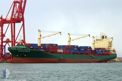
MERATUS JAYAWIJAYA
Container Ship
Current Trip
MUPLO
| Time Travelled | 7 days |
|---|---|
| Remaining Time | --- |
| Distance Travelled | 441.90 nm |
| Remaining Distance | --- |
| AVG Speed | 8 Noeuds |
| MAX Speed | 13.3 Noeuds |
| AVG Wind | 11.7 knots |
| MAX Wind | 19 knots |
| MIN Temp | 24.8°C / 76.64°F |
| MAX Temp | 30.1°C / 86.18°F |
| Tirant d eau | 11.4 m |
| Position reçue | 1 m depuis |
Current Position
| Longitude | 57.48485° |
|---|---|
| Latitude | -20.13983° |
| Etat | Under way using engine |
| Vitesse | 2.3 Noeuds |
| Parcours | 98° |
| Zone | Indian Ocean |
| Station | T-AIS |
| Position reçue | 1 m depuis |
Info
Information
The current position of MERATUS JAYAWIJAYA is in Indian Ocean with coordinates -20.13983° / 57.48485° as reported on 2026-01-04 09:05 by AIS to our vessel tracker app. The vessel's current speed is 2.3 Noeuds
The vessel MERATUS JAYAWIJAYA (IMO: 9305881, MMSI: 352002312) is a Container Ship that was built in 2005 ( 21 Age ). It's sailing under the flag of [PA] Panama.
In this page you can find informations about the vessels current position, last detected port calls, and current voyage information. If the vessels is not in coverage by AIS you will find the latest position.
The current position of MERATUS JAYAWIJAYA is detected by our AIS receivers and we are not responsible for the reliability of the data. The last position was recorded while the vessel was in Coverage by the Ais receivers of our vessel tracking app.
The current draught of MERATUS JAYAWIJAYA as reported by AIS is 11.4 meters
Weather
| Temperature | 30.2°C / 86.36°F |
|---|---|
| Wind Speed | 11 knots |
| Direction | 81° E |
| Pressure | 1010.6 hPa |
| Humidity | 53.8 % |
| Cloud Coverage | 30 % |
Featured Company
Last Port Calls
| Port | Arrival | Departure | Time In Port |
|---|---|---|---|
| 2025-12-26 07:08 | 2025-12-27 19:02 | 1 d | |
| 2025-12-16 01:57 | 2025-12-17 00:00 | 22 h | |
| 2025-12-03 19:01 | 2025-12-04 20:11 | 1 d | |
| 2025-11-24 15:44 | 2025-11-26 14:32 | 1 d | |
| 2025-11-22 05:36 | 2025-11-23 12:30 | 1 d | |
| 2025-11-14 07:02 | 2025-11-15 07:09 | 1 d | |
| 2025-11-03 23:00 | 2025-11-04 23:41 | 1 d |
Most Visited Ports (Last year)
| Port | Arrivals | |
|---|---|---|
| 12 | ||
| 12 | ||
| 11 | ||
| 8 |
Last Trips
| Origin | Departure | Destination | Arrival | Distance | |
|---|---|---|---|---|---|
| 2025-12-17 00:00 | 2025-12-26 07:08 | 2492.66 nm | |||
| 2025-12-04 20:11 | 2025-12-16 01:57 | 2370.05 nm | |||
| 2025-11-26 14:32 | 2025-12-03 19:01 | 482.01 nm | |||
| 2025-11-23 12:30 | 2025-11-24 15:44 | 148.24 nm | |||
| 2025-11-15 07:09 | 2025-11-22 05:36 | 2425.52 nm | |||
| 2025-11-04 23:41 | 2025-11-14 07:02 | 2367.19 nm | |||
| 2025-10-30 21:48 | 2025-11-03 23:00 | 381.91 nm |
Events
| Heure | Evenement | Détails | Position/ Destination | Info |
|---|---|---|---|---|
| 2026-01-04 08:59 | Tirant d'eau modifié | 11.4 11 |
-20.13912 / 57.48009
MUPLO
|
Vitesse: 2.1 kn Parcours: 99° |
| 2026-01-04 08:59 | Changement de destination | MUPLO MGTOA |
-20.13912 / 57.48009
MUPLO
|
Vitesse: 2.1 kn Parcours: 99° |
| 2026-01-04 08:59 | Changement d'ETA | 2026/01/04 11:30 2025/11/28 05:00 |
-20.13912 / 57.48009
MUPLO
|
Vitesse: 2.1 kn Parcours: 99° |
| 2026-01-04 08:52 | Etat Changé | Under way using engine Default |
-20.13838 / 57.47556
MGTOA
|
Vitesse: 4.9 kn Parcours: 99° |
| 2026-01-04 08:48 | Etat Changé | Default Under way using engine |
-20.13755 / 57.47034
MGTOA
|
Vitesse: 5.1 kn Parcours: 99° |
| 2026-01-04 08:48 | Etat Changé | Under way using engine Default |
-20.13747 / 57.46980
MGTOA
|
Vitesse: 5 kn Parcours: 101° |
| 2026-01-04 08:40 | Dans la zone couverte |
-20.13747 / 57.46980
Indian Ocean
|
Vitesse: 5.1 kn Parcours: 99° |
|
| 2026-01-04 07:48 | Démarrage | 4.45 nm, West of PORT LOUIS |
-20.11364 / 57.40909
MGTOA
|
Vitesse: 6.9 kn Parcours: 118° |
| 2026-01-04 07:32 | Arret | 4.78 nm, North West of PORT LOUIS |
-20.10972 / 57.40445
MGTOA
|
Vitesse: 0.2 kn Parcours: 105° |
| 2026-01-04 06:16 | Démarrage | 14.52 nm, North West of PORT LOUIS |
-20.02181 / 57.25819
MGTOA
|
Vitesse: 3.8 kn Parcours: 38° |