
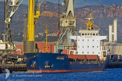
MERCURIUS
Cargo
Current Trip
| Trip Time | 11 days |
|---|---|
| Trip Distance | 441.44 nm |
| AVG Speed | 6.6 Noeuds |
| MAX Speed | 12.7 Noeuds |
| Tirant d eau | 3.5 m |
| AVG Wind | 14.5 knots |
| MAX Wind | 25 knots |
| MIN Temp | -3.2°C / 26.24°F |
| MAX Temp | 15.2°C / 59.36°F |
| Position reçue | 3 m depuis |
Current Position
| Longitude | 24.53846° |
|---|---|
| Latitude | 36.74979° |
| Etat | At anchor |
| Vitesse | |
| Parcours | 59° |
| Zone | Aegean Sea |
| Station | T-AIS |
| Position reçue | 3 m depuis |
Info
Information
The current position of MERCURIUS is in Aegean Sea with coordinates 36.74979° / 24.53846° as reported on 2025-03-01 16:05 by AIS to our vessel tracker app. The vessel's current speed is 0 Noeuds and is currently inside the port of VOUDIA.
The vessel MERCURIUS (IMO: 9622394, MMSI: 577252000) is a Cargo It's sailing under the flag of [VU] Vanuatu.
In this page you can find informations about the vessels current position, last detected port calls, and current voyage information. If the vessels is not in coverage by AIS you will find the latest position.
The current position of MERCURIUS is detected by our AIS receivers and we are not responsible for the reliability of the data. The last position was recorded while the vessel was in Coverage by the Ais receivers of our vessel tracking app.
The current draught of MERCURIUS as reported by AIS is 3.5 meters
Weather
| Temperature | 14.5°C / 58.1°F |
|---|---|
| Wind Speed | 2 knots |
| Direction | 359° N |
| Pressure | 1022.9 hPa |
| Humidity | 70.1 % |
| Cloud Coverage | 13 % |
Featured Company
Last Port Calls
| Port | Arrival | Departure | Time In Port |
|---|---|---|---|
| 2025-03-01 09:50 | |||
| 2025-02-13 07:08 | 2025-02-18 01:07 | 4 d | |
| 2025-01-29 11:47 | 2025-01-31 12:43 | 2 d | |
| 2025-01-19 13:05 | 2025-01-21 20:05 | 2 d | |
| 2025-01-16 09:55 | 2025-01-17 15:30 | 1 d | |
| 2025-01-13 07:07 | 2025-01-14 17:59 | 1 d | |
| 2025-01-10 19:52 | 2025-01-11 00:17 | 4 h | |
| 2025-01-04 11:45 | 2025-01-07 18:37 | 3 d |
Last Trips
| Origin | Departure | Destination | Arrival | Distance | |
|---|---|---|---|---|---|
| 2025-02-18 04:07 | 2025-03-01 11:50 | 441.44 nm | |||
| 2025-01-31 13:43 | 2025-02-13 10:08 | 1562.12 nm | |||
| 2025-01-21 21:05 | 2025-01-29 12:47 | 604.10 nm | |||
| 2025-01-17 16:30 | 2025-01-19 14:05 | 196.02 nm | |||
| 2025-01-14 17:59 | 2025-01-16 10:55 | 273.12 nm | |||
| 2025-01-11 01:17 | 2025-01-13 07:07 | 322.17 nm | |||
| 2025-01-07 19:37 | 2025-01-10 20:52 | 543.95 nm | |||
| 2024-12-31 13:46 | 2025-01-04 12:45 | 620.23 nm |
Events
| Heure | Evenement | Détails | Position/ Destination | Info |
|---|---|---|---|---|
| 2025-03-01 09:59 | Arret |
36.74924 / 24.53886
[GR] VOUDIA
|
Vitesse: 0.3 kn Parcours: 31° |
|
| 2025-03-01 09:50 | Port d'arrivée |
|
36.74915 / 24.53977
[GR] VOUDIA
|
Vitesse: 1.6 kn Parcours: 325° |
| 2025-03-01 09:27 | Démarrage | 1.03 nm, East of VOUDIA |
36.74773 / 24.55822
GRMLO
|
Vitesse: 3.2 kn Parcours: 260° |
| 2025-03-01 00:00 | Changement d'ETA | 2026/02/21 09:00 2025/02/21 09:00 |
36.74723 / 24.55866
GRMLO
|
Vitesse: Parcours: 21° |
| 2025-02-23 06:06 | Arret | 0.82 nm, East of VOUDIA |
36.74699 / 24.55373
GRMLO
|
Vitesse: Parcours: 65° |
| 2025-02-23 03:43 | Dans la zone couverte |
36.77077 / 24.81351
Aegean Sea
|
Vitesse: 6.4 kn Parcours: 180.4° |
|
| 2025-02-23 02:34 | Hors de la zone couverte |
36.89951 / 24.82014
Aegean Sea
|
Vitesse: 6.5 kn Parcours: 214.7° |
|
| 2025-02-23 02:21 | Dans la zone couverte |
36.89951 / 24.82014
Aegean Sea
|
Vitesse: 6.5 kn Parcours: 214.7° |
|
| 2025-02-23 01:13 | Hors de la zone couverte |
37.03544 / 24.78185
Aegean Sea
|
Vitesse: 6.6 kn Parcours: 157° |
|
| 2025-02-22 16:35 | Dans la zone couverte |
37.97083 / 24.59592
Aegean Sea
|
Vitesse: 8 kn Parcours: 207.3° |