
MERSEY
Dredging or underwater ops
Current Trip
| Trip Time | --- |
|---|---|
| Trip Distance | --- |
| AVG Speed | --- |
| MAX Speed | --- |
| Tirant d eau | --- |
| AVG Wind | --- |
| MAX Wind | --- |
| MIN Temp | --- |
| MAX Temp | --- |
| Position reçue | Maintenant |
Current Position
| Longitude | 9.41157° |
|---|---|
| Latitude | 53.78466° |
| Etat | Under way using engine |
| Vitesse | 0.1 Noeuds |
| Parcours | 260° |
| Zone | North Sea |
| Station | T-AIS |
| Position reçue | Maintenant |
Info
Information
The current position of MERSEY is in North Sea with coordinates 53.78466° / 9.41157° as reported on 2025-02-11 00:51 by AIS to our vessel tracker app. The vessel's current speed is 0.1 Noeuds and is currently inside the port of GLUECKSTADT.
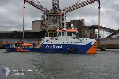
The vessel MERSEY (IMO: 9904950, MMSI: 246262000) is a Dredging or underwater ops It's sailing under the flag of [NL] Netherlands.
In this page you can find informations about the vessels current position, last detected port calls, and current voyage information. If the vessels is not in coverage by AIS you will find the latest position.
The current position of MERSEY is detected by our AIS receivers and we are not responsible for the reliability of the data. The last position was recorded while the vessel was in Coverage by the Ais receivers of our vessel tracking app.
The current draught of MERSEY as reported by AIS is 2 meters
Weather
| Temperature | 0.2°C / 32.36°F |
|---|---|
| Wind Speed | 14 knots |
| Direction | 91° E |
| Pressure | 1029.2 hPa |
| Humidity | 57.2 % |
| Cloud Coverage | 43 % |
Featured Company
Last Port Calls
| Port | Arrival | Departure | Time In Port |
|---|---|---|---|
| 2025-02-11 00:43 | |||
| 2025-02-09 10:49 | 2025-02-10 05:21 | 18 h | |
| 2025-02-07 15:05 | 2025-02-08 08:57 | 17 h | |
| 2025-02-06 12:40 | 2025-02-07 02:00 | 13 h | |
| 2025-02-05 11:39 | 2025-02-06 11:01 | 23 h | |
| 2025-02-03 07:25 | 2025-02-04 05:05 | 21 h | |
| 2025-02-01 08:06 | 2025-02-02 14:03 | 1 d | |
| 2025-01-30 15:13 | 2025-01-31 05:02 | 13 h | |
| 2025-01-28 09:57 | 2025-01-29 13:13 | 1 d | |
| 2025-01-27 14:33 | 2025-01-27 14:42 | 9 m |
Most Visited Ports (Last year)
| Port | Arrivals | |
|---|---|---|
| 154 | ||
| 144 | ||
| 17 | ||
| 17 | ||
| 16 | ||
| 2 |
Last Trips
| Origin | Departure | Destination | Arrival | Distance | |
|---|---|---|---|---|---|
| 2025-02-08 09:57 | 2025-02-09 11:49 | 20.21 nm | |||
| 2025-02-07 03:00 | 2025-02-07 16:05 | 10.91 nm | |||
| 2025-02-06 12:01 | 2025-02-06 13:40 | 4.18 nm | |||
| 2025-02-04 06:05 | 2025-02-05 12:39 | 46.51 nm | |||
| 2025-02-02 15:03 | 2025-02-03 08:25 | 14.13 nm | |||
| 2025-01-31 06:02 | 2025-02-01 09:06 | 24.29 nm | |||
| 2025-01-29 14:13 | 2025-01-30 16:13 | 24.46 nm | |||
| 2025-01-27 15:42 | 2025-01-28 10:57 | 19.17 nm | |||
| 2025-01-27 07:06 | 2025-01-27 15:33 | 15.89 nm | |||
| 2025-01-25 07:26 | 2025-01-26 09:56 | 25.74 nm |
Events
| Heure | Evenement | Détails | Position/ Destination | Info |
|---|---|---|---|---|
| 2025-02-11 00:46 | Arret |
53.78486 / 9.41146
[DE] GLUECKSTADT
|
Vitesse: 0.3 kn Parcours: 162° |
|
| 2025-02-11 00:43 | Port d'arrivée |
|
53.78478 / 9.40857
[DE] GLUECKSTADT
|
Vitesse: 3.5 kn Parcours: 89° |
| 2025-02-11 00:06 | Démarrage | 1.76 nm, West of SSV BORSFLETH |
53.82458 / 9.36023
DREDGING ELBE
|
Vitesse: 3.2 kn Parcours: 153° |
| 2025-02-11 00:03 | Etat Changé | Under way using engine Restricted manoeuverability |
53.82543 / 9.36028
DREDGING ELBE
|
Vitesse: 0.2 kn Parcours: 327° |
| 2025-02-10 16:21 | Arret | 1.81 nm, West of SSV BORSFLETH |
53.82210 / 9.35944
DREDGING ELBE
|
Vitesse: 0.3 kn Parcours: 142° |
| 2025-02-10 16:18 | Etat Changé | Restricted manoeuverability Under way using engine |
53.82157 / 9.35997
DREDGING ELBE
|
Vitesse: 20.2 kn Parcours: 329.9° |
| 2025-02-10 16:18 | Etat Changé | Under way using engine Restricted manoeuverability |
53.82149 / 9.36004
DREDGING ELBE
|
Vitesse: 1 kn Parcours: 144° |
| 2025-02-10 16:18 | Démarrage | 1.8 nm, West of SSV BORSFLETH |
53.82149 / 9.36004
DREDGING ELBE
|
Vitesse: 20.2 kn Parcours: 329.9° |
| 2025-02-10 07:28 | Etat Changé | Restricted manoeuverability Under way using engine |
53.82114 / 9.36776
DREDGING ELBE
|
Vitesse: 19.9 kn Parcours: 337.2° |
| 2025-02-10 07:27 | Etat Changé | Under way using engine Restricted manoeuverability |
53.82111 / 9.36778
DREDGING ELBE
|
Vitesse: 0.7 kn Parcours: 155° |