

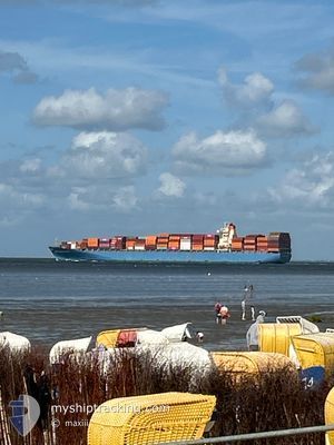
MOL PROFICIENCY
Container Ship

Current Trip
| Time Travelled | 11 days |
|---|---|
| Remaining Time | --- |
| Distance Travelled | 305.47 nm |
| Remaining Distance | --- |
| AVG Speed | 10.7 Noeuds |
| MAX Speed | 15 Noeuds |
| AVG Wind | 14.6 knots |
| MAX Wind | 25 knots |
| MIN Temp | 11.7°C / 53.06°F |
| MAX Temp | 22.4°C / 72.32°F |
| Tirant d eau | 9.1 m |
| Position reçue | 2 m depuis |
Current Position
| Longitude | -0.14270° |
|---|---|
| Latitude | 49.57083° |
| Etat | At anchor |
| Vitesse | |
| Parcours | 254° |
| Zone | English Channel |
| Station | T-AIS |
| Position reçue | 2 m depuis |
Information
The current position of MOL PROFICIENCY is in English Channel with coordinates 49.57083° / -0.14270° as reported on 2025-06-10 21:33 by AIS to our vessel tracker app. The vessel's current speed is 0 Noeuds
The vessel MOL PROFICIENCY (IMO: 9403619, MMSI: 538002961) is a Container Ship that was built in 2007 ( 18 Age ). It's sailing under the flag of [MH] Marshall Is.
In this page you can find informations about the vessels current position, last detected port calls, and current voyage information. If the vessels is not in coverage by AIS you will find the latest position.
The current position of MOL PROFICIENCY is detected by our AIS receivers and we are not responsible for the reliability of the data. The last position was recorded while the vessel was in Coverage by the Ais receivers of our vessel tracking app.
The current draught of MOL PROFICIENCY as reported by AIS is 9.1 meters
Weather
| Temperature | 15.6°C / 60.08°F |
|---|---|
| Wind Speed | 6 knots |
| Direction | 303° WNW |
| Pressure | 1020.4 hPa |
| Humidity | 89.1 % |
| Cloud Coverage | 98 % |


Featured Company
Last Port Calls
| Port | Arrival | Departure | Time In Port |
|---|---|---|---|
| 2025-05-14 06:29 | 2025-05-30 18:58 | 16 d | |
| 2025-04-27 17:13 | 2025-04-28 18:26 | 1 d | |
| 2025-04-26 10:15 | 2025-04-27 07:21 | 21 h | |
| 2025-04-13 10:53 | 2025-04-16 12:11 | 3 d | |
| 2025-04-09 10:32 | 2025-04-10 16:27 | 1 d | |
| 2025-04-01 13:47 | 2025-04-03 12:22 | 1 d |
Last Trips
| Origin | Departure | Destination | Arrival | Distance | |
|---|---|---|---|---|---|
| 2025-04-28 18:26 | 2025-05-14 06:29 | 4035.40 nm | |||
| 2025-04-27 07:21 | 2025-04-27 17:13 | 116.36 nm | |||
| 2025-04-16 12:11 | 2025-04-26 10:15 | 4435.46 nm | |||
| 2025-04-10 16:27 | 2025-04-13 10:53 | 434.15 nm | |||
| 2025-04-03 12:22 | 2025-04-09 10:32 | 651.52 nm | |||
| 2025-03-11 09:26 | 2025-04-01 13:47 | 5306.24 nm |
Events
| Heure | Evenement | Détails | Position/ Destination | Info |
|---|---|---|---|---|
| 2025-06-10 20:02 | Tirant d'eau modifié | 9.1 9 |
49.57068 / -.14263
FRLEH
|
Vitesse: Parcours: 258° |
| 2025-06-10 19:57 | Tirant d'eau modifié | 9 9.1 |
49.57058 / -.14255
FRLEH
|
Vitesse: 0.1 kn Parcours: 259° |
| 2025-06-10 19:57 | Changement d'ETA | 2025/06/11 07:00 2025/06/11 19:00 |
49.57058 / -.14255
FRLEH
|
Vitesse: 0.1 kn Parcours: 259° |
| 2025-06-10 18:12 | Etat Changé | At anchor Default |
49.56955 / -.14267
FRLEH
|
Vitesse: 0.1 kn Parcours: 291° |
| 2025-06-10 18:09 | Etat Changé | Default At anchor |
49.56947 / -.14270
FRLEH
|
Vitesse: Parcours: 294° |
| 2025-06-10 17:09 | Etat Changé | At anchor Default |
49.56845 / -.14377
FRLEH
|
Vitesse: 0.1 kn Parcours: 327° |
| 2025-06-10 17:03 | Etat Changé | Default At anchor |
49.56830 / -.14397
FRLEH
|
Vitesse: 0.2 kn Parcours: 330° |
| 2025-06-10 16:42 | Etat Changé | At anchor Default |
49.56798 / -.14495
FRLEH
|
Vitesse: 0.1 kn Parcours: 348° |
| 2025-06-10 16:36 | Etat Changé | Default At anchor |
49.56802 / -.14518
FRLEH
|
Vitesse: Parcours: 353° |
| 2025-06-10 15:42 | Etat Changé | At anchor Default |
49.56838 / -.14715
FRLEH
|
Vitesse: 0.2 kn Parcours: 36° |